Solve this fun puzzle to watch how remote sensing imagery of the Great Lakes changes through the seasons.
Let’s dive into one of Earth’s most significant water resources—the Great Lakes!
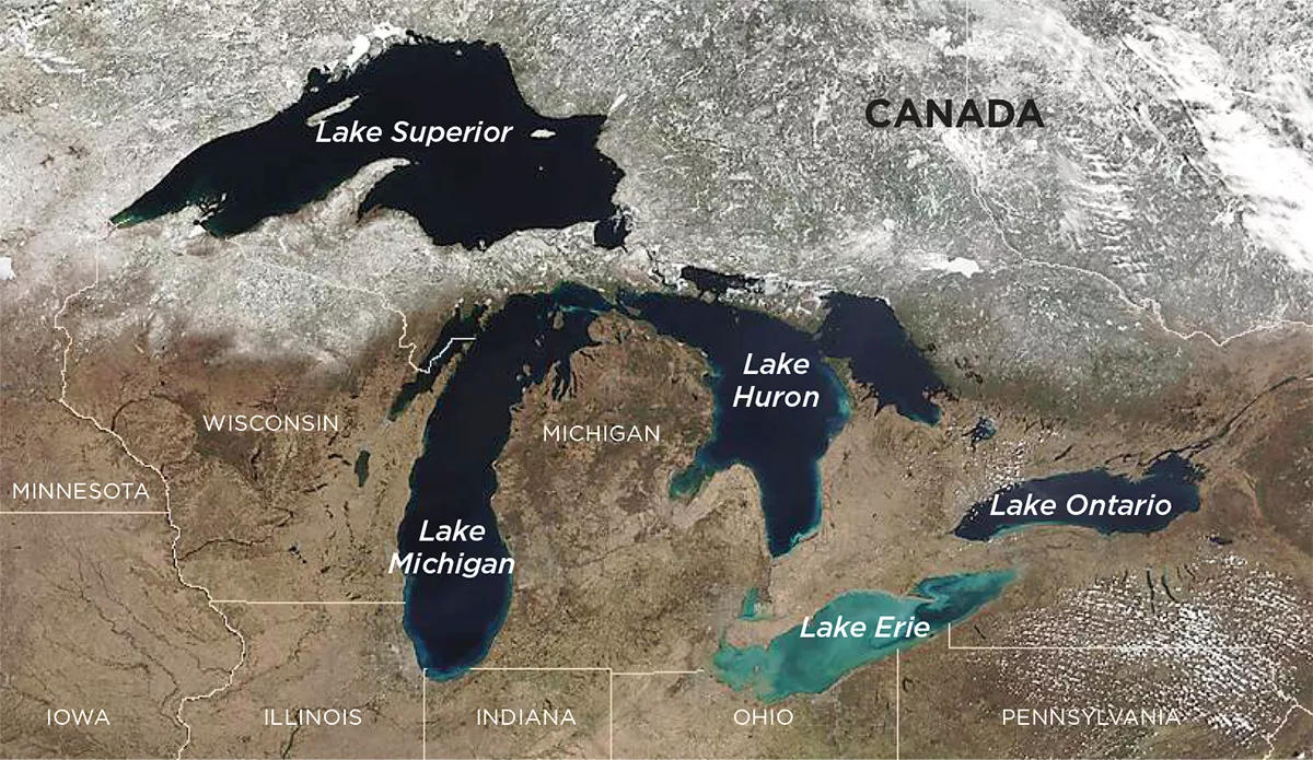
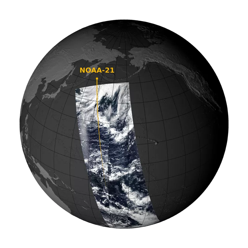
Nestled between Canada and the United States, this group of lakes includes Superior, Michigan, Huron, Erie, and Ontario. These lakes are an important landmark that can be seen by the National Oceanic and Atmospheric Administration (NOAA) and National Aeronautics and Space Administration (NASA)’s Joint Polar Satellite System (JPSS) satellites. The three satellites currently flying are NOAA/NASA Suomi National Polar-orbiting Partnership (Suomi NPP) satellite, NOAA-20, previously known as JPSS-1, and NOAA-21, previously known as JPSS-2. These satellites make a polar orbit over our planet 14 times a day, to provide a complete view of Earth.
There are two ways to think about seasons: meteorological and astronomical.
Meteorological seasons are based on each calendar month, grouping parts of the year together based on how the weather changes. So, when it’s warm and flowers bloom, it’s spring. When it’s chilly and snowy, that’s winter. These seasons have set date ranges to help scientists study the weather.
Astronomical seasons are based on the positioning of the Earth and the Sun in space. Imagine the Sun as a heat lamp in the sky. When it shines straight at us, it’s warm (to show that it’s summer). When it’s not as direct, it’s colder (to show that it’s winter). There are also times during the year when daytime and nighttime are the same length (these are called equinoxes), and times when we have the shortest and longest days (these are solstices).
In comparison, meteorological seasons are based on Earth’s changing weather, while astronomical seasons help us understand how the Earth and Sun work together to indicate different times of the year.
How can you notice both ways of thinking about seasons in your everyday life? The calendar you use each month follows astronomical seasons, but when you hear from weather experts on the news, they use meteorological seasons.
JPSS Satellites Piece Together Earth Like a Puzzle
Satellites use remote sensing, which is when they retrieve information from a distance to create the imagery we see. One sensor onboard JPSS satellites is the Visible Infrared Imaging Radiometer Suite (VIIRS) sensor, which acquires images of Earth from far away. These images help scientists understand more about the weather, oceans, and even how plants grow.
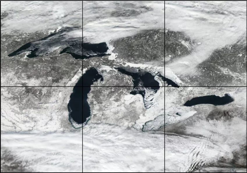
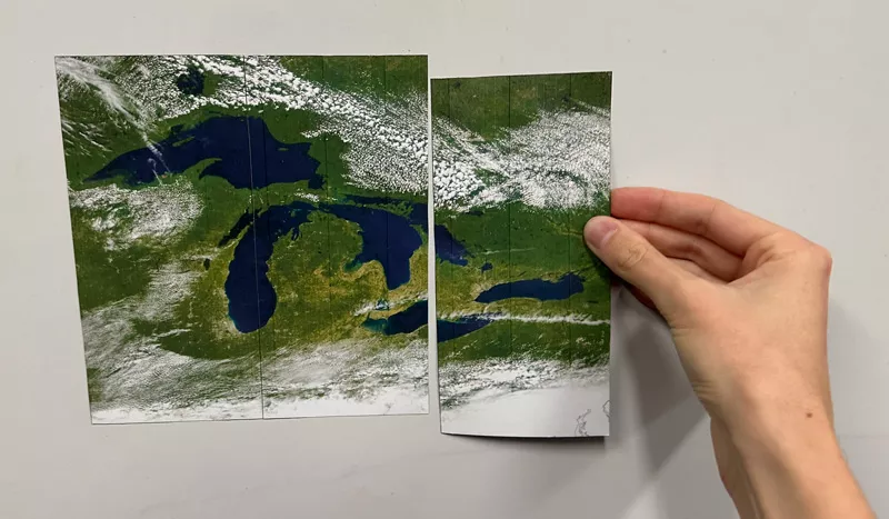
JPSS satellites use their VIIRS sensor to piece together Earth’s puzzle daily. They capture imagery of Earth in “satellite swaths,” like mowing a strip of grass. Instead of using satellite swaths, in this activity, you may cut out puzzle pieces, based on images of the Great Lakes, for your students to interact with in order to create completed JPSS satellite images.
Objectives
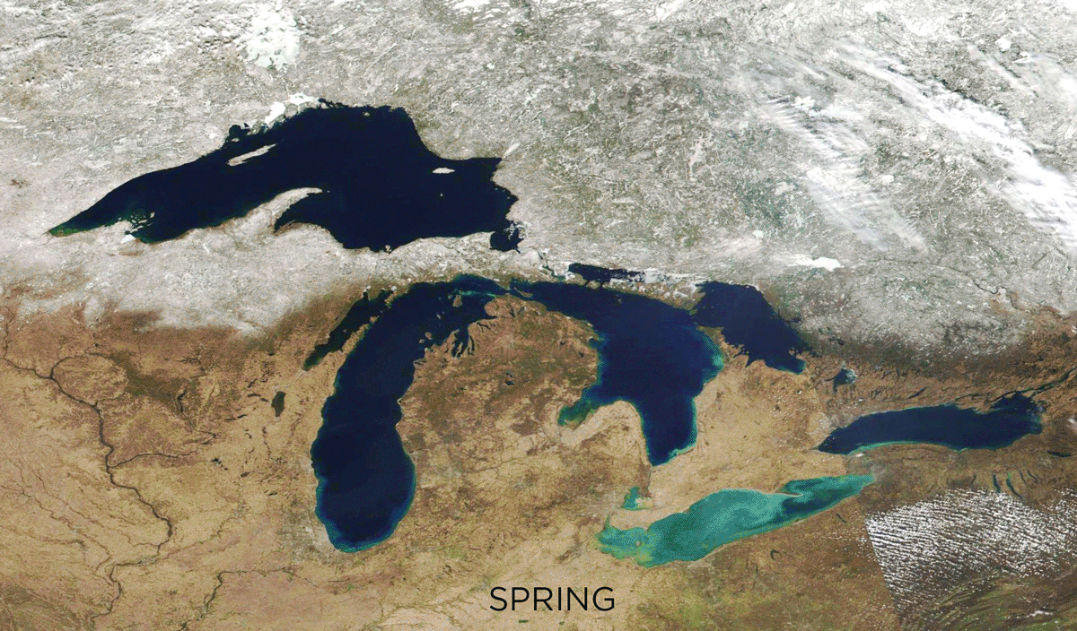
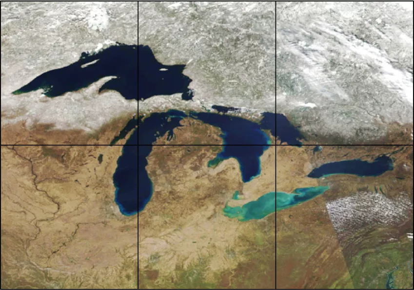
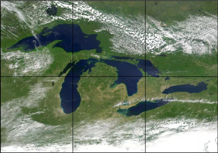
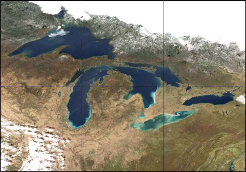
Attached to the packet are four puzzles of the Great Lakes featured in seasons: Spring, Summer, Winter, and Fall. Each puzzle directly corresponds with real data from JPSS satellites. The Spring puzzle is based on JPSS satellite data from April 12, 2023, Summer is based on data from July 9, 2022, Fall is based on data from November 4, 2020, and Winter is based on data from February 14, 2018.
Based on the level of difficulty, your class can use the provided three or six piece puzzles. Each puzzle has attached labels that indicate the different parts of the image. You do not have to cut out the labels with the puzzle pieces, but they may serve as a helpful guide in order to more easily put the puzzle back together.
If students need more help with puzzle assembly, an image guide is included in the activity packet for their reference, which shows the complete Great Lakes satellite images for each season.
Please note: this activity is best completed with color printing to best identify each season.
You Will Need
- Scissors
- Four worksheets, which include a Great Lakes puzzle from each season.
- Puzzle Key (optional)
Puzzle Key:
SPRING
April 12, 2023
(NOAA-20 satellite image)
SUMMER
July 9, 2022
(NOAA-20 satellite image)
FALL
November 4, 2020
(NOAA-20 satellite image)
WINTER
February 14, 2018
(Suomi-NPP satellite image)