
The Joint Polar Satellite System (JPSS) is a series of polar-orbiting environmental satellites. JPSS satellites cross the equator 14 times each day in order to observe the entire Earth twice a day. These satellites contribute critical meteorological data that NOAA’s National Weather Service uses to make accurate weather forecasts and predict severe weather three to seven days in advance. Satellites in the JPSS constellation gather global measurements of conditions in the atmosphere, oceans, and on land—including temperature, moisture, clouds, rainfall, dense fog, volcanic ash, fire locations, smoke plumes, vegetation, snow and ice cover, and ozone. Two instruments on JPSS measure temperature: the Cross-Track Infrared Sounder (CrIS) and the Advanced Technology Microwave Sounder (ATMS).
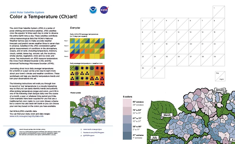
Journaling about local daily average temperatures for a month or a year can be a fun way to learn more about your town’s climate and weather conditions. These worksheets will help you identify temperature trends and turn your observations into art.
The following instructions will walk you through how to record or ‘log’ temperatures in a visually interesting way so that you can easily identify trends and patterns. After picking temperature ranges and colors, you’ll fill in one of the following chart designs daily over the course of a month, a year, or whatever time period you’d like. Color examples have been supplied for you that use a traditional hot color (reds) to cool color (blues) scheme but a column has also been left blank so you can choose your own key based on the colors you have available.