
The Joint Satellite Conference (JSC) merges three unique satellite conferences into one major event in Boston, from Sept. 30–Oct. 4, 2019. This first-ever joint conference is co-organized by NOAA, EUMETSAT and the AMS Committee on Satellite Meteorology, Oceanography, and Climatology, and is hosted by the American Meteorological Society.
The theme for the 2019 JSC is:Shaping the Future Together – Providing Observations for the Coupled Earth Systemand it ties together important areas of research, engineering, and operations in meteorological and Earth environmental fields. Panel discussions and other presentations are covering a range of topics, including how an international fleet of next-generation satellites is:
- Better predicting severe weather and flooding
- Providing more accurate hurricane forecasts
- Detecting and tracking wildfires across the globe
- Monitoring climate trends in the Arctic and Antarctic
- Mapping lightning strikes around the world
- Guiding drought forecasts and assisting food security
We will be live-tweeting throughout each day of the event. Follow @NOAAsatellitePA for Twitter updates, as well as the official conference hashtag, #2019JointSatelliteConf.
This webpage will also serve as a daily summary of some of the JSC talks, presentations and panels from a NOAA Satellites perspective, and will highlight the interesting and innovative ways a myriad of international Earth-observing satellites are shaping our future, together.
October 3, 2019
At the #2019JointSatelliteConf this morning, we saw how #satellites like #NOAA20 and NOAA/NASA's #SuomiNPP provide ocean color data from space. This can help monitor the health of ecosystems, coastal habitats, and even protect people from #HarmfulAlgalBlooms. pic.twitter.com/P6x4qVVgFs
— NOAA Satellites - Public Affairs (@NOAASatellitePA) October 3, 2019
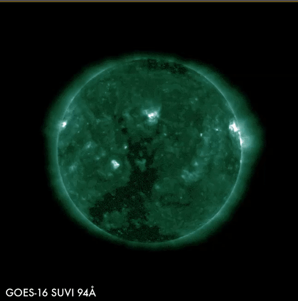
Where is NOAA headed with its #satellite technology? At the #2019JointSatelliteConf today, there were a few future possibilities—including a satellite in “tundra orbit” to improve our view of the polar regions and a #SpaceWeather satellite to better monitor #SolarFlares. pic.twitter.com/Pk5mRawBcM
— NOAA Satellites - Public Affairs (@NOAASatellitePA) October 3, 2019
Earth-observing #satellites are helping determine #climate trends in the #Arctic and #Antarctic. #SeaIce extent, polar #snowfall , and the #Greenland #IceSheet are all being studied and monitored by satellites like #NOAA20 and NOAA/NASA’s #SuomiNPP. #2019JointSatelliteConf pic.twitter.com/RF339nl9jS
— NOAA Satellites - Public Affairs (@NOAASatellitePA) October 3, 2019
What a difference a day makes! After highs in the upper 70s yesterday, a cold front brought much cooler temperatures, rain and clouds to Boston. This morning, Beantown started out with cloudy skies and temperatures in the low 50s. Inside at the decidedly warmer JSC, Thursday was another full day — with about 100 presentations scheduled.
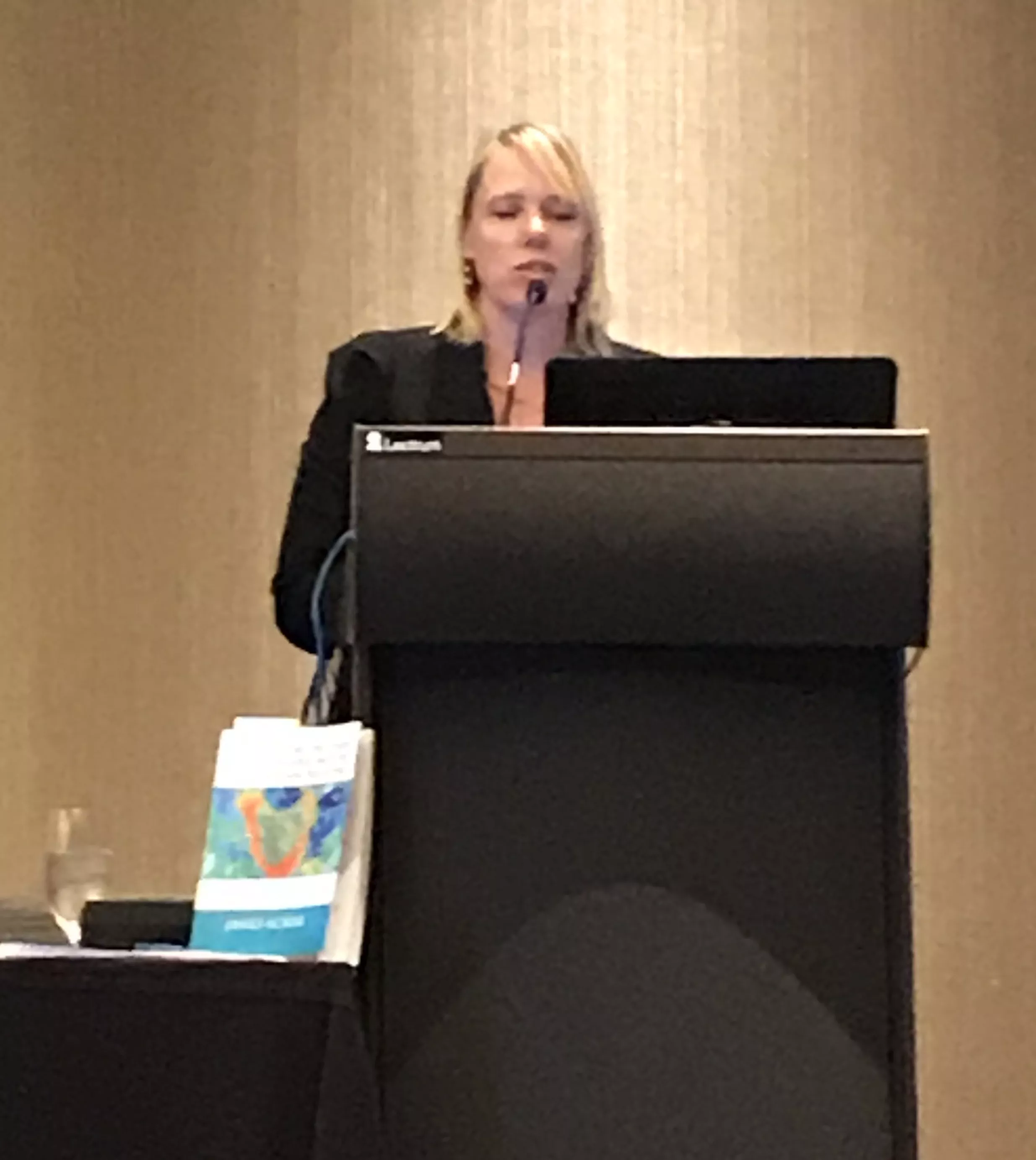
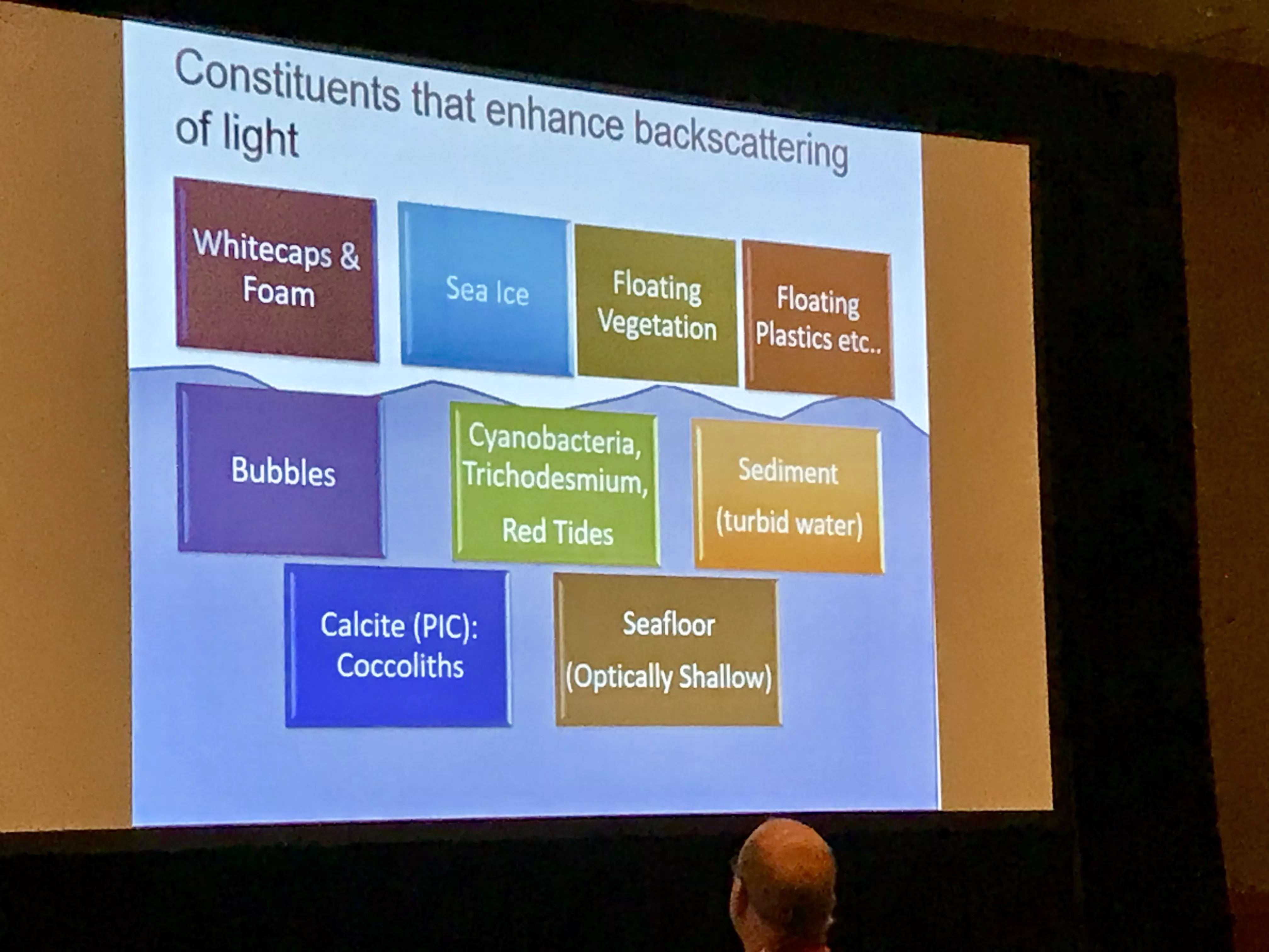
The day started out with a session about the history and scientific advances of ocean color data from satellites. Ocean color is the water’s apparent hue due to the presence of tiny plants containing chlorophyll pigment, sediments, and colored dissolved organic material.
Ocean color data, from satellites like NOAA-20 and Suomi-NPP, can provide an estimate of the live phytoplankton in the water and also provide a proxy for the water’s suspended sediments. This information can then be used to help monitor the health of ecosystems, coastal habitats, predict harmful algal blooms, and more.
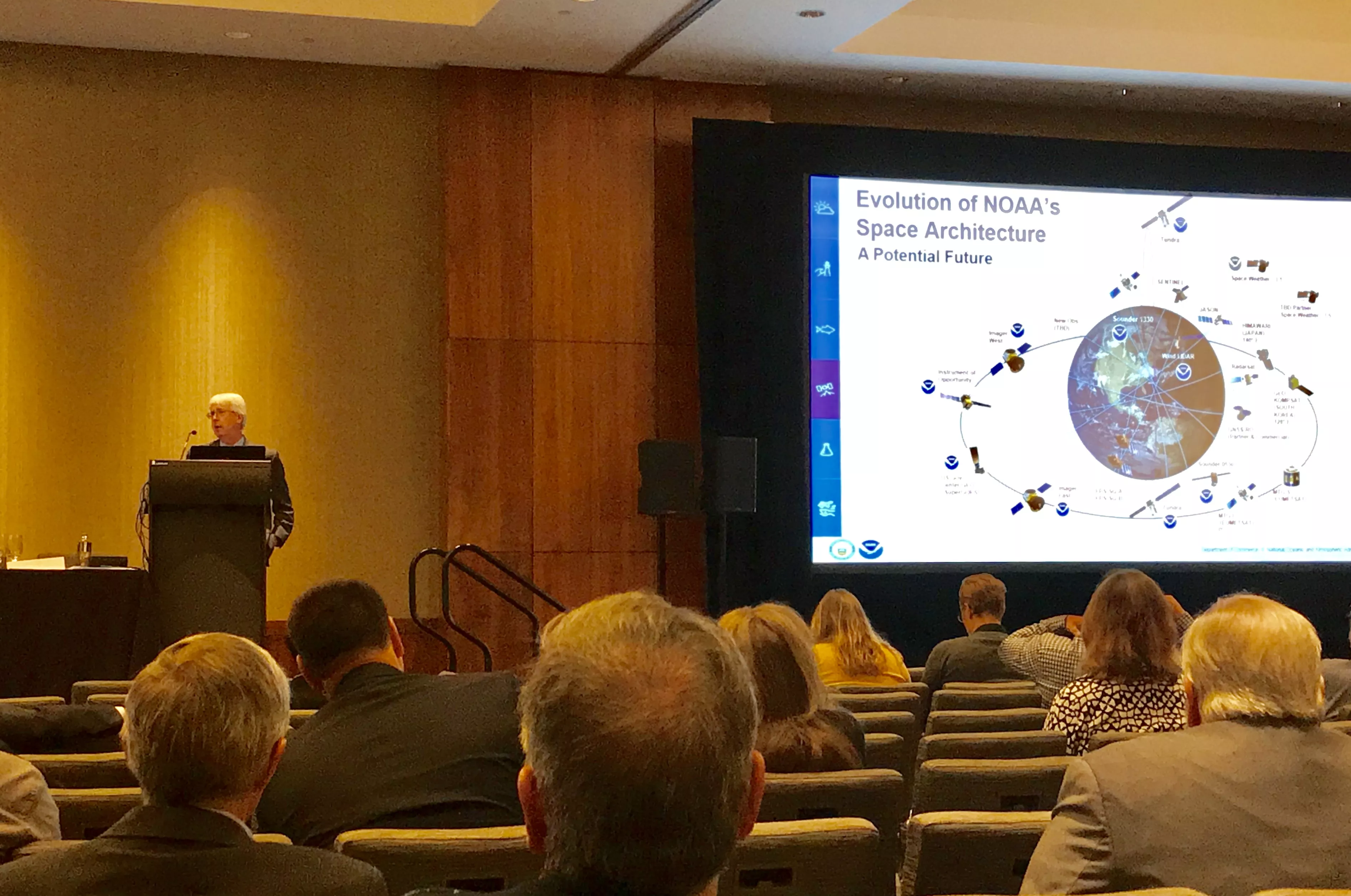
A late-morning meeting reviewed where NOAA hopes to go in the future with its Earth-observing satellites. A couple of potential missions that are being investigated include a satellite in “tundra orbit,” which would improve geosynchronous observations of Earth’s polar regions.
Another included a future space weather satellite or instrument to better enable us to monitor and protect our infrastructure — and ourselves — from solar flares and coronal mass ejections (CMEs). Solar flares can produce strong x-rays that degrade or block high-frequency radio waves used for radio communication. CMEs cause geomagnetic storms that can degrade power grid operations. Both can also potentially harm humans onboard the International Space Station and people flying at high latitudes.
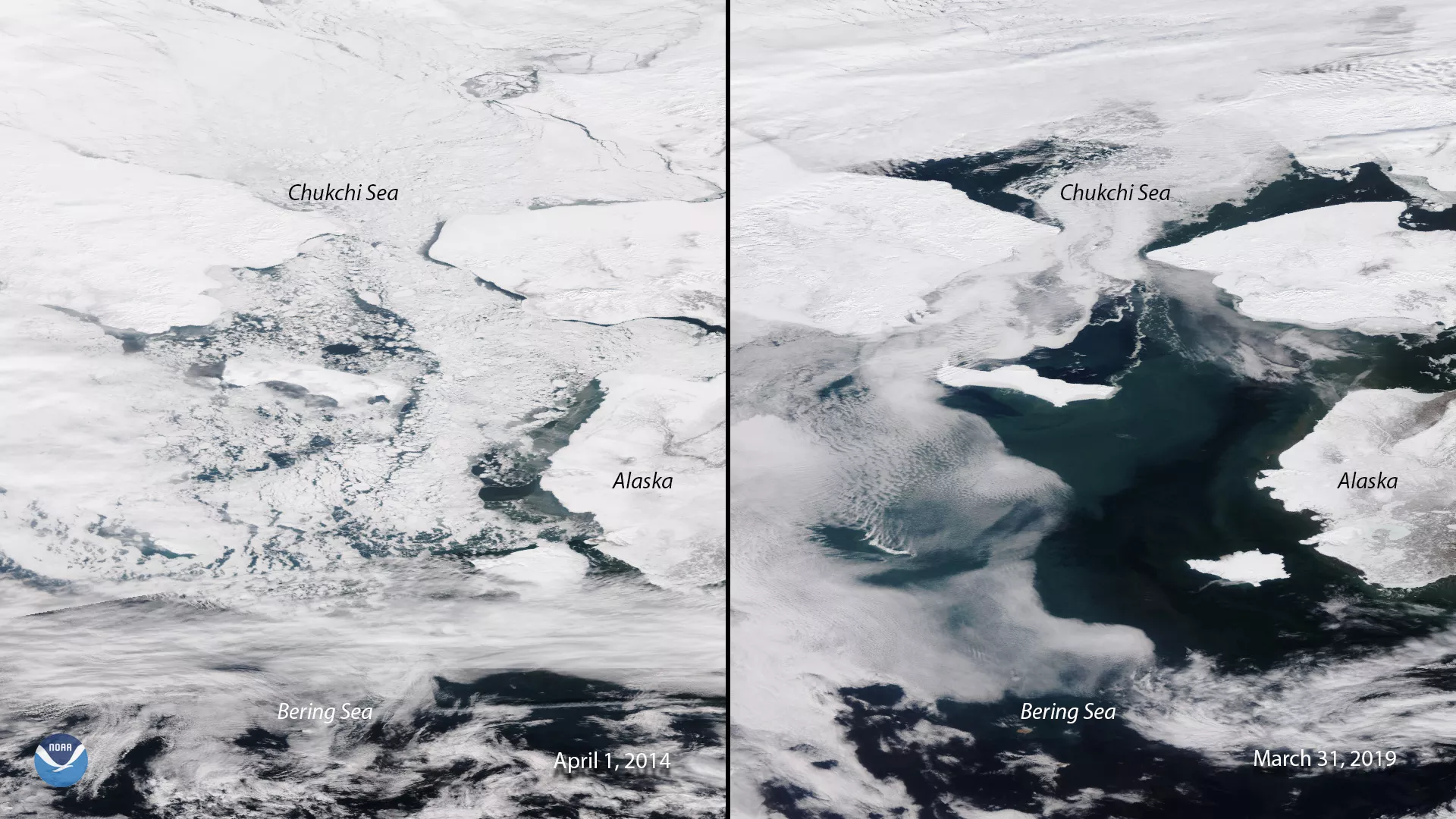
Another session at the JSC today focused on the significance of satellite data for monitoring the recent climate trends in the polar regions of Earth. The branch chief of NOAA’s Advanced Satellite Products, Jeffrey Key, was the chair of this session. Here, several panelists presented about how satellites are helping monitor Arctic sea ice extent, polar snowfall, and the Greenland ice sheet, from their perspective in Earth orbit.
Tomorrow will just be a half-day for the JSC — and it will also be its last day. Still, there will be more interesting talks about the innovative ways a fleet of international satellites is helping people study and monitor the Earth as one complete system. One session on Friday will show how satellites are helping measure air pollution and forecast air quality. Another is focusing on how satellites assist in weather hazard forecasting — like flooding and hail storms —and also help with disaster response.
After a week of seeing some truly amazing examples of satellite technology, it is really inspiring to see an international team working together to shape the world’s future. We really appreciate you following our tweets and Daily Debrief throughout the JSC.
–The NOAA NESDIS team
October 2, 2019
As we crossed the half-way mark for the JSC, today was a bit of an erratic day weather-wise in Boston. The day started out in the mid-70s with a few scattered showers, but a cold front breezed through by afternoon, dropping temperatures and bringing gusty winds.
Fortunately, today was much more tranquil affair within the walls of the Westin Boston Waterfront Hotel — the location of the first-ever JSC. It was another day that offered numerous sessions, talks, and presentations about satellite science and technology — and it started off with a brief, but fascinating history lesson about weather satellites.
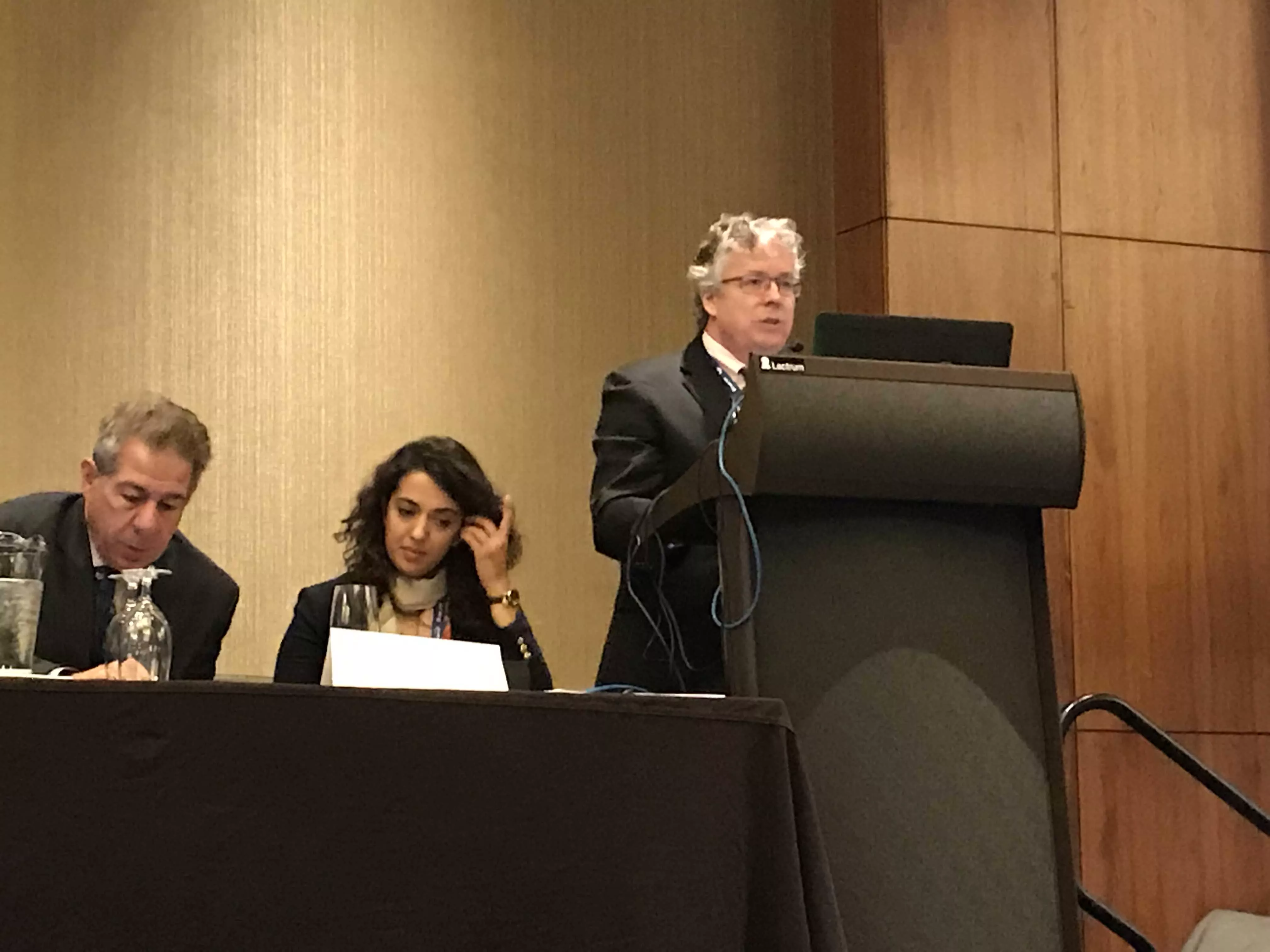
That lesson came during a session co-chaired by NOAA/NESDIS and EUMETSAT, with panelists from the Cooperative Institute for Research in the Atmosphere (CIRA) and EUMETSAT. CIRA is a research cooperative partner of NOAA. NOAA scientists are embedded at CIRA to facilitate collaborative work between the university/academic community and NOAA. Together they work to find ways of improving the satellite technology to get the most out of the data and observations the satellites collect.
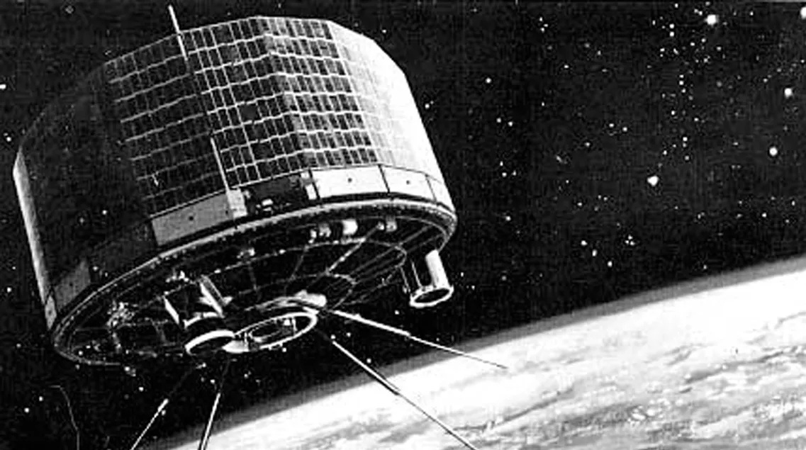
And all of the weather satellites in orbit today can give their thanks to the world’s first-ever weather satellite — the Television Infrared Observation Satellite (TIROS-1). TIROS-1 launched on April 1, 1960, but there’s no foolin’ that is started a new era of weather monitoring and forecasting. Though it operated for only about two-and-a-half months, it provided our first glimpses of clouds and weather systems from 450 miles up.
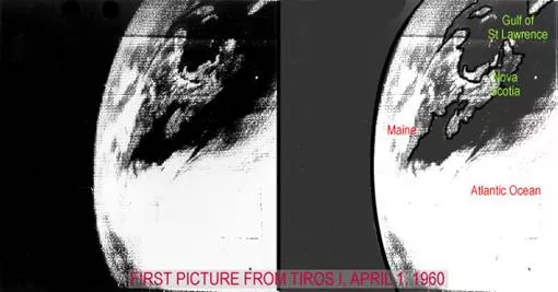
In fact, above is the first image from TIROS-1, which is hovering over the Canadian Maritimes and Northeastern U.S. in this image, from its first day in low-Earth, polar orbit. For nearly 60 years now, weather satellites — and their ever-increasing technology and capabilities — have revolutionized remote sensing of Earth.
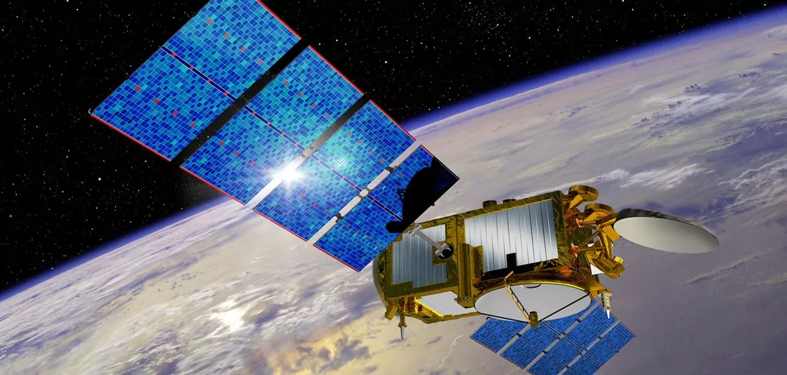
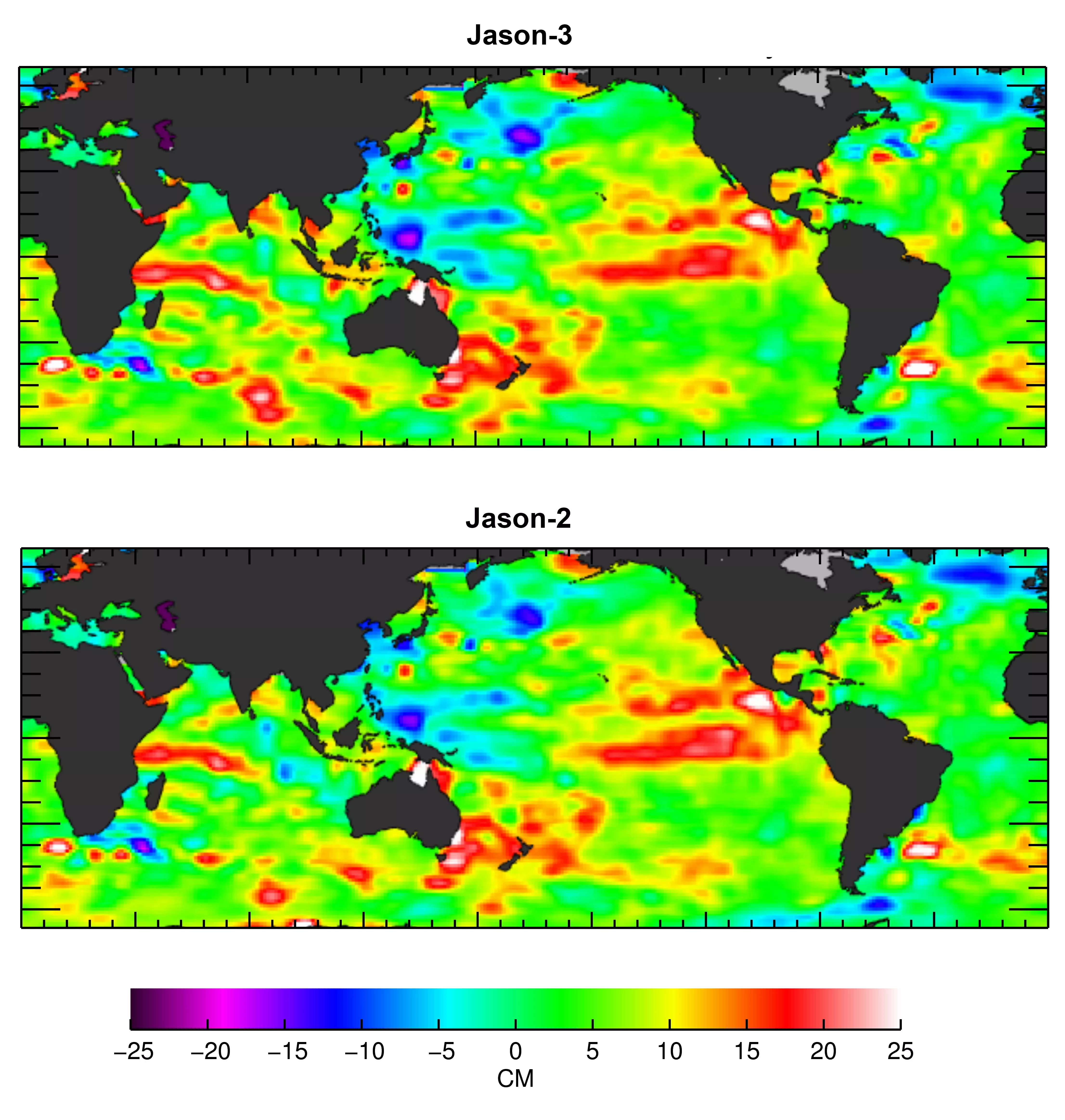
Later in the morning, attendees were given the opportunity to learn more about satellite data’s use in hurricane research and applications. In particular, the satellites Jason-2 and Jason-3. Both Jason-3 (pictured), and its predecessor Jason-2, are international missions for which NOAA collaborates with NASA, the Centre National d’Etudes Spatiales (CNES, the French Space Agency) and the European Organisation for the Exploitation of Meteorological Satellites (EUMETSAT).
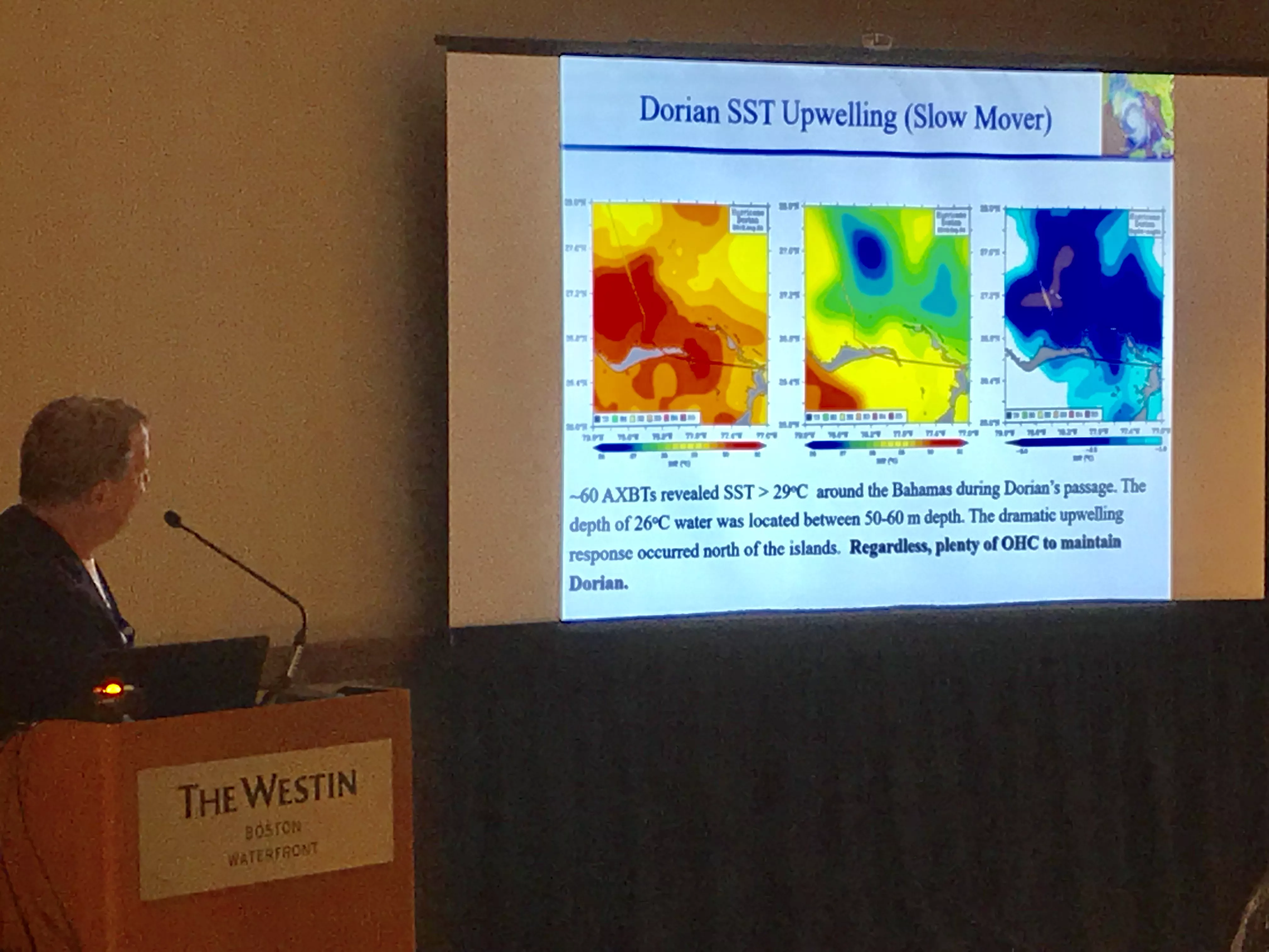
Jason-2 and -3 satellite data are part of a suite of remote-sensing and other data that are helping scientists derive the variations in the ocean’s heat content. This, in turn, can assist both researchers and forecasters with their understanding of changes in hurricane intensity.
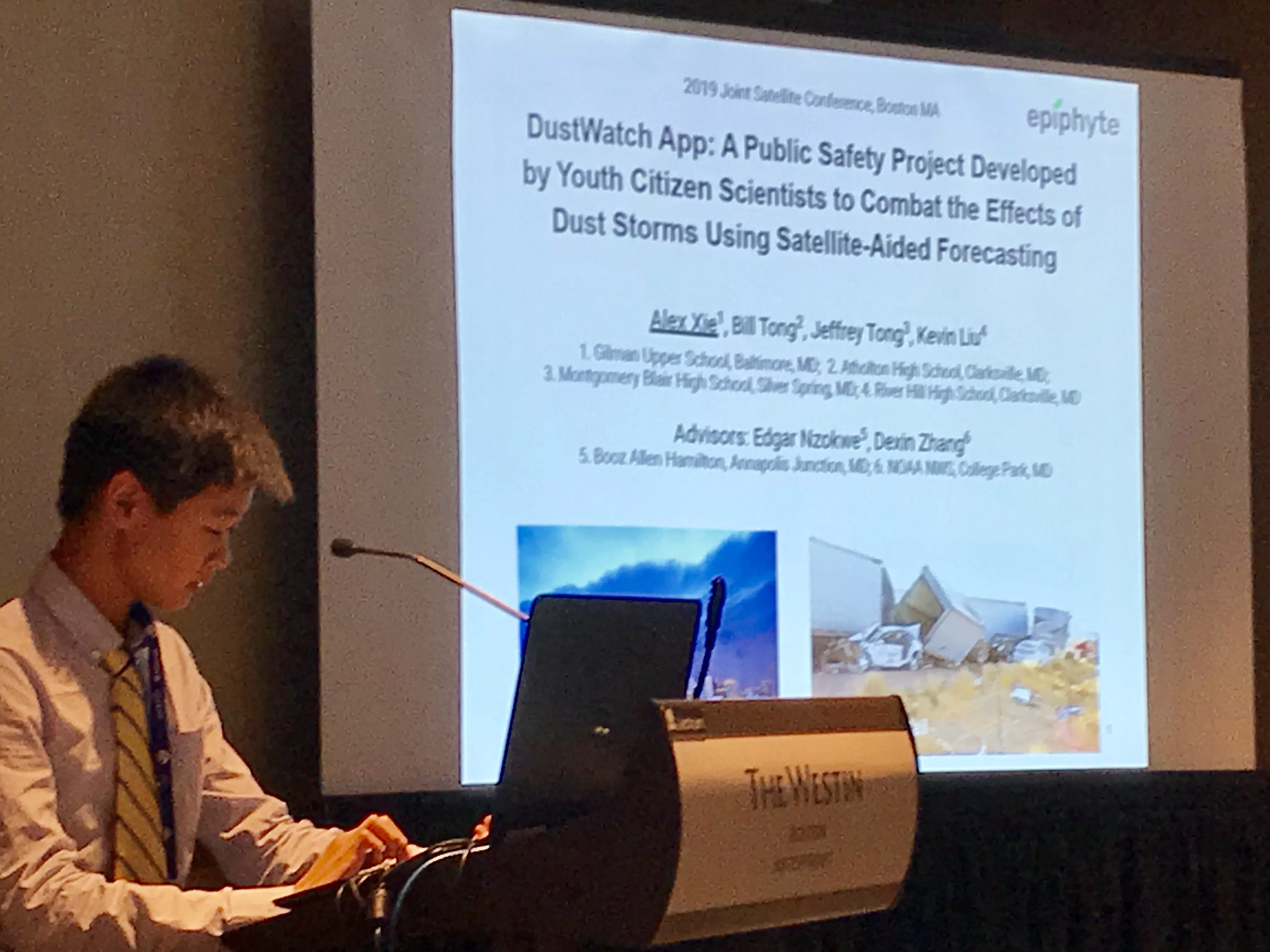
Lastly, the afternoon had one of the day’s more interesting presentations given by high school student Alex Xie of Gilman School in Baltimore, Md. He, along with three of his school friends, recently created a smartphone application called DustWatch, which taps into NOAA NWS forecasts, satellite data, and other resources to provide public alerts for potentially deadly dust storms in the American Southwest. This is definitely something we will follow-up with Alex and his team about for a web story down the road. Great work, Alex and team!
We’ll have another JSC Daily Debrief update tomorrow afternoon. Once again, there are many sessions, talks, and presentations planned about how satellites are shaping our future. Some topics on Thursday will touch upon how satellites are helping monitor climate change in the polar regions, as well as how satellites are assisting drought forecasting and food security around the globe.
For a full look at the day of talks at the JSC, click here.
October 1, 2019
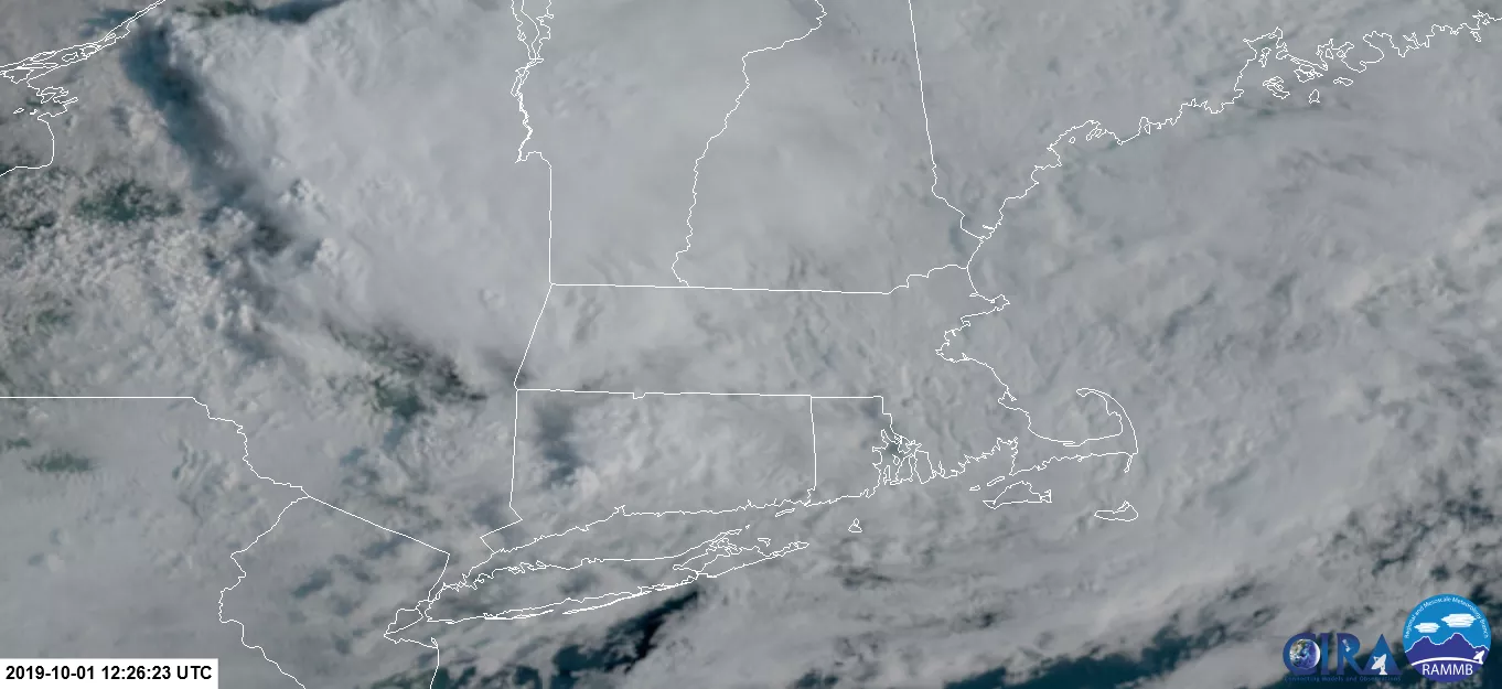
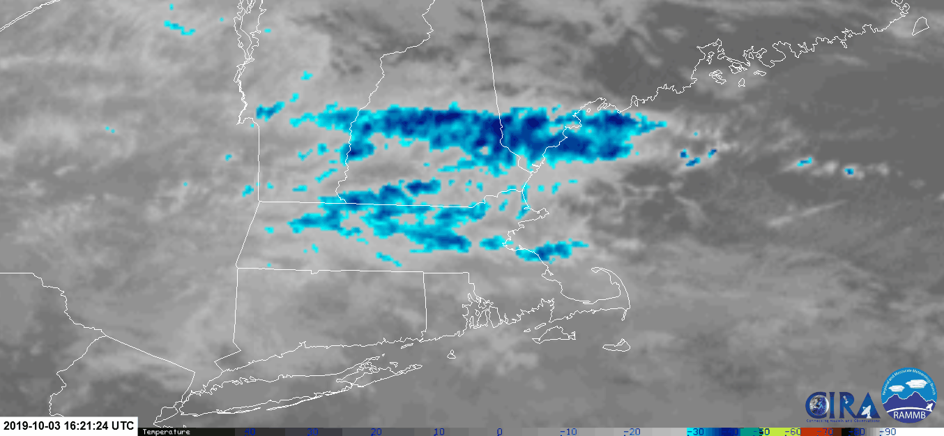
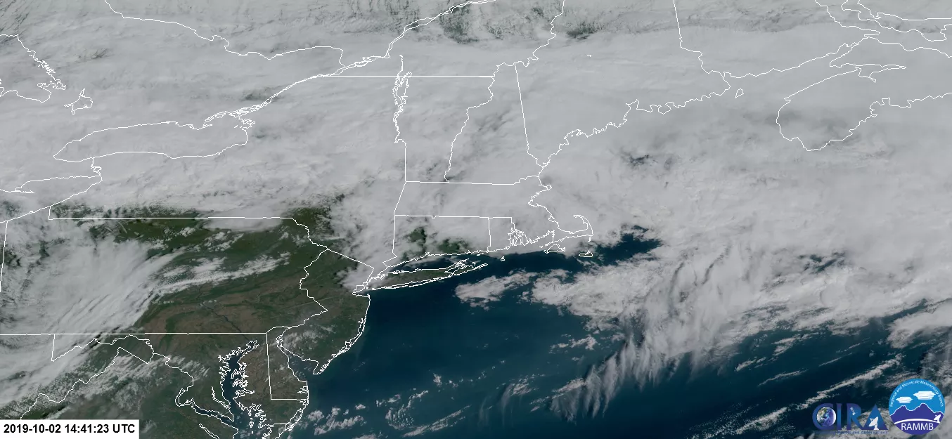
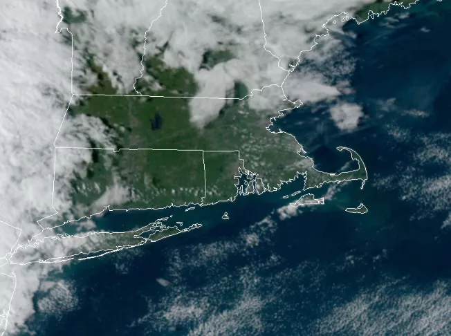
Day 2 of the JSC started on a cool, cloudy and drizzly note. NOAA’s GOES-16 satellite caught this socked-in image of New England early this morning—can you see Massachusetts under all those clouds? After a jammed-packed day of plenary talks, events, and poster sessions yesterday, today had many smaller, more focused sessions on satellite science and technology.
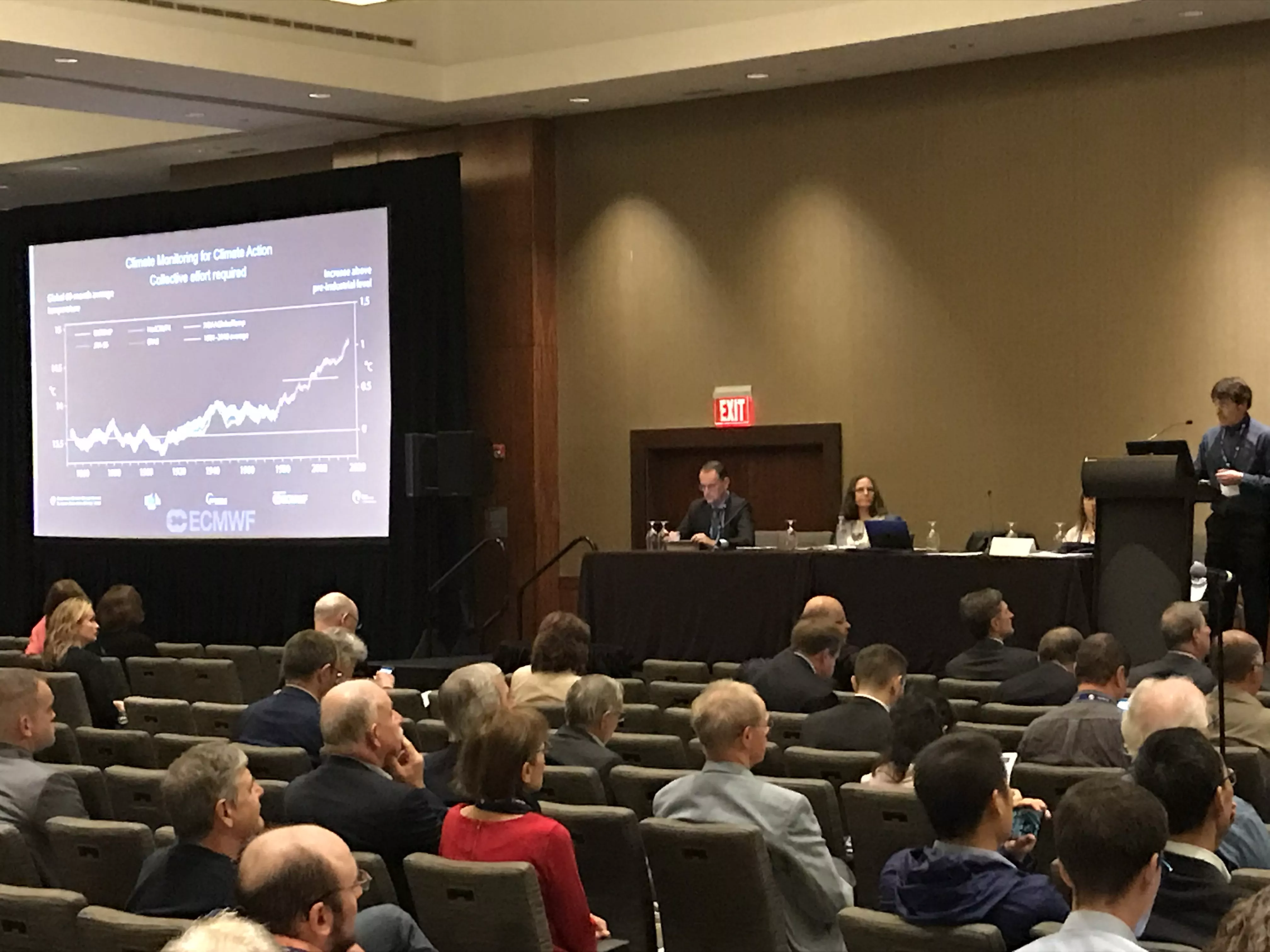
The morning began with a session chaired by our JSC co-sponsor, the European Organisation for the Exploitation of Meteorological Satellites (EUMETSAT). The session and its panelists provided innovative examples of how space-based observations (aka, satellites and their instruments) are helping track global carbon emissions and their role in climate change.
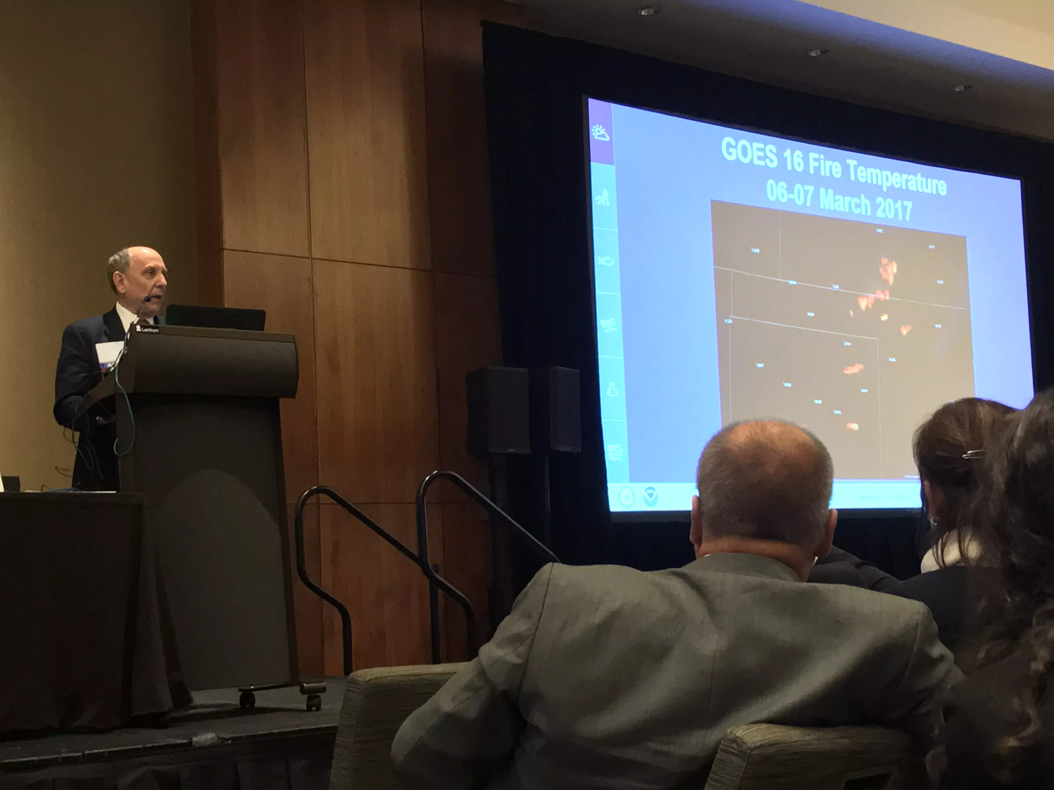
A mid-morning session focused on the recent capabilities of new satellite systems and instruments. Here is where NOAA’s next-generation series of Geostationary Environmental Operational Satellites (GOES-R) and Joint Polar Satellite Systems (JPSS) took the spotlight.
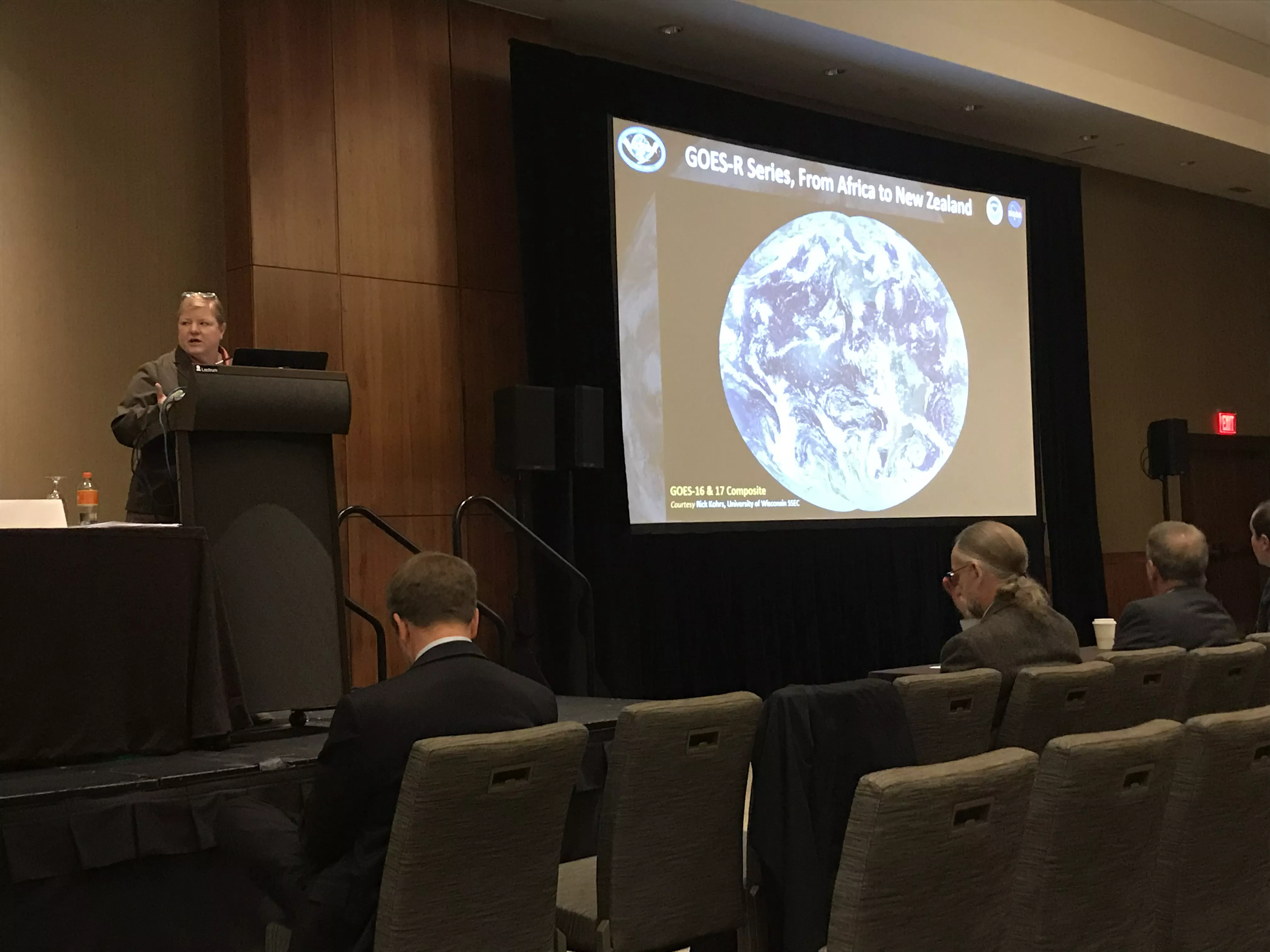
Several presentations highlighted the new capabilities of GOES-R satellites and their instruments, which is helping scientists and forecasters improve their understanding of Earth and its weather and climate. NOAA’s GOES-R System Program Director, Pam Sullivan, spoke about the operations and applications of both GOES-16 and GOES-17. A few examples:
- Both GOES-16 and -17 are now allowing for better wildfire detection across the United States
- GOES-17 allows the north coast of Alaska to track sea ice movement from space
- GOES-17 enabled the National Weather Service Office in Juneau, Alaska, to issue its first-ever severe thunderstorm warning based on satellite imagery this past summer
Following that GOES talk, NOAA Deputy Program Director, Tim Walsh, highlighted the Joint Polar Satellite System (JPSS), in particular, the NOAA-20 and Suomi NPP satellite. Both satellites orbit around the Earth’s poles 14 times a day, providing a complete, global image twice a day.
They are both critical for numerical weather forecasting, operational weather data for the polar regions, and supporting environmental monitoring. Tim Walsh estimated that 85 percent of the data in global weather models comes from polar-orbiting satellites.
In the early afternoon, Matt Cadwallader from Woods Hole Group, Inc., explained how Earth-observing satellites are helping to improve forecasts for the offshore oil and gas industry in the Gulf of Mexico from an end-user’s point of view. Better forecasts mean less disruptions to production; and therefore, save time, money and resources. Several satellites, including Jason-3, were highlighted in this talk.
It’s hard to believe we’ll be more than half-way done by tomorrow, but it will be another full day. Wednesday will feature how new satellites and sensors are improving hurricane research and forecasting. There will be a session on the NOAA GOES’ Geostationary Lightning Mapper, and how it is improving scientists’ understanding of lightning on a global scale. There also will be a presentation explaining how NOAA satellite data helped a group of high-school students create a mobile phone app for alerting the public about hazardous dust storms in the American Southwest.
For a full look at the day of talks at the JSC, click here.
September 30, 2019
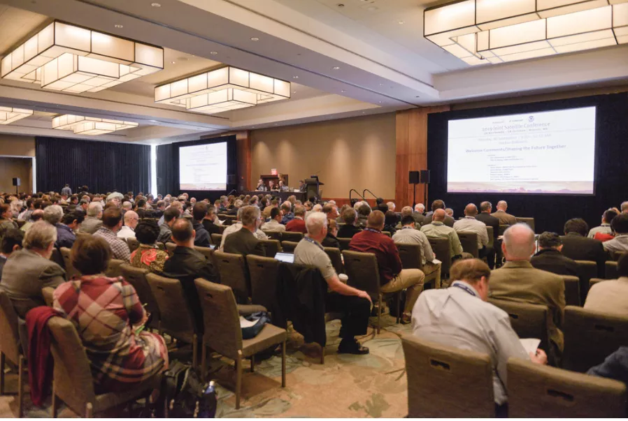
It was a pleasantly cool fall day for the kickoff of the 2019 JSC in Boston this morning. Today was an all-day plenary—which is a meeting attended by all participants at a conference. With more than 700 people registered to attend the JSC, the plenary was a standing room only affair.
The morning started off with a warm welcome from the leadership of NOAA’s National Environmental Satellite, Data, and Information Service (NESDIS), the American Meteorological Society (AMS), and the European Organisation for the Exploitation of Meteorological Satellites (EUMETSAT). After welcoming attendees early in the day, the assistant administrator of NOAA NESDIS, Dr. Steve Volz, gave a talk on the future of international collaboration for observing the Earth as a complete system.
During a late morning panel, NOAA’s acting Administrator, Dr. Neil Jacobs, addressed the attendees and emphasized how a robust global observing system of high-quality and timely data is critical for understanding our dynamic planet.
Later in the afternoon, the director of NOAA’s National Weather Service, Dr. Louis Uccellini, along with other national and international satellite users, provided an overview of how important satellite data and imagery are for their individual missions.
This morning at the #2019JointSatelliteConf , we reviewed the nearly 60 years of #weather #satellite technology. On April 1, 1960, the world’s first television infrared observation satellite ( #TIROS1 ) launched, and the rest as they say, is history. pic.twitter.com/I9PYa6yDzy
— NOAA Satellites - Public Affairs (@NOAASatellitePA) October 2, 2019
NEW: Here’s a Wednesday weather satellite trivia question from the #2019JointSatelliteConf … Despite operating for just 78 days, the world’s first #weather #satellite , #TIROS1 , highlighted the importance of monitoring weather from space. pic.twitter.com/SkDBpTPd8O
— NOAA Satellites - Public Affairs (@NOAASatellitePA) October 2, 2019
At the #2019JointSatelliteConf today, attendees saw how Earth-observing #satellites , like #Jason2 and #Jason3 , are measuring the heat content and sea-surface temperatures of the world's oceans. This can help scientists better understand how those impact #hurricane intensity. pic.twitter.com/G3YkjiUCkr
— NOAA Satellites - Public Affairs (@NOAASatellitePA) October 2, 2019
A formal poster session came at the end of the afternoon where more than 200 posters from collaborators and partners to scientists and students displayed fascinating examples of satellite data and imagery being used in interesting and innovative ways across the globe.
As we kick off the month of October tomorrow, it will be another full day of satellite scientists and collaborators highlighting how satellites are shaping the world’s future, including NOAA’s Joint Polar Satellite System (JPSS). There will also be a panel on how satellites are supporting safe and efficient operations in the offshore industry. For a full look at the day of talks at the JSC, click here.