Phenomena: Total solar eclipse, space weather
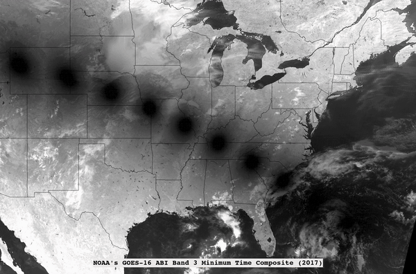
Satellite: GOES-16 (GOES East)
Product: ABI band 3 (0.86 um)
Time: Composite of 2017 and 2024 total solar eclipses
There are many GOES loops showing the moon’s shadow from the total solar eclipse on April 8, 2024 (UW/CIMSS; CIRA; Satellite Liaison; NOAA), but another occurred seven years ago. This time-composited image shows both paths of totality from these two events, the shadows of which were recorded multiple times along their journeys.
The size of the Moon’s shadow on the Earth during the total solar eclipses were very different between 2017 and 2024. We use ABI band 3 (0.86 um), since the land background tends to be bright (due to reflection off vegetation), hence giving more contrast with the dark shadow.
The GOES East geostationary satellite, also known as GOES-16, keeps watch over most of North America, including the contiguous United States and Mexico, as well as Central and South America, the Caribbean, and the Atlantic Ocean to the west coast of Africa. The satellite's high-resolution imagery provides optimal viewing of severe weather events, including thunderstorms, tropical storms, and hurricanes.