


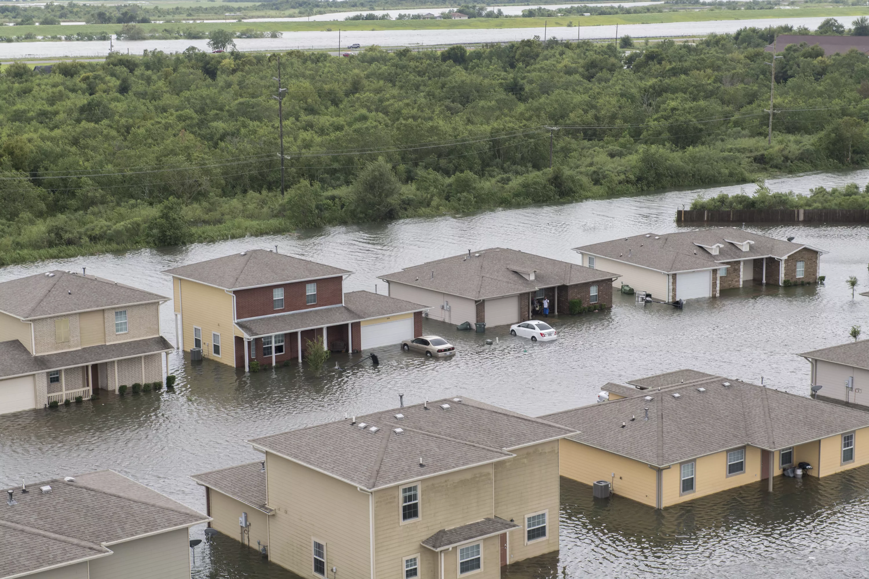
Hurricane Harvey left streets and houses flooded after making landfall. The 347th Rescue Group from Moody Air Force Base, Ga. responded with its rescue aircraft and personnel in support of FEMA after Hurricane Harvey brought flooding and destruction to parts of Texas. (U.S. Air Force photo by Tech. Sgt. Zachary Wolf)
Forecasters use satellite data to predict and monitor storms, estimate the amount of precipitation that will fall, and determine where and how high the flooding will occur.
Reasons for the Rise
Flooding can happen for many reasons, including heavy rainfall or when snow and ice melt quickly. Geography can also play a role in the likelihood of flooding: coastal areas are vulnerable to storm surges, low-lying areas near rivers face higher risks, and cities with limited green space have fewer places for the rain to soak into. Even drought can contribute, since dry ground often repels water instead of soaking it in.
Along with thunderstorms and hurricanes, atmospheric rivers are another major source of flooding. Atmospheric rivers are long, narrow channels of water vapor. They contain so much water vapor that they are the largest transporters of Earth’s freshwater, moving vast amounts from the tropics toward the poles like rivers. One atmospheric river known as the Pineapple Express forms when a band of warm, moist air over the tropics near Hawaii is carried by winds toward the West Coast of North America. Once over land, they often release this water vapor as heavy rain or snow over relatively short periods. The warm, tropical air can also cause snow and ice to melt, which, along with heavy precipitation, can lead to major flooding.
Not all atmospheric rivers lead to flooding. In fact, many provide a much-needed supply of fresh water. Fortunately, weather satellites monitor their activity, allowing forecasters and emergency management agencies to be prepared if a disaster strikes.
Satellites Enable Better Flood Forecasts
Floods are one of the leading causes of weather-related deaths, with an average of 88 per year. They can wipe out roads, bridges, homes, and infrastructure. While the water on the road may seem shallow, it can be very dangerous, with rushing flood water just 12 inches deep able to whisk away a car. Accurate and timely forecasts are critical to warn the public, give people valuable time to evacuate and for emergency teams to coordinate and respond.
Instruments on both the JPSS and GOES satellites are crucial in issuing timely flood warnings. The JPSS’s Advanced Technology Microwave Sounder (ATMS) measures the temperature and water vapor of storms, while the GOES’s Advanced Baseline Imager (ABI) captures cloud traits and atmospheric conditions. This data helps forecasters track quickly changing weather. The GOES Geostationary Lightning Mapper also delivers vital weather data by tracking lightning. Rapid upticks in lightning strikes mean a storm is gaining strength, and the part of the storm with the most lightning tends to produce the most rain. Forecasters combine this data to predict the storm’s direction, strength and how much rain it might bring.
The Visible Infrared Imaging Radiometer Suite (VIIRS) and the ABI help to create flood zone maps. These maps are provided to FEMA, local emergency management, and first responders. This, along with data from other resources, lets them know where flooding is most likely to occur, where the water will recede first, and when it is safe for people to return to their homes. This data helps them better assign resources, plan evacuations, and focus their recovery efforts.
River Ice & Flooding Initiative
Flooding can also occur when frozen rivers block the natural flow of water. As the ice thaws, it can break apart, and chunks may travel downstream, creating jams that obstruct water flow. When combined with heavy precipitation, these events can become catastrophic. Satellite data can give residents early warning of these events, saving lives and property.
In 2013, NOAA partnered with river forecast centers to form the River Ice & Flooding Initiative. This effort serves regions throughout the United States and around the world that face flooding risks from ice jams and heavy rain or snow. River ice and flooding products are available from the Cooperative Institute for Meteorological Satellite (CIMSS) RealEarth’s Data Discovery and Visualization Platform.


