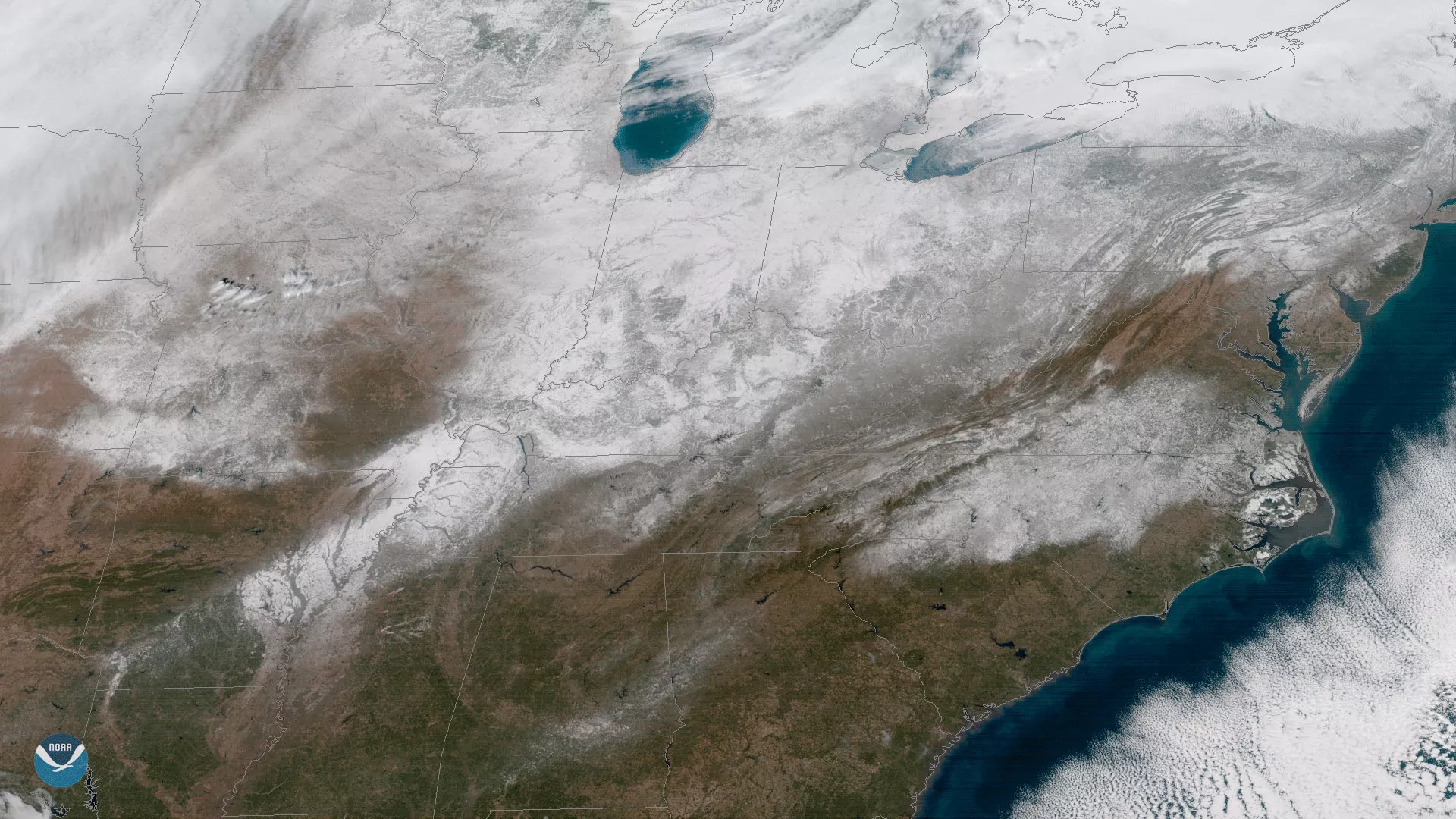
Clear skies enabled the GOES East satellite to capture this view of current snow cover over the eastern United States on January 18, 2018. An active weather pattern combined with below-normal temperatures this winter have brought accumulating snow as far south as Mississippi and Alabama for the second time in less than six weeks. In this image, a faint swath of snow is visible across southern Alabama and western Georgia. Brighter white areas indicate greater snow depths, as seen in parts of Arkansas, southern Missouri, Indiana and Ohio. Significant snowfall remains conspicuously absent in parts of the mid-Atlantic, including the Washington, D.C. area, as snow-producing storms have frequently tracked to the north or south of the region this winter.
Created by our partners at the Cooperative Institute for Research in the Atmosphere, the GOES East geocolor imagery enhancement displays geostationary satellite data in different ways depending on whether it is day or night. In daytime imagery (shown here), land and shallow-water features appear as they do in true-color imagery, while at night, the window infrared channel 13 and the traditional fog product are used to identify both ice and liquid water clouds, and are made partially transparent against a static city lights background.