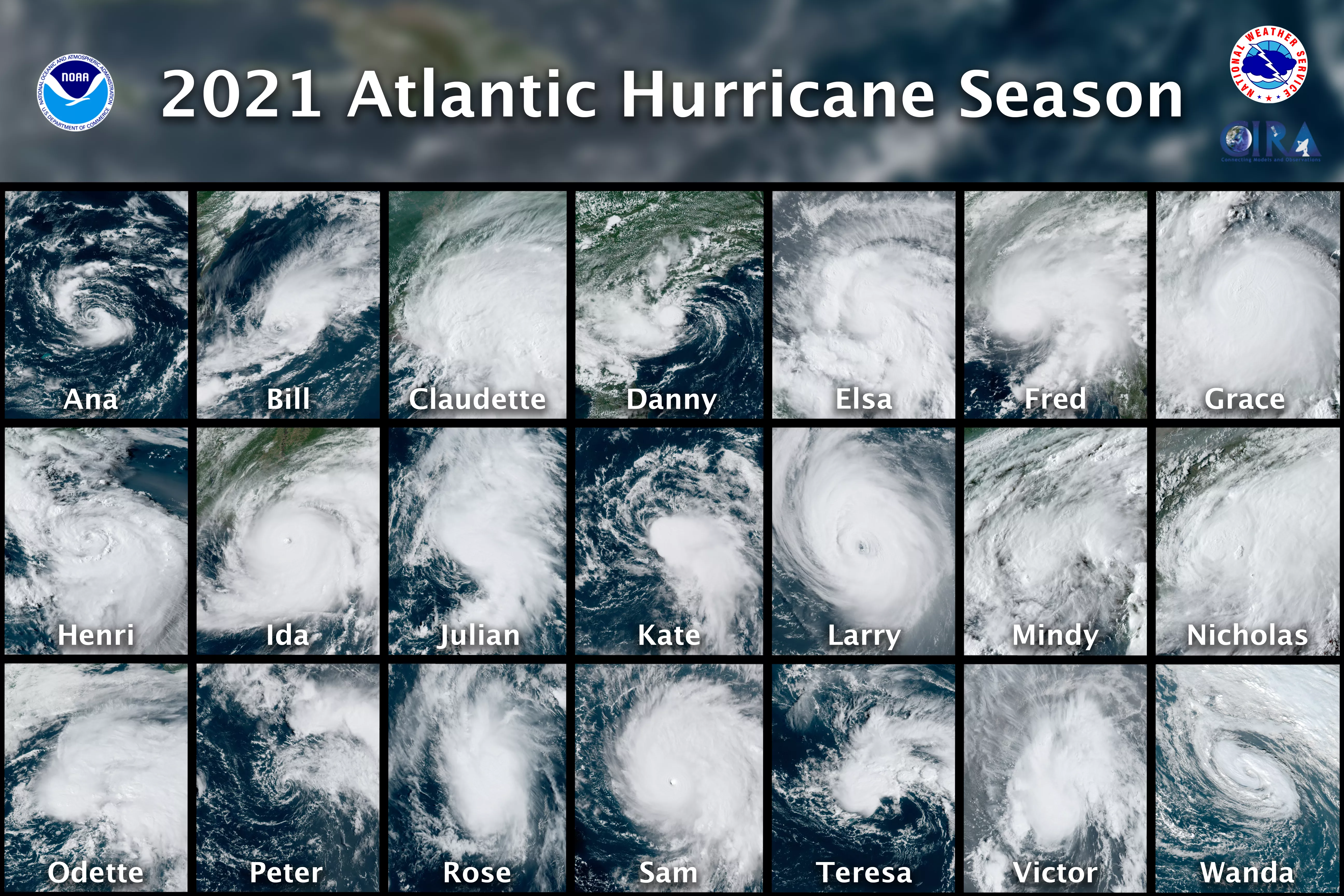
The Atlantic Basin had another busy hurricane season this year, which officially wrapped up on November 30. In this composite image above, all 21 named storms—from Ana to Wanda—are seen from NOAA’s GOES-16 (GOES East) satellite.
With those 21 storms, the 2021 season ranks as the third-busiest Atlantic season on record, behind last year’s unprecedented 30 named storms, and the 27 named storms and one unnamed storm that developed in 2005.
The most destructive storm of 2021 was Category-4 Hurricane Ida, which came ashore near Port Fourchon, Louisiana, on August 29. When Ida made landfall, maximum sustained winds were estimated around 150 mph and reconnaissance aircraft estimated its minimum central pressure as 930 mb (27.46 in). This ranks as the second-most-intense hurricane to strike Louisiana on record, after Hurricane Katrina in 2005.
The GOES East geostationary satellite, also known as GOES-16, keeps watch over most of North America, including the continental United States and Mexico, as well as Central and South America, the Caribbean, and the Atlantic Ocean to the west coast of Africa. The satellite's high-resolution imagery provides optimal viewing of severe weather events, including thunderstorms, tropical storms, and hurricanes.