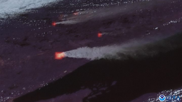
NOAA’s GOES East satellite had its eye on Minnesota’s Greenwood Fire on August 23, as the wildfire nearly doubled in size over a 24-hour period in the state’s Arrowhead region. In this image above, the satellite is using its GeoColor imagery and Fire Temperature imagery to detect the smoke and heat signature of the blaze, which is the largest, southernmost fire in this loop.
The fire was first reported on Aug. 15 near Greenwood Lake, approximately 15 miles southwest of Isabella, Minn. The U.S. Forest Service said lightning caused the fire, and it quickly grew into Minnesota’s largest active wildfire. On Sunday, August 22, the wildfire was reported to have covered just under 9,000 acres and by Tuesday morning, it had grown to more than 19,500 acres. Fire officials said it was so large and intense that the wildfire created its own fire-induced thunderstorm that sparked lightning across the region.
The GOES East geostationary satellite, also known as GOES-16, keeps watch over most of North America, including the continental United States and Mexico, as well as Central and South America, the Caribbean, and the Atlantic Ocean to the west coast of Africa. The satellite's high-resolution imagery provides optimal viewing of severe weather events, including thunderstorms, tropical storms, and hurricanes.