
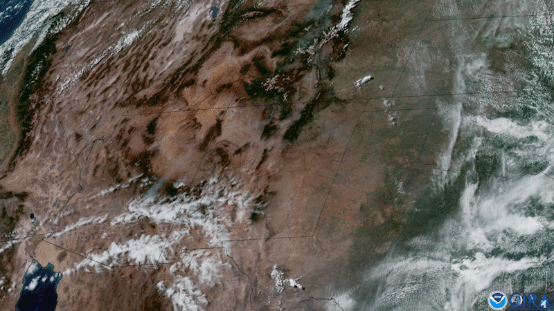
Wildfire season is cranking up, and smoke was filling the western skies of the United States this week.
On June 8, 2021, NOAA’s GOES East satellite viewed several fires in the states of California, New Mexico, Idaho, Utah, and Arizona. Some of the largest, in Arizona and New Mexico, reportedly have burned more than 200,000 acres of land. Sensors on GOES satellites can allow authorities to spot wildfires before they are spotted by the human eye by detecting smoke in remote areas and thermal hot spots from recently sparked fires.
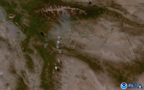
In this zoomed-in imagery from GOES West, you can clearly see the smoke plume from the largest wildfire burning in Utah---the Bear Fire. During its first 24 hours, it had reportedly burned more than 1,900 acres, and was 0% contained as of Wednesday morning.
As of the last report, Red Flag Warnings covered parts of Arizona, California, Colorado, Idaho, Nevada, New Mexico, and Utah. Agencies such as the California Safe Council urged residents to deter fires from their homes by keeping gutters and roofs clear of leaves and debris and maintaining a five foot noncombustible zone around houses and decks.
The GOES geostationary satellites keep watch over the entire Western Hemisphere and most of the Pacific Ocean. The satellite's high-resolution imagery provides optimal viewing of severe weather events, including thunderstorms, tropical storms, and hurricanes.