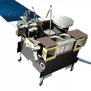
March 4, 2016, was the 6th anniversary of the launch of GOES-P (now GOES-15), one of NOAA’s Eyes in the Sky for the Western Hemisphere.
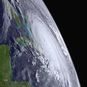
The last of the GOES-N series of geostationary satellites, GOES-15 takes atmospheric measurements and captures higher-resolution images of weather patterns than its predecessors, allowing forecasters to pinpoint the location of severe weather with greater accuracy.
GOES-15 currently operates in the GOES West position, providing coverage of the western United States; the northeastern, central, and eastern Pacific; Alaska; and Hawaii. In conjunction with GOES East (currently the GOES-13 satellite), they provide full coverage of the Western Hemisphere from their orbit 22,240 miles above the Earth's equator.
GOES History
For more than 40 years, GOES -- an acronym for geostationary operational environmental satellite -- satellites have provided environmental information used in a variety of applications, including weather monitoring and prediction models, ocean temperatures and moisture locations, climate studies, cryosphere (ice, snow, glaciers) detection and extent, land temperatures and crop conditions, and hazard detection.
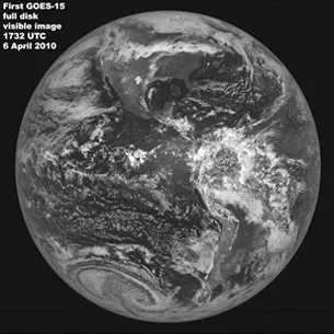
GOES-1 was launched on October 16, 1975, from Cape Canaveral Air Force Station in Florida. It returned its first image just nine days later, on October 25, and quickly became an essential tool used by the NOAA’s National Weather Service. Using a Visible/Infrared Spin Scan Radiometer (VISSR), the satellite provided day and night observations of cloud and surface temperatures, cloud heights and wind fields. Although GOES-1 was spin-stabilized, only viewing Earth about 10 percent of the time and providing data in only two dimensions, it gave forecasters their first near-real time look at atmospheric conditions from a fixed location.
The following generations of GOES satellites and their instruments continued to improve, experiencing significant enhancements, and providing continuous and accurate imagery and data on atmospheric conditions, solar activity, and Earth’s weather systems for the next four decades. During that time, GOES satellites have taken well over 3 million images of Earth!
The Next Generation: GOES-R
With the next generation of weather observing satellites on the horizon, NOAA is poised to once again significantly improve weather forecasting and severe weather prediction.
The first satellite in this series of satellites, called GOES-R, is scheduled to launch in October 2016.
From its position above North America, GOES-R will scan the Earth five times faster at four times image resolution, and triple the number of channels scientists can tap into to observe global weather and climate.
This increase in data production means satellite imagery of severe weather, like hurricanes and tornados, will be available in near real-time, giving forecasters even more tools to make timely warnings during a severe weather event.
To learn more about the GOES satellite mission, visit the NOAA website.
To see the latest GOES-15 imagery from across all of its sectors, check out the GOES-West imagery page on the NOAA's Satellite and Information Service website.