Himawari-8 spies an island creating swirling cloud streets in the East China Sea.
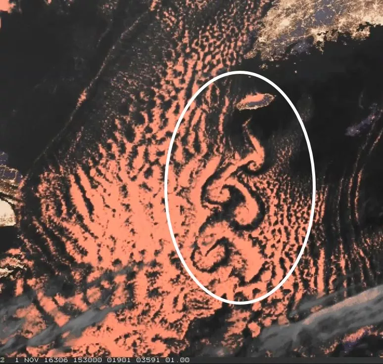
The Japan Meteorological Agency's Himawari-8 satellite produced this GeoColor imagery of Von Karman Vortices over the East China Sea on November 1, 2016.
Swirling von Karman vortices (aka cloud streets) form when geological features, like islands and volcanoes, disrupt the flow of the wind, causing it to spiral. (Similar to the way large boulders create downstream eddies in rivers.) The vortices were named after Theodore von Karman, a co-founder of NASA’s Jet Propulsion Laboratory, who was one of the first scientists to describe this type of atmospheric phenomenon.
Developed by the Cooperative Institute for Research in the Atmosphere (CIRA) in partnership with the Naval Research Laboratory, GeoColor imagery displays geostationary satellite data in a way that depicts daytime land and shallow-water features in true color and, at night, liquid water clouds in pinkish-red, ice clouds in grayish-white, the land appears purple (to help distinguish it from bodies of water), and, of course, the city lights appear in gold. (Note: the city lights data are from a static database derived from the VIIRS Day Night Band.)
The primary instrument aboard Himawari-8 is the Advanced Himawari Imager, a 16-channel multi-spectral imager designed to capture visible light and infrared images of the Asia-Pacific region. This GeoColor imagery demonstrates the kind of imagery that will be possible following the launch of NOAA's new GOES-R satellite.
This imagery comes to us courtesy of our partners at the Cooperative Institute for Research in the Atmosphere (CIRA). To see more Himawari imagery, visit the CIRA website.