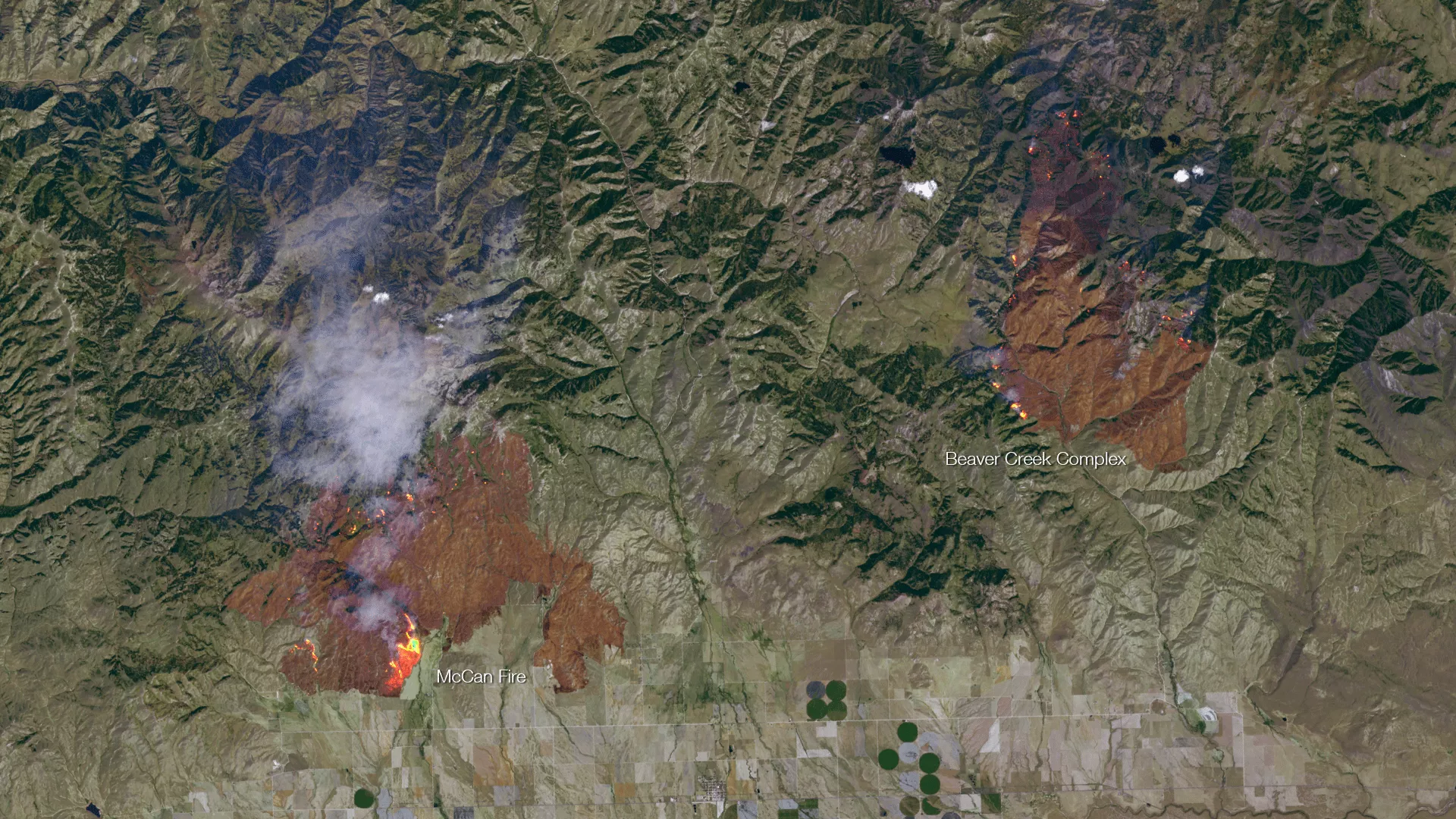
Taken on August 10th, 2013 by the Landsat-8 satellite, this image shows the active fire areas along with burn scars for the McCan and Beaver Creek Complex fires. Landsat, a collaboration between the USGS and NASA, provides high resolution 30-meter per pixel imagery using specialized visible and thermal sensors to distinguish between different land surface types. The use of the thermal information in this image allows the hot spots of active fires to be clearly seen as specks (and in some cases, large areas) of yellow and orange. The much narrower swath of Landsat requires 16 days to cover the entire planet – unlike satellites like the Suomi NPP, which have much lower spatial resolution but can provide global coverage in 12 hours.