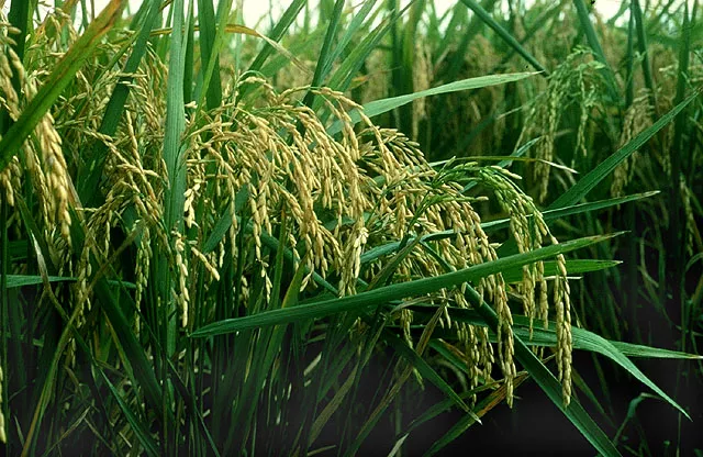
In “NOAA Satellite Data Aids the Nation's Agricultural Forecasts,” we highlighted the Joint Agricultural Weather Facility and its publication,Weekly Weather and Crop Bulletin,which offers detailed descriptions of satellite imagery and blended data products to help agricultural producers respond to changing weather conditions. In this article, we're taking a look at another USDA information product that relies on satellite data—Crop Explorer.
When it comes to the use of satellite data in agriculture, there's more to see than the images and maps included in the USDA'sWeekly Weather and Crop Bulletin.The Internet offers a bumper crop of websites that use satellite data to “produce” information useful to the agricultural community and among the juiciest of these is Crop Explorer.
A creation of the Production Estimates and Crop Assessment Division (PECAD) of the U.S. Department of Agriculture's Foreign Agricultural Service (FAS), Crop Explorer is a web-based application offering near real-time agro-meteorological information and other data products that the agency uses to promote the security and stability of the U.S. food supply, improve foreign market access for U.S. agricultural products, report on world food security, and advise the U.S. government on international food aid requirements.
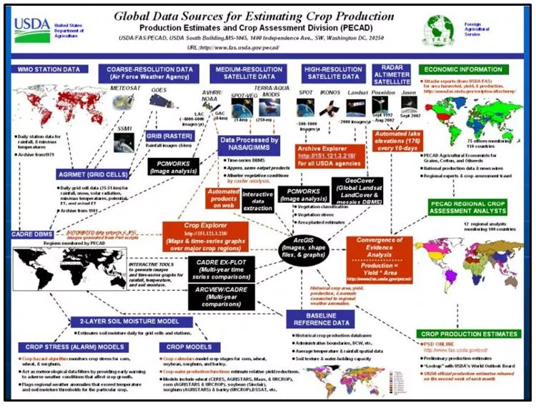
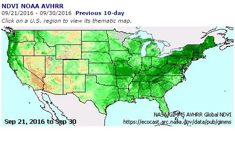
The heart of Crop Explorer is the Crop Condition Data Retrieval and Evaluation database (or CADRE), which uses data sets from several of sources, including NOAA's NOAA's geostationary (GOES), polar-orbiting (POES), and altimetry satellites, to produce imagery and data products such as maps of greenness and plant health and lake-level height graphs.
The outputs based on these data sources not only benefit the FAS's assessments of global agricultural production, which are an integral component of the USDA's monthly crop assessments and a primary source for agricultural information worldwide, they're also used by international development agencies to monitor global food scarcity and helpless affluent nations become more self-sufficient by improving their agricultural production systems and adopting sustainable land management practices.
For example, the Famine Early Warning Systems Network (FEWS Net), a collaborative effort among several US government agencies, including the US Agency for International Development, uses satellite estimates of soil-water availability and usage along with other satellite data to produce weekly weather hazard assessments and identify regions where agricultural production deficits are likely to occur.