
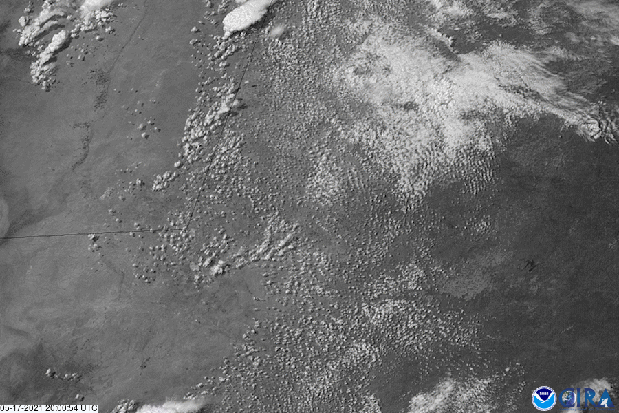
On May 17, 2021, the GOES East satellite captured more spectacular visible imagery of supercell thunderstorms developing over Texas. Thanks to the satellite’s Geostationary Lightning Mapper (GLM), we could also track lightning flashes within these storms.
The storms produced heavy rain, damaging winds, hail, and several tornadoes, according to the National Weather Service’s Storm Prediction Center. Hail the size of baseballs was reported near Girard, Texas, and wind gusts of more than 70 mph downed trees and damaged buildings in some places.
Farther to the east of these powerful thunderstorms, torrential rain fell over parts of eastern Texas and Louisiana, producing widespread flooding. This flooding, which was particularly extreme in southewestern Louisiana , prompted the state’s governor, John Bel Edwards, to declare a state of emergency yesterday.
The GOES East geostationary satellite, also known as GOES-16, keeps watch over most of North America, including the continental United States and Mexico, as well as Central and South America, the Caribbean, and the Atlantic Ocean to the west coast of Africa. The satellite's high-resolution imagery provides optimal viewing of severe weather events, including thunderstorms, tropical storms, and hurricanes.