May 17, 2021
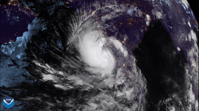
From May 15-17, 2021, Europe’s Meteosat-8 tracked Tropical Cyclone Tauktae as the storm tracked through the Arabian Sea over the course of 48 hours. As Tauktae made its way up India’s western coastline, it brought casualties and damage to parts of Maharashtra state, including India’s largest city, Mumbai.
At one point on May 17, the tropical cyclone had winds of more than 130 mph , making it equivalent to a Category-4 hurricane on the Saffir-Simpson wind scale. It is expected to make landfall near Jafrabad, Gujarat state, the most western-lying territory of India.
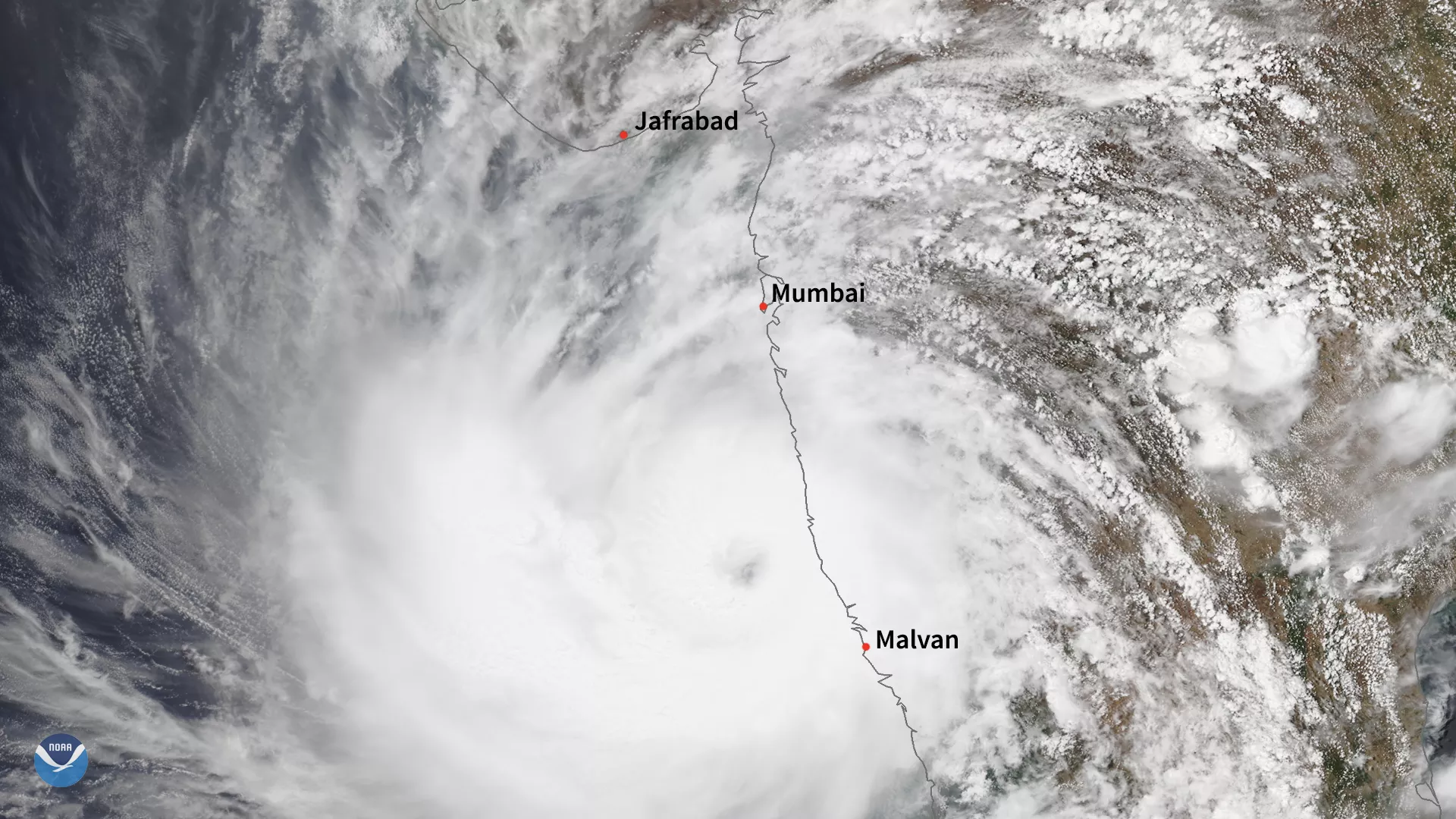
Below, the True Color NOAA-20 imagery shows the storm between Mumbai and Malvan on May 16.
In geostationary orbit at approximately 22,300 miles above the equator, the Meteosat-8 satellite operates over Europe, Africa, and the Indian Ocean. Meteosat-8 is one of the four geostationary satellites operated by EUMETSAT (European Organisation for the Exploitation of Meteorological Satellites).
This second image was captured by the NOAA-20 satellite's VIIRS instrument , which scans the entire Earth twice per day at a 750-meter resolution. Multiple visible and infrared channels allow it to detect atmospheric aerosols, such as dust, smoke and haze associated with industrial pollution and fires. The polar-orbiting satellite circles the globe 14 times daily and captures a complete daytime view of our planet once every 24 hours.