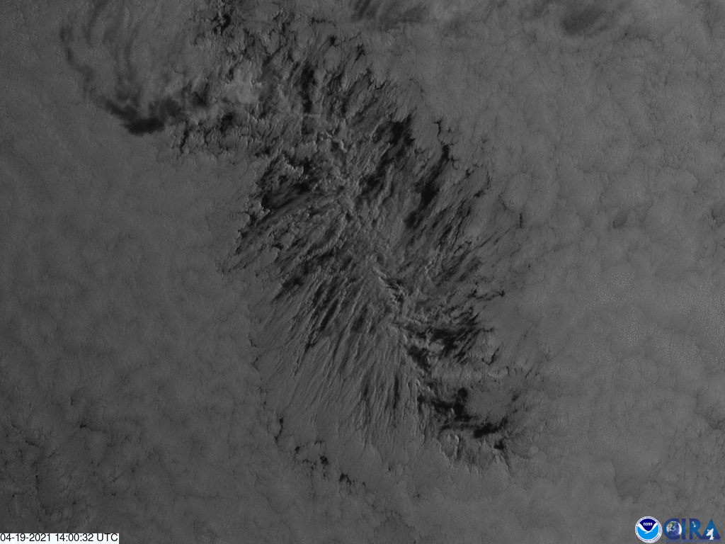
On April 19, 2021, the GOES West satellite captured this spectacular imagery of a converging cluster of stratocumulus clouds over the Pacific. This type of visible channel 2 imagery has the finest spatial resolution of all the bands on the satellite’s Advanced Baseline Imager instrument.
“These are essentially actinoform clouds,” said meteorologist Dakota Smith. “This one is just a little elongated and not quite circular.” Normally, actinoform clouds have a puffy radial structure reminiscent of a wagon wheel or a leaf that stands out from the rest of the low-lying cloud field. Their name even describes their spoke-like shape, since “actino-” comes from the Greek word for “ray” and their arms/spoke-like structures that reach out in all directions are called “actiniae.”
He continued to explain that these types of clouds are relatively rare, popping up every month or so, most commonly over open Pacific waters.
NOAA’s GOES West satellite, also known as GOES-17, provides geostationary satellite coverage of the Western Hemisphere, including the United States, the Pacific Ocean, Alaska, and Hawaii. First launched in March 2018, the satellite became fully operational in February 2019.