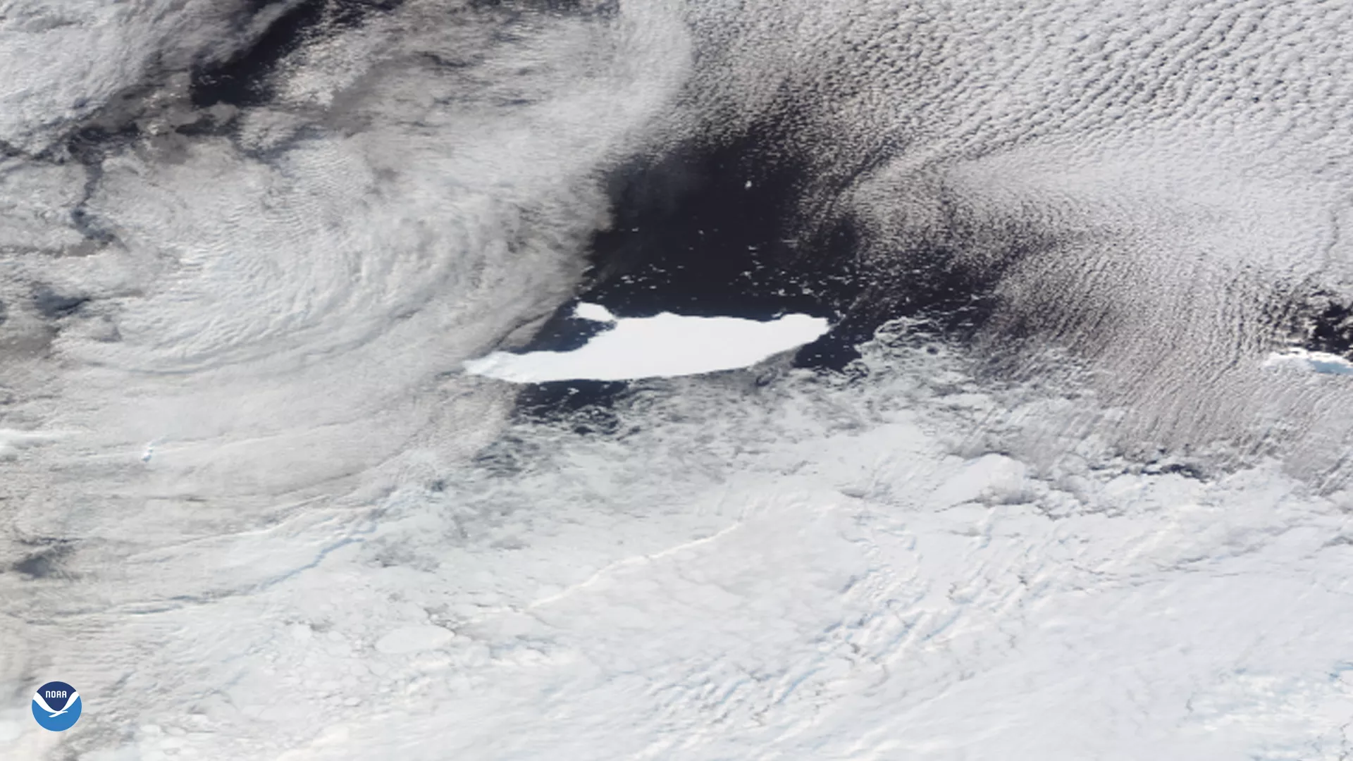
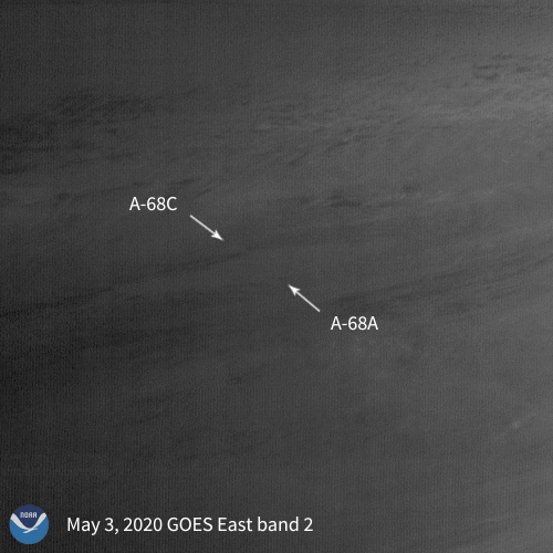
As the NOAA-20 satellite passed over the Antarctic Peninsula on May 5, 2020, it captured this cloudy image of the world’s largest iceberg, known as A-68A, drifting near the South Orkney Islands on the edge of the Weddell Sea and South Atlantic Ocean. According to the U.S. National Ice Center, a large piece of A-68A broke off, (or “calved”), on April 22, 2020, and that piece has been named A-68C.
Iceberg researchers divide Antarctica into quadrants (A, B, C, and D) and icebergs are named after which one they originate from as well as the particular order in which they calve. A-68A, for example, was the 68th iceberg to break off the continent’s A-quadrant since tracking began in the early 1970s.
According to Christopher Readinger, an analyst with the US National Ice Center, A-68A was originally 84 x 25 nautical miles (96.6 x 28.7 miles) in size when it calved from the Larsen-C Ice Shelf in Antarctica, on July 12, 2017. This is roughly the area of Juneau, Alaska. About four to five days later, another piece, A-68B, broke off of the parent iceberg. According to Readiner, “A-68B is still alive and well, and currently seems to be going the wrong way down Bransfield Strait in the Antarctic.” Although currents there generally flow from west to east, the iceberg has been heading west. Readinger added that icebergs can float up to 200 nautical miles (roughly 230 miles) per week.
Despite having just lost this new significant chunk of ice, A-68A is still the largest iceberg currently floating on Earth. A-68C is roughly 11 x 7 nautical miles (~100 square miles in area) in size, an area equivalent to Milwaukee, Wis. The largest iceberg ever recorded during the satellite era was B-15, which broke off the Ross Ice Shelf in late March of 2000. It was 160 x 20 nautical miles (184 x 23 miles), with an estimated area of 11,000 square kilometers (roughly 4,250 square miles). To put this in perspective, this area was larger than the state of Delaware.
The U.S. National Ice Center tracks icebergs that are larger than 26.5 square miles; otherwise they are considered too small. Even though smaller icebergs are still technically very large, Readinger explained that they have to draw the line somewhere.
This image was captured by the NOAA-20 satellite's VIIRS instrument , which scans the entire Earth twice per day at a 750-meter resolution. Multiple visible and infrared channels allow it to detect atmospheric aerosols, such as dust, smoke and haze associated with industrial pollution and fires. The polar-orbiting satellite circles the globe 14 times daily and captures a complete daytime view of our planet once every 24 hours.