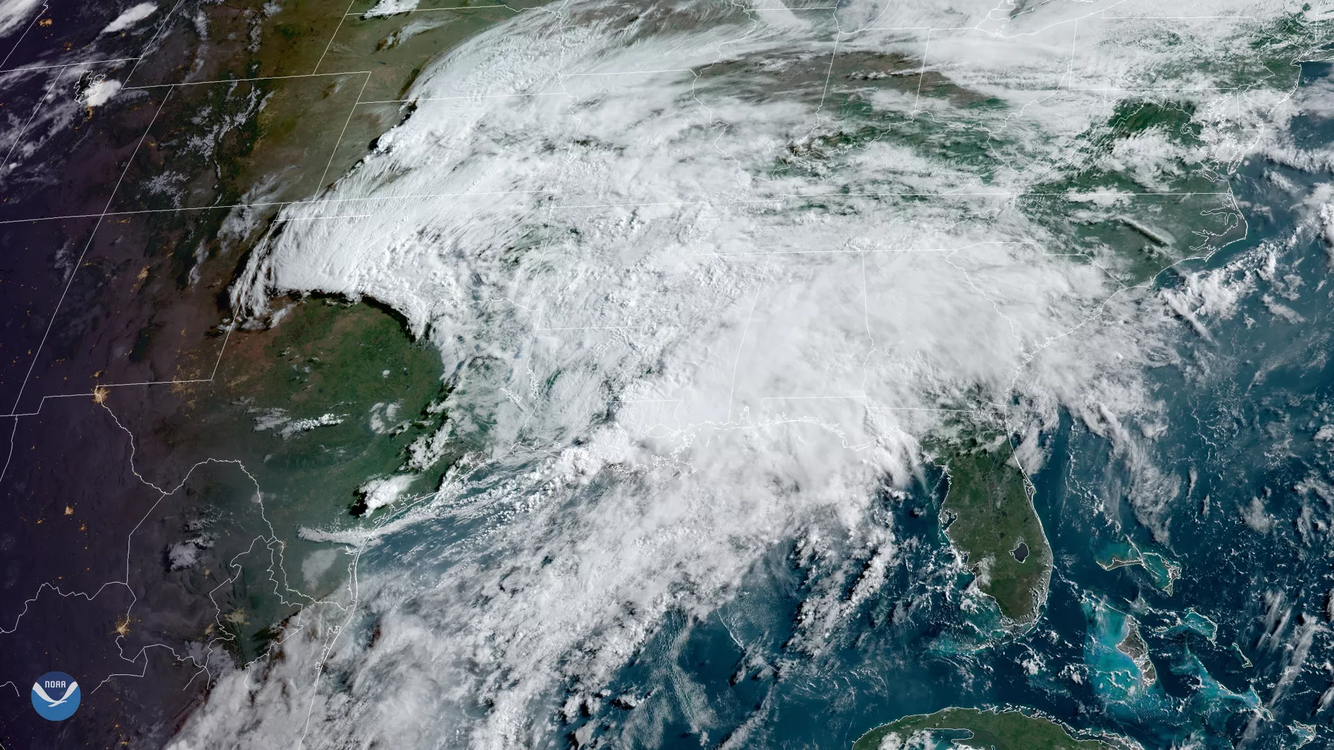
Tropical moisture is producing heavy rain across the Gulf Coast and lower Mississippi and Tennessee Valleys. Severe storms, seen bubbling up over Louisiana in this GOES East view from June 6, 2019, at 8:50 a.m. ET prompted several tornado warnings in the southeastern region of the state. The storm system had already unloaded 4-8 inches of rain on south central Louisiana by 10 a.m. ET, according to the National Weather Service (NWS).
While some rain will be beneficial to parts of the Southeast, too much rain can cause flash flooding. Flash flood watches are in effect for already waterlogged parts of Arkansas, Kansas, Louisiana and Mississippi, Missouri and Oklahoma.
As this system moves eastward over the next seven days, areas from the Florida Panhandle to the Carolinas could pick up more than 5 inches of rain.
The GOES East geostationary satellite, also known as GOES-16, provides coverage of the Western Hemisphere, including the United States, the Atlantic Ocean and the eastern Pacific. The satellite's high-resolution Advanced Baseline Imager provides optimal viewing of severe weather events, including thunderstorms, tropical storms and hurricanes.