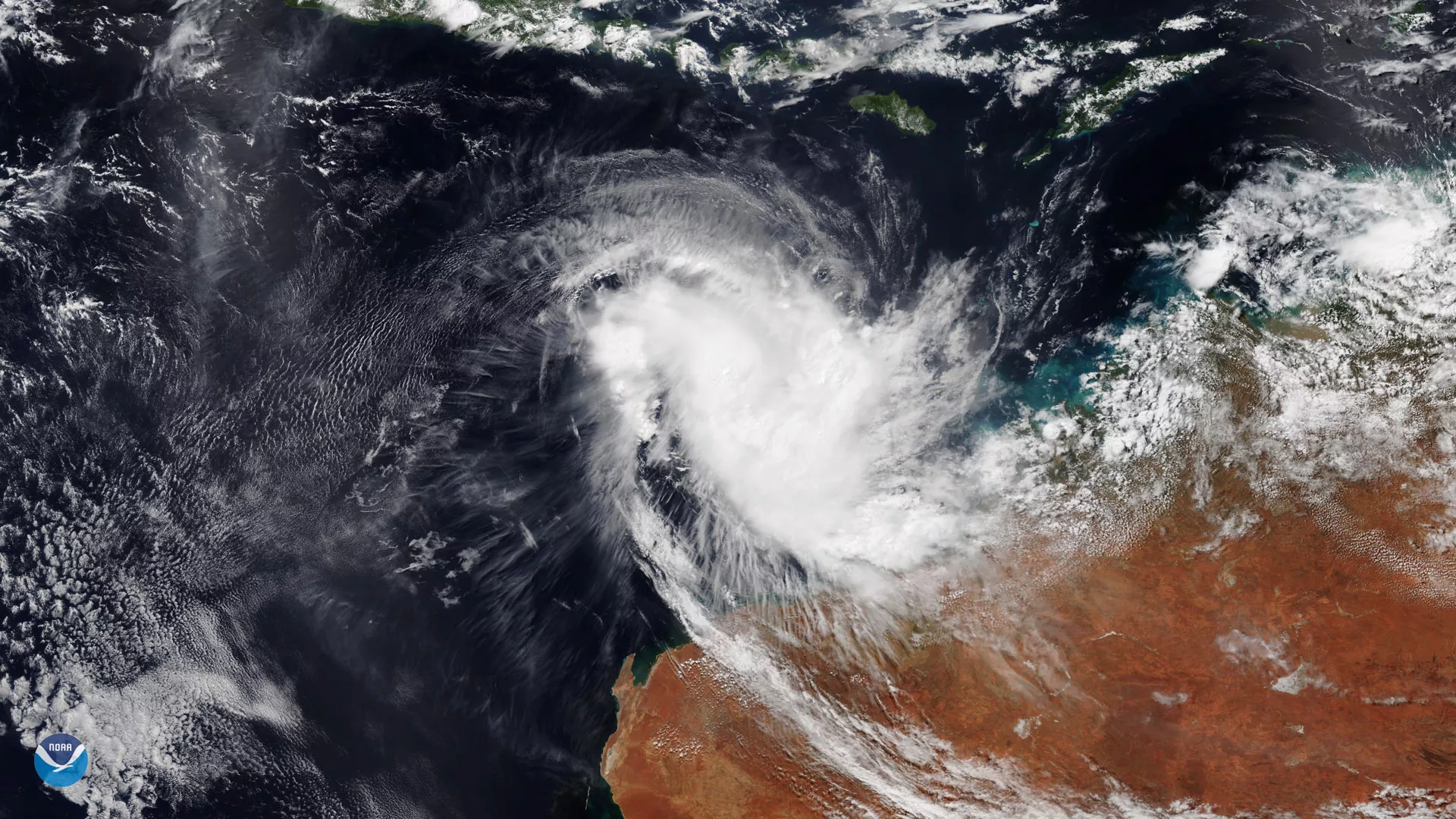
While Tropical Cyclone Wallace appeared to be gaining strength off the coast of Western Australia over the weekend, this NOAA-20 imagery from April 8, 2019, shows a much weaker system. The Category 1 tropical cyclone, which is equivalent to a tropical storm using the U.S. wind scale terminology, is expected to weaken as it tracks westward, according to Australia’s Bureau of Meteorology (BoM).
“Wallace is forecast to be below tropical cyclone intensity by Wednesday afternoon,†BoM noted in its latest forecast.
This is in large part due to wind shear, which is a change in wind speed or direction over some distance within the atmosphere. Vertical wind shear can cause a tropical system to weaken because it disrupts the flow of heat and moisture into the storm, which are two major factors that contribute to a storm gaining strength.
This image was captured by the NOAA-20 satellite's VIIRS instrument, which scans the entire globe twice daily at a 750-meter resolution. The VIIRS sensor provides high-resolution visible and infrared imagery of Earth's atmosphere, land, and oceans, and helps atmospheric scientists monitor severe weather events such as hurricanes and tropical storms.