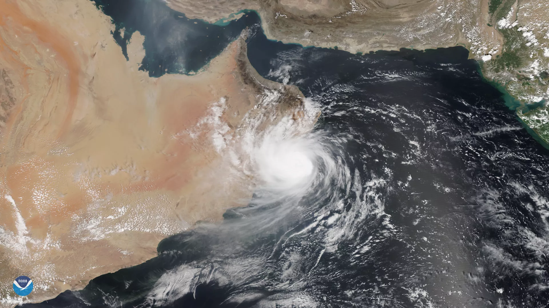
While we typically think of tropical cyclones as storms that form in the Atlantic and Pacific oceans, they do occasionally appear in the North Indian Ocean and can spin northward into the Arabian Sea, bringing strong winds and heavy rains to the Arabian Peninsula. Tropical Cyclone Hikaa, seen here by the NOAA-20 satellite on Sept. 24, 2019, is one of these relatively rare storms that made landfall over Oman yesterday.
The storm hit the coast with maximum sustained wind speeds of 80 mph. Today, Sept. 25, 2019, it is now considered a well-marked low pressure area , according to the India Meteorological Department and is hovering over the Arabian Sea, moving west-southwestwards.
Roughly seven percent of the world’s tropical cyclones occur in this part of the world, and the region often goes years without a storm. However, in 2018, three significant cyclones — Sagar, Mekunu, and Luban — made landfall over Yemen and Oman.
This true-color image was captured by the VIIRS sensor onboard NOAA-20, which provides daily, high-resolution visible and infrared images of Earth's atmosphere from across the globe.