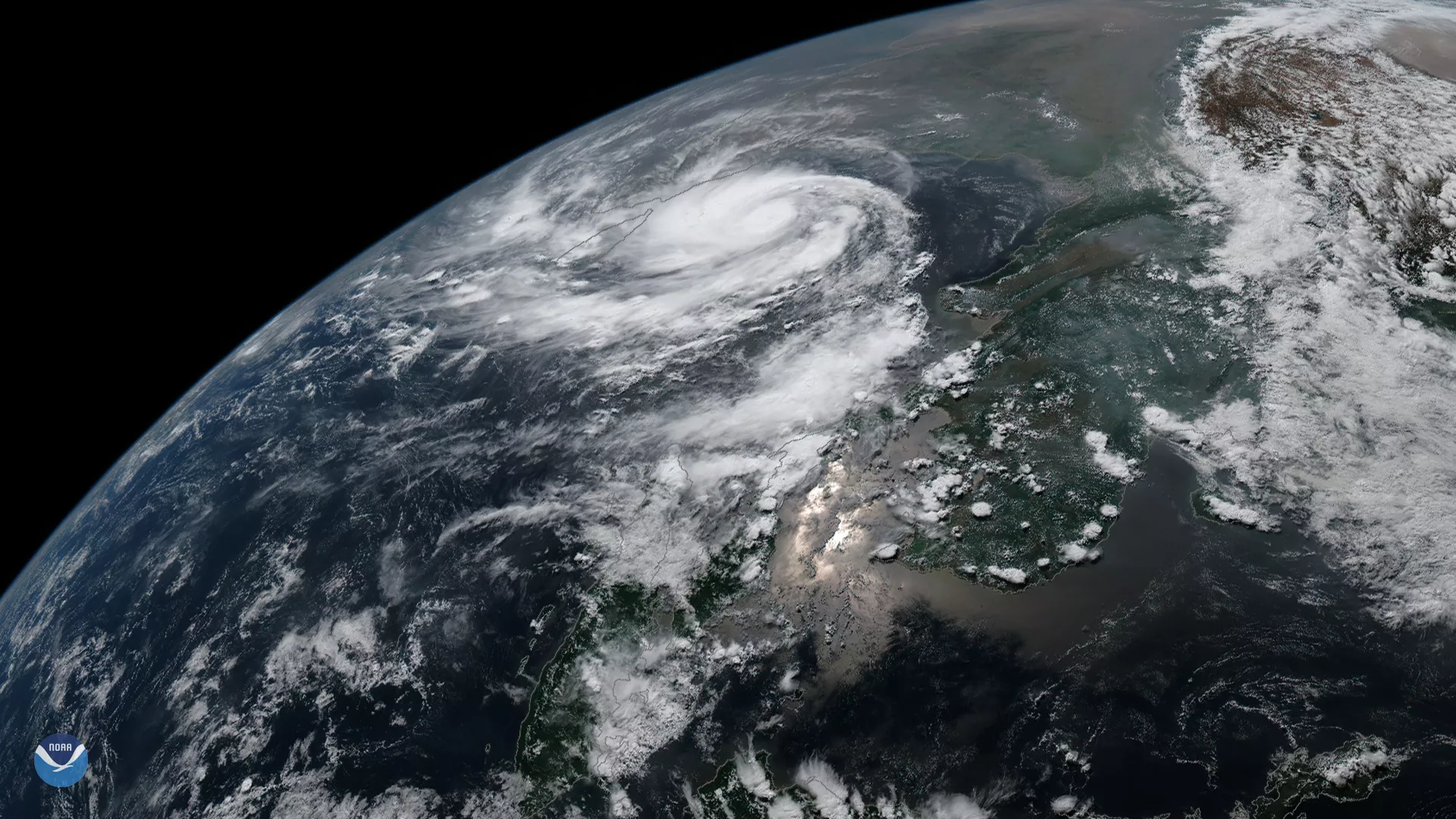
Tropical Cyclone Fani, seen here by the Japan Meteorological Agency's Himawari-8 satellite on April 30, 2019, is rapidly intensifying in the Bay of Bengal. Now classified as a “very severe cyclonic storm,” Fani has wind speeds of 110 mph, which is equivalent to a Category 2 storm on the Saffir-Simpson Hurricane Wind Scale.
As Fani continues to track toward the northwest, the storm is expected to encounter favorable conditions for strengthening, including warm sea surface temperatures and low vertical wind shear. The Joint Typhoon Warning Center is forecasting Fani to strengthen to the equivalent of a strong Category 3 storm over the next two days.
Fani will continue on its track before turning north and then northeast, where it could affect the eastern coast of India, and it could also cause impacts in Bangladesh.