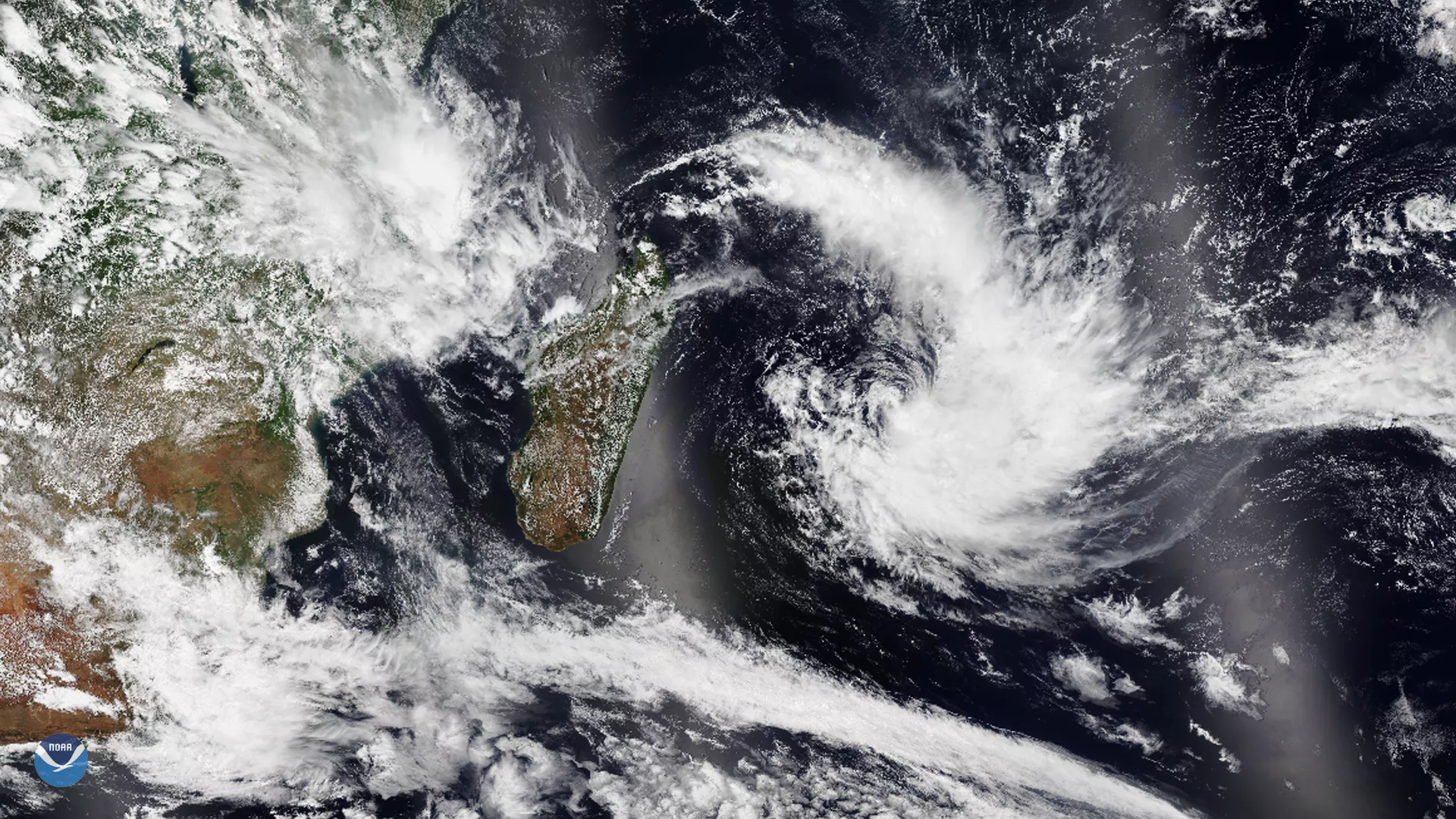
The NOAA-20 satellite spotted tropical cyclone Calvinia in the southern Indian Ocean near the small island of Mauritius on Dec. 29, 2019, which lies roughly 700 miles east of Madagascar. The storm , whose center was about 75 miles east of the small island nation at 9:00 a.m. local time, is packing strong winds and torrential rainfall as it slowly moves south-southeastward.
Currently, the storm’s maximum sustained winds are about 60 mph, with gusts up to 80 mph; this makes it equivalent to a tropical storm in the northern hemisphere. However, according to Keraunos , the French Observatory for Tornadoes and Severe Thunderstorms, the strongest gusts are expected to spare the island, but heavy rain may affect the surrounding areas, including nearby Réunion Island.
On Monday, Dec. 30, 2019, Mauritius closed its only airport as well as its stock exchange after the Mauritius Meteorological Services issued a Class III cyclone warning. The agency also advised the public not to venture along shorelines, riverbanks, and other watercourses due to potential flooding. However, as the storm moves away from Mauritius, it is expected to head toward the open water of the southwestern Indian Ocean.
This image was captured by the NOAA-20 satellite's VIIRS instrument , which scans the entire Earth twice per day at a 750-meter resolution. Multiple visible and infrared channels allow it to detect atmospheric aerosols, such as dust, smoke and haze associated with industrial pollution and fires. The polar-orbiting satellite circles the globe 14 times daily and captures a complete daytime view of our planet once every 24 hours.