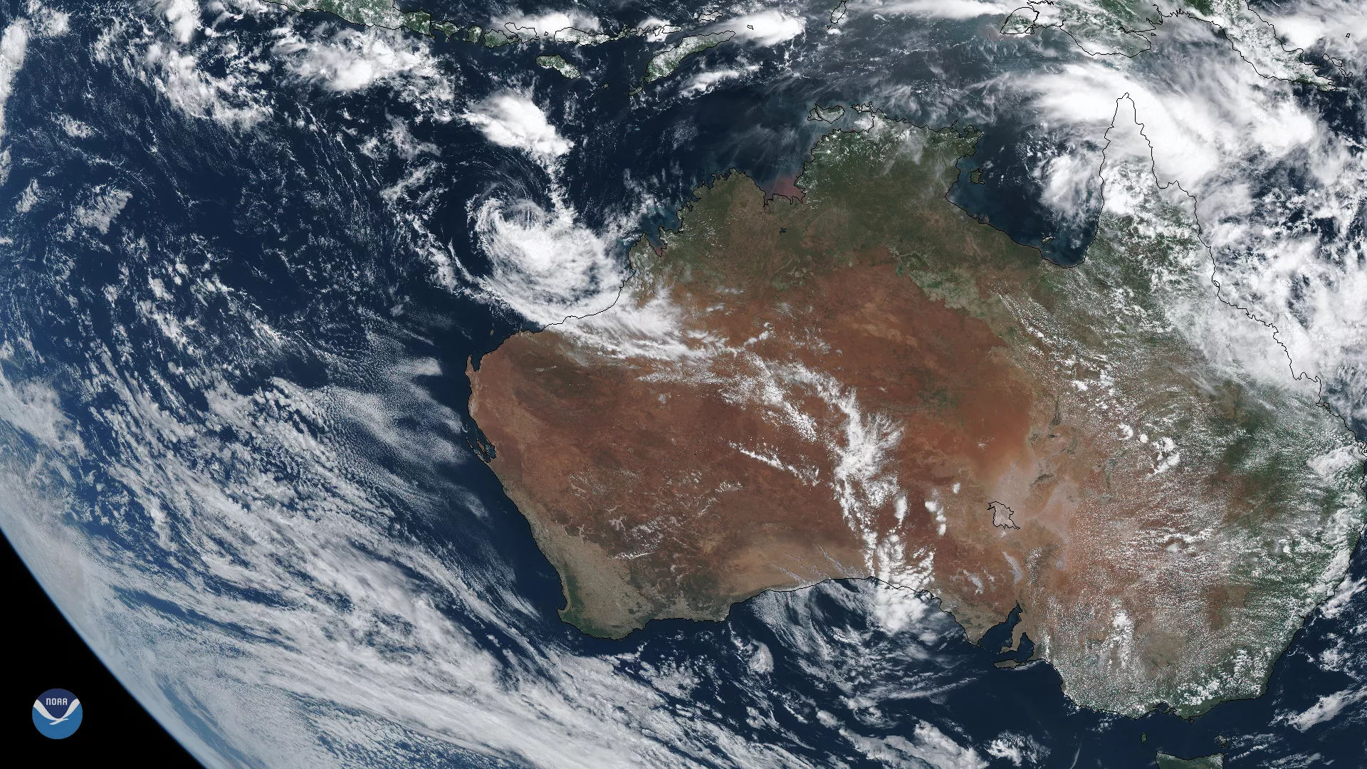
On March 11, 2020, the Himawari-8 satellite recorded this True Color image of a newly-formed tropical cyclone over the northwestern coast of Australia. Another tropical disturbance, near northern Queensland, may possibly develop over the next few days.
As of early Thursday morning, Sydney Time, Tropical Cyclone 21S was about 230 miles north-northwest of Port Hedland in Western Australia, and is tracking south-southwestward with maximum sustained winds at roughly 40 mph and gusts up to 52 mph. It is estimated to make landfall around North West Cape and Learmonth by late Thursday evening or early Friday morning, though the storm will begin to weaken prior. It will remain a marginal system until it dissipates.
Additionally, the Joint Typhoon Warning Center estimates that a developing system near the tip of northern Queensland, south of Papua New Guinea, has a high potential to become another tropical cyclone within 24 hours.
This image was captured by the Advanced Himawari Imager (AHI) on Japan’s Himawari-8 satellite. This satellite, the first unit of the Japan Meteorological Agency's (JMA) third-generation of geostationary satellites, provides visible light and infrared images of the Asia-Pacific region. Himawari's data are vital for global geostationary coverage, which is why NOAA and JMA have agreed to mutual back-up arrangements for their geostationary systems.