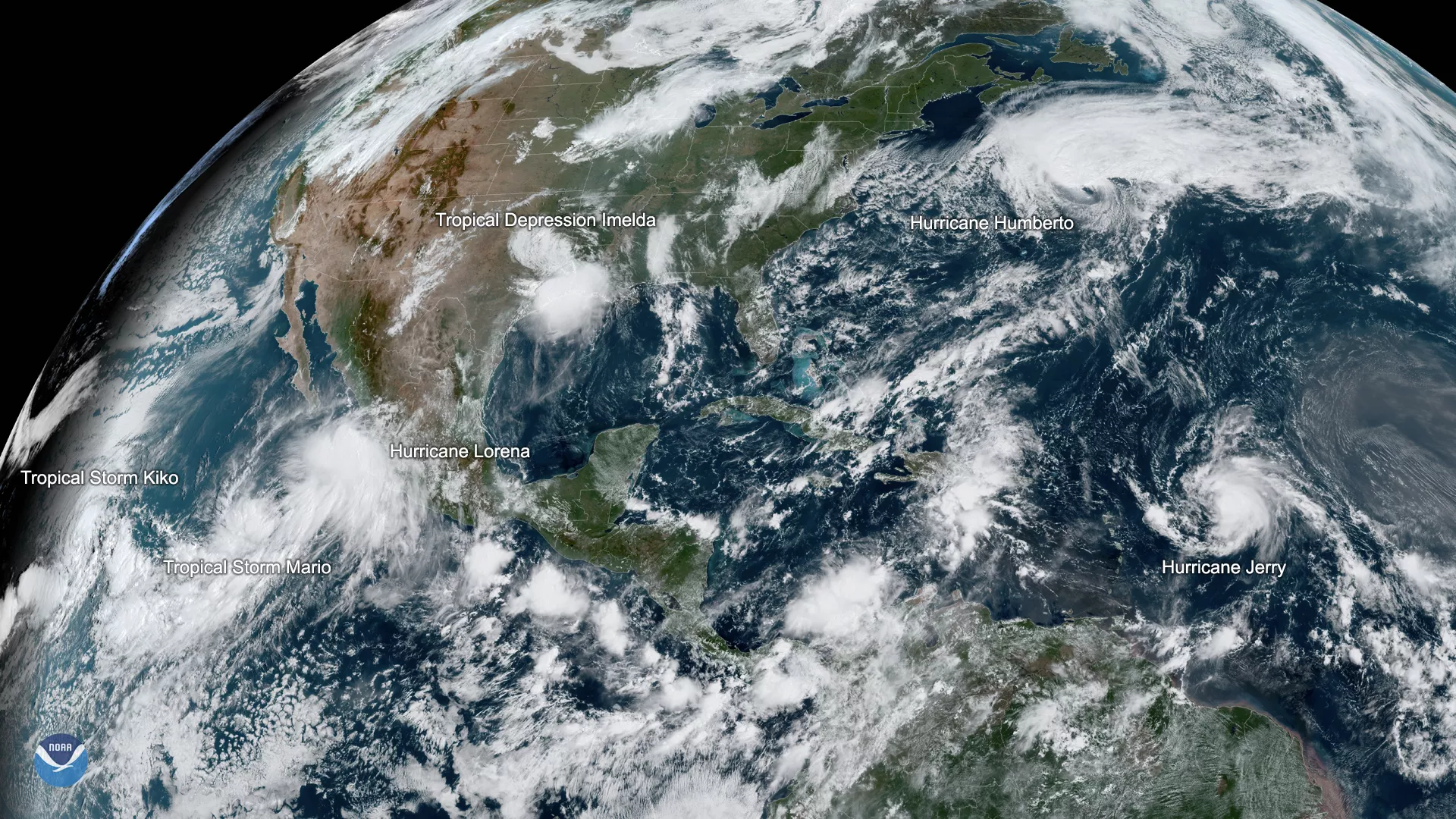
Tropical storms certainly aren’t in short supply this month, as you can see from this GOES East imagery captured at 11:30 a.m. EDT on Sept. 19, 2019. Five named storms are active across the Atlantic and Eastern Pacific basins, including Hurricanes Humberto and Jerry, and Tropical Storms Lorena, Mario and Kiko. Tropical Depression Imelda has weakened further to a remnant low.
On Wednesday, before Imelda became a depression, National Hurricane Center hurricane specialist Eric Blake tweeted, noting that six combined storms across the two basins ties with the modern record set in 1992.
On average, early September marks the peak of hurricane season, especially in the Atlantic basin because the combination of warm sea surface temperatures, low vertical wind shear and, of course, a pre-existing disturbance create the perfect conditions for a hurricane. From 1975 to 2017, there has been an average of 3.1 Atlantic hurricanes per year in September.
While Humberto is moving away from the East Coast after skirting around Bermuda, the remnants of Tropical Depression Imelda are inundating parts of the Texas Gulf Coast and southwest Louisiana with heavy rain that is causing life-threatening flash floods. Meanwhile, Jerry is still churning across the Atlantic and will approach the Leeward Islands on Friday.
In the Eastern Pacific, Tropical Storm Lorena is hugging the southwestern coast of Mexico and unleashing strong winds and heavy rains along its path. It should regain hurricane strength later today or tonight. While Tropical Storms Kiko and Mario currently don’t pose any threat to land, the latter is expected to strengthen to a hurricane by tonight.
This geocolor-enhanced imagery was created by NOAA's partners at the Cooperative Institute for Research in the Atmosphere. The GOES East geostationary satellite, also known as GOES-16, provides coverage of the Western Hemisphere, including the United States, the Atlantic Ocean and the eastern Pacific. The satellite's high-resolution imagery provides optimal viewing of severe weather events, including thunderstorms, tropical storms, and hurricanes.
Click here to launch our 2019 hurricane tracker