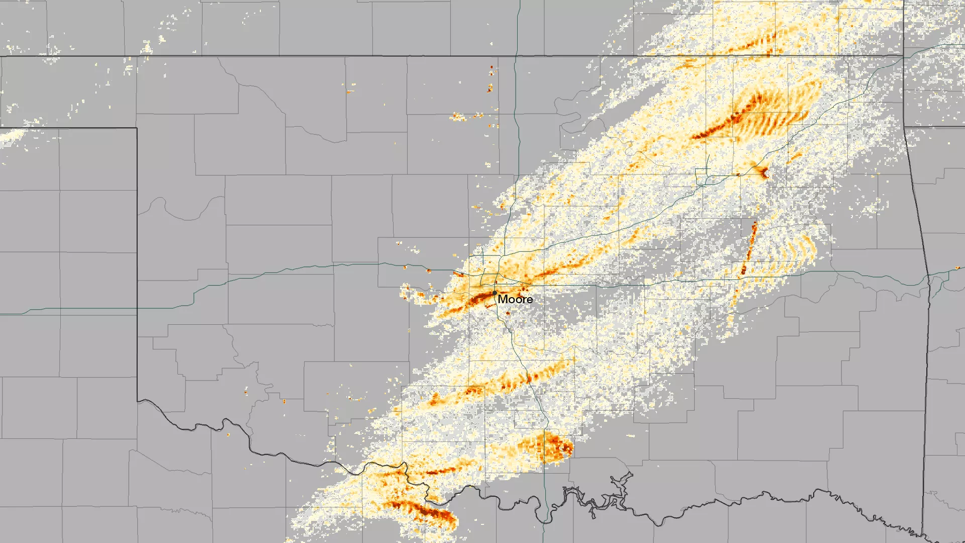
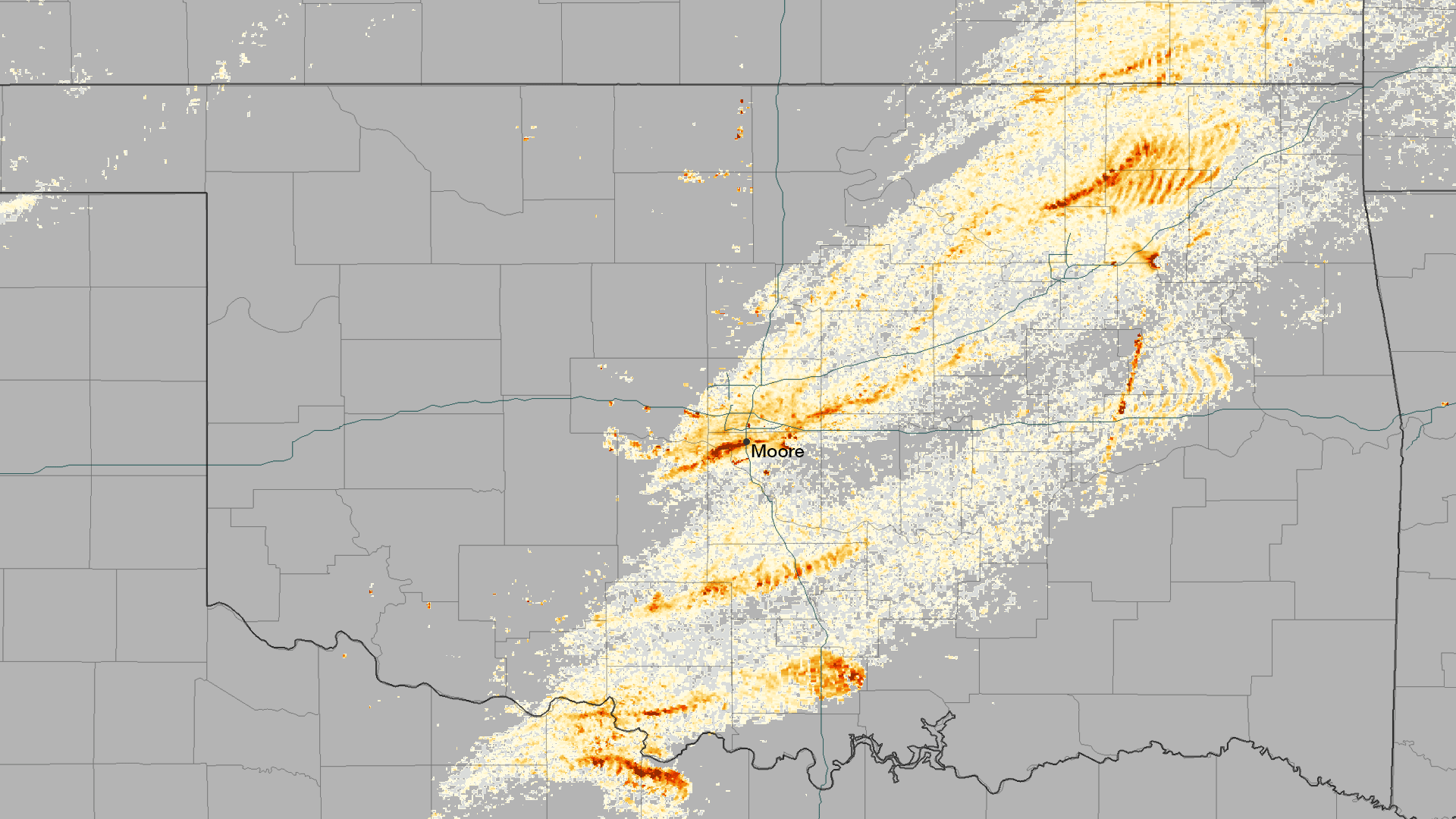
The rotation of tornadoes creates a distinctive signature in radar data, and can be used to estimate the track that the system takes over land. This image shows the rotational velocity of the systems that passed over Oklahoma on the afternoon of May 20, 2013. A single cohesive structure can be seen to cut across seven counties, with Moore directly in the middle. The rotational velocity data, being run experimentally by the NOAA National Severe Storms Laboratory , is helping to identify potential tornado structures and increase lead-time for severe weather warnings.