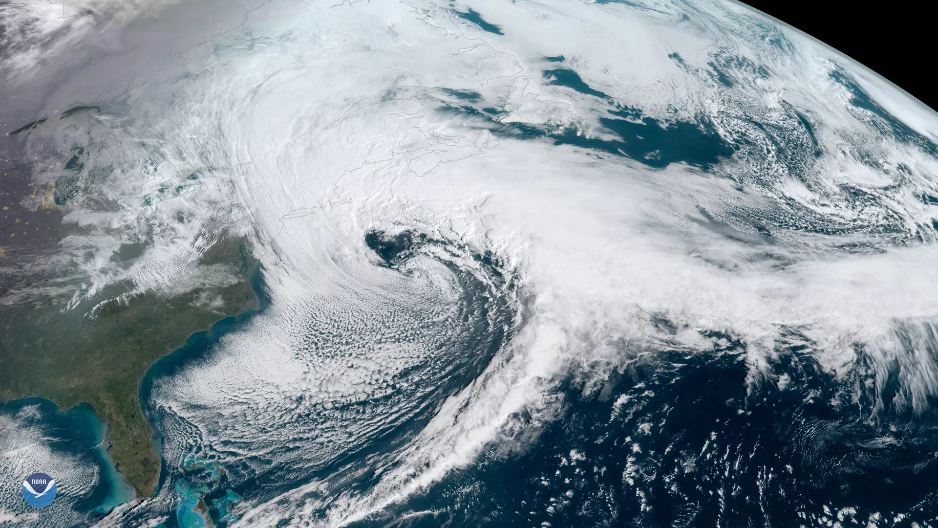
NOAA's GOES East satellite (GOES-16) captured the Nor'easter storm over the East Coast this morning (13:15 UTC). The National Weather Service reports heavy snow and strong winds impacting New England. The U.S. East Coast provides an ideal breeding ground for Nor’easters. During winter, the polar jet stream transports cold Arctic air southward across the plains of Canada and the United States, then eastward toward the Atlantic Ocean where warm air from the Gulf of Mexico and the Atlantic tries to move northward. The warm waters of the Gulf Stream help keep the coastal waters relatively mild during the winter, which in turn helps warm the cold winter air over the water. This difference in temperature between the warm air over the water and cold Arctic air over the land is the fuel that feeds Nor’easters.
This geocolor enhanced imagery was created by NOAA's partners at the Cooperative Institute for Research in the Atmosphere. The GOES East satellite, also known as GOES-16, provides geostationary satellite coverage of the Western Hemisphere, including the United States, the Atlantic Ocean and the Gulf of Mexico. First launched in late 2016, the satellite became fully operational in December 2017.