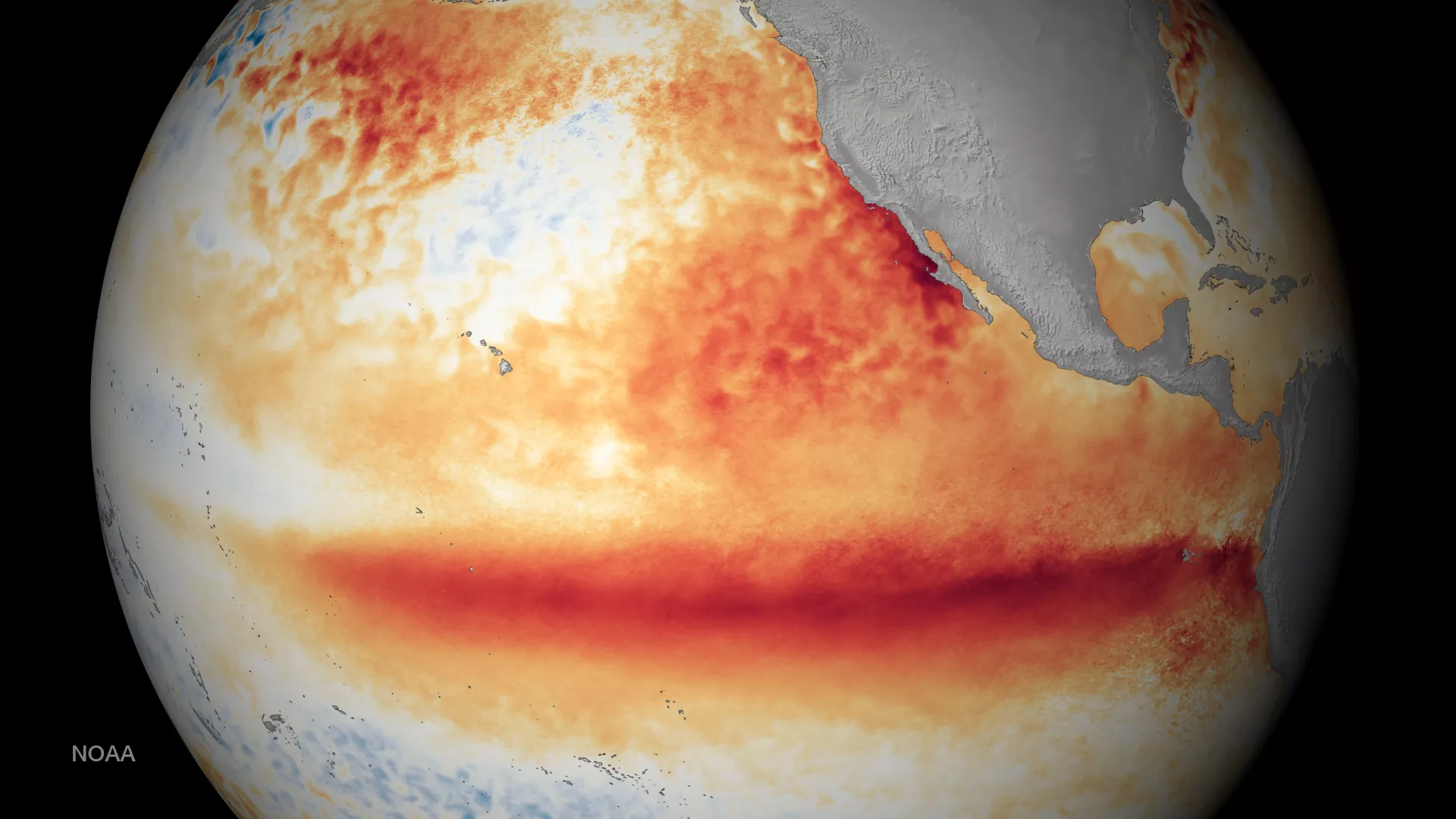
NOAA has released an update to its El Niño advisory. This image shows the satellite sea surface temperature departure for the month of October 2015, where orange-red colors are above normal temperatures and are indicative of El Niño. This event is forecast to continue through the winter, likely ranking as one of the top 3 strongest events since 1950, before fading in late spring or early summer. El Niño has already produced significant global impacts, and is expected to affect temperature and precipitation patterns across the United States during the upcoming months. Seasonal outlooks generally favor below-average temperatures and above-median precipitation across the southern tier of the United States, and above-average temperatures and below-median precipitation over the northern tier of the United States.