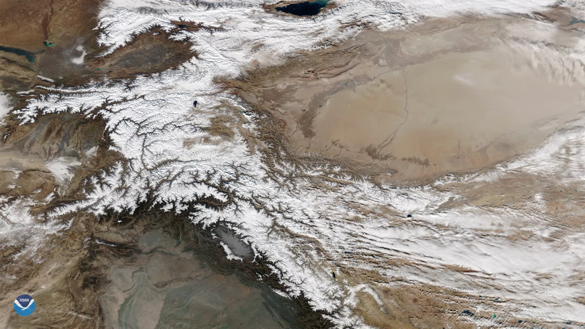
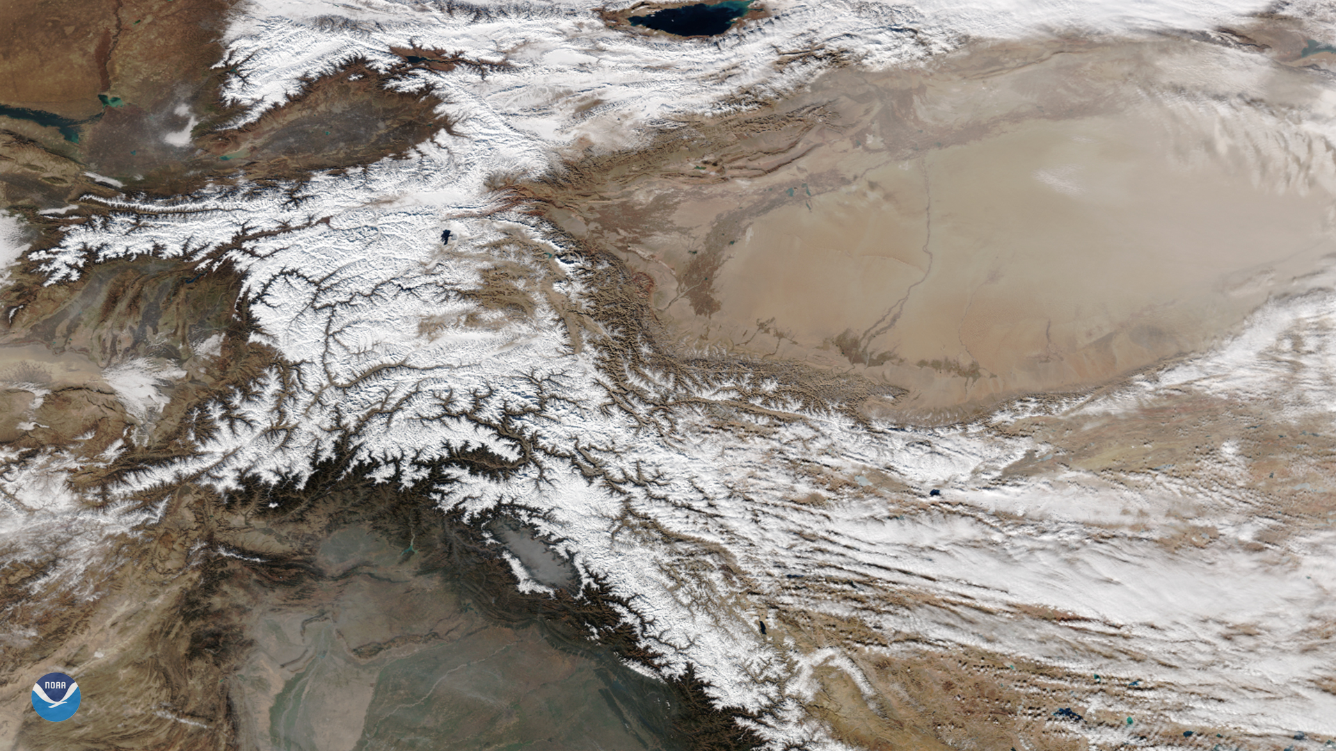
As winter arrives in the Northern Hemisphere and temperatures turn colder, satellites see increasing amounts of snow cover in middle- and lower latitudes. When skies are clear, towering mountain ranges, such as the Himalayas in southern and central Asia, look especially dramatic from space when blanketed in a coat of white.
This true color image, captured by the NOAA-20 VIIRS sensor on Dec. 2, 2018, reveals the jagged snowy peaks and intricate network of valleys of several mountain ranges in Central Asia. In the south are the northwestern Himalayas, to the west lie the Hindu Kush and the Pamir Mountains, and in the north are the Tian Shan Mountains. At the top of the image, we can see Issyk-Kul, the largest lake in Kyrgyzstan, and the seventh-deepest lake in the world.
The snowy peaks form a ring around the vast Taklamakan Desert and Tarim Basin in northwestern China (center-right). Covering some 130,000 square miles, this remote region lies in the rain shadow of the Himalayas and surrounding mountains to the west and north, and receives extremely little precipitation. Dust storms are common in the Taklamakan Desert, especially in spring and summer when strong surface winds can loft sand several miles up into the atmosphere. High-altitude winds from the west periodically blow the dust eastward across China and sometimes over the Pacific.