
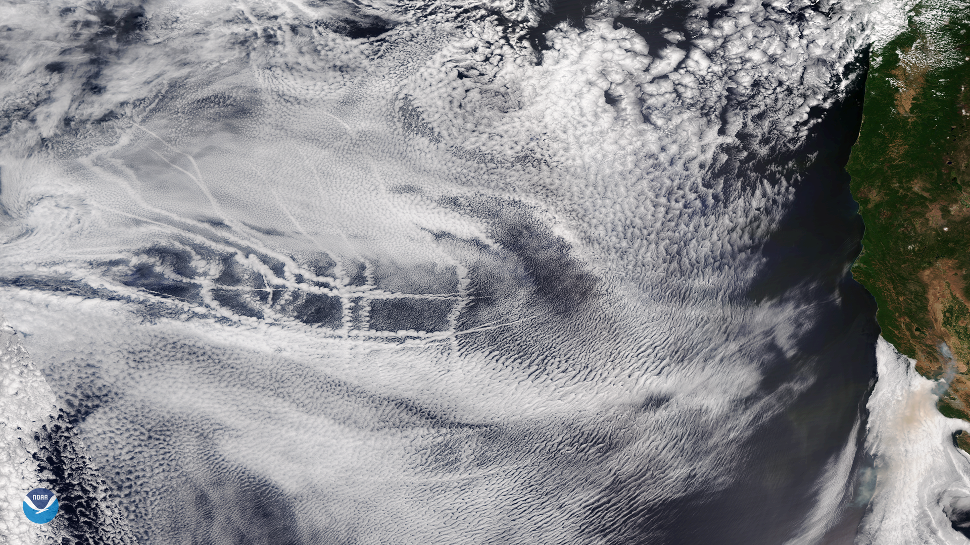
This image, captured by the NOAA-20 satellite's VIIRS instrument, shows several criss-crossing ship tracks embedded in a layer of mid- and high-level clouds over the eastern Pacific Ocean on July 2, 2018. In addition to the ship tracks, which were visible about 500 miles off the California coast, a plume of smoke from the ongoing wildfires in northern California appears in the center to lower-right portion of the imagery.
As cargo ships steam across the oceans, the tiny aerosol particles in their exhaust act as cloud nuclei, or seeds around which moisture in the atmosphere can condense. Occasionally this results in ship tracks becoming visible in cloud imagery. Though the exhaust released by ships is not a significant source of pollution, it does modify clouds, which may have an impact on Earth's climate.
This true-color satellite imagery is not a simple photograph of Earth, but rather a composite image. It was created by combining data from the three color channels on the NOAA-20 satellite's VIIRS instrument sensitive to the red, green and blue (or RGB) wavelengths of light. In addition, data from several other channels are also included to cancel out or correct atmospheric interference that may blur parts of the image.