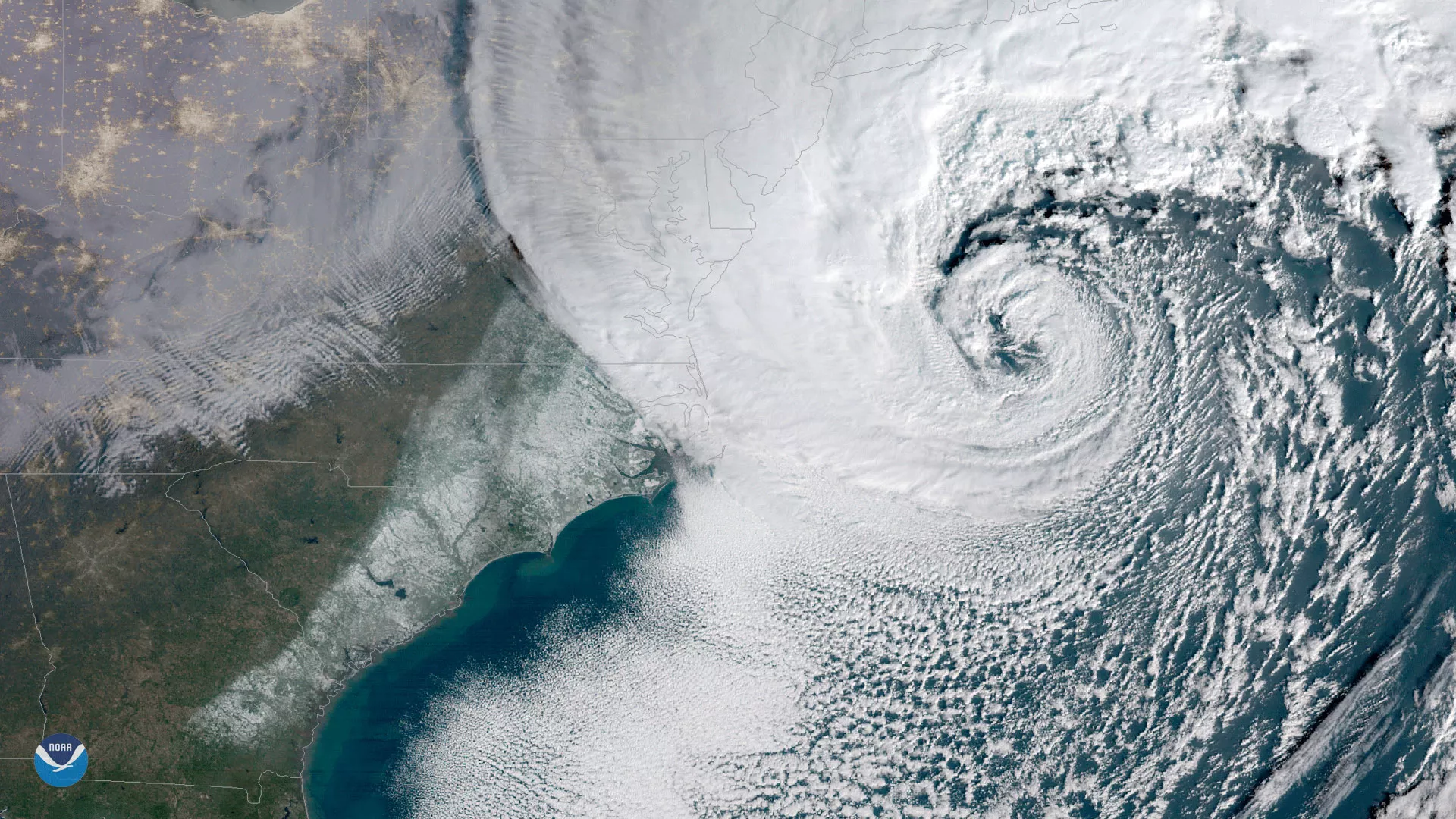
NOAA's GOES East satellite captured this geocolor enhanced image of a powerful nor'easter moving up the U.S. Eastern Seaboard on January 4, 2018. The winter storm, which rapidly intensified off of the mid-Atlantic coast, has battered coastal areas from Florida to Maine with a combination of heavy snow, ice, and gusty winds. In this image, clearing skies over the Southeast reveal a swath of snow left behind in the storm's wake. The National Weather Service reported accumulating snow as far south as Tallahassee, Florida for the first time in 28 years. Several inches of snow also fell across the Southeast, including Charleston, South Carolina, which recorded one of its snowiest days on record. As the storm intensified near the mid-Atlantic, blizzard conditions have been reported from coastal Virginia into southern New England.
This nor'easter meets the definition of a "bomb cyclone," a term used by meteorologists to describe a mid-latitude storm that rapidly intensifies over a short period. To meet this criteria, the barometric pressure at the center of the storm's circulation must drop at least 24 millibars within 24 hours. Media reports indicate that the storm's pressure fell at more than twice this rate in 24 hours, which ranks it among the most explosive East Coast winter storms on record, similar in strength to a Category 2 hurricane.
Created by our partners at the Cooperative Institute for Research in the Atmosphere, the GOES East geocolor imagery enhancement displays geostationary satellite data in different ways depending on whether it is day or night. In daytime imagery (shown here), land and shallow-water features appear as they do in true-color imagery, while at night, the window infrared channel 13 and the traditional fog product are used to identify both ice and liquid water clouds, and are made partially transparent against a static city lights background.