Another powerful atmospheric river event is bringing heavy rain to the West Coast this week. The National Weather Service has issued flash flood watches in parts of northern California, where some areas picked up more than 3 inches of rain in 24 hours.
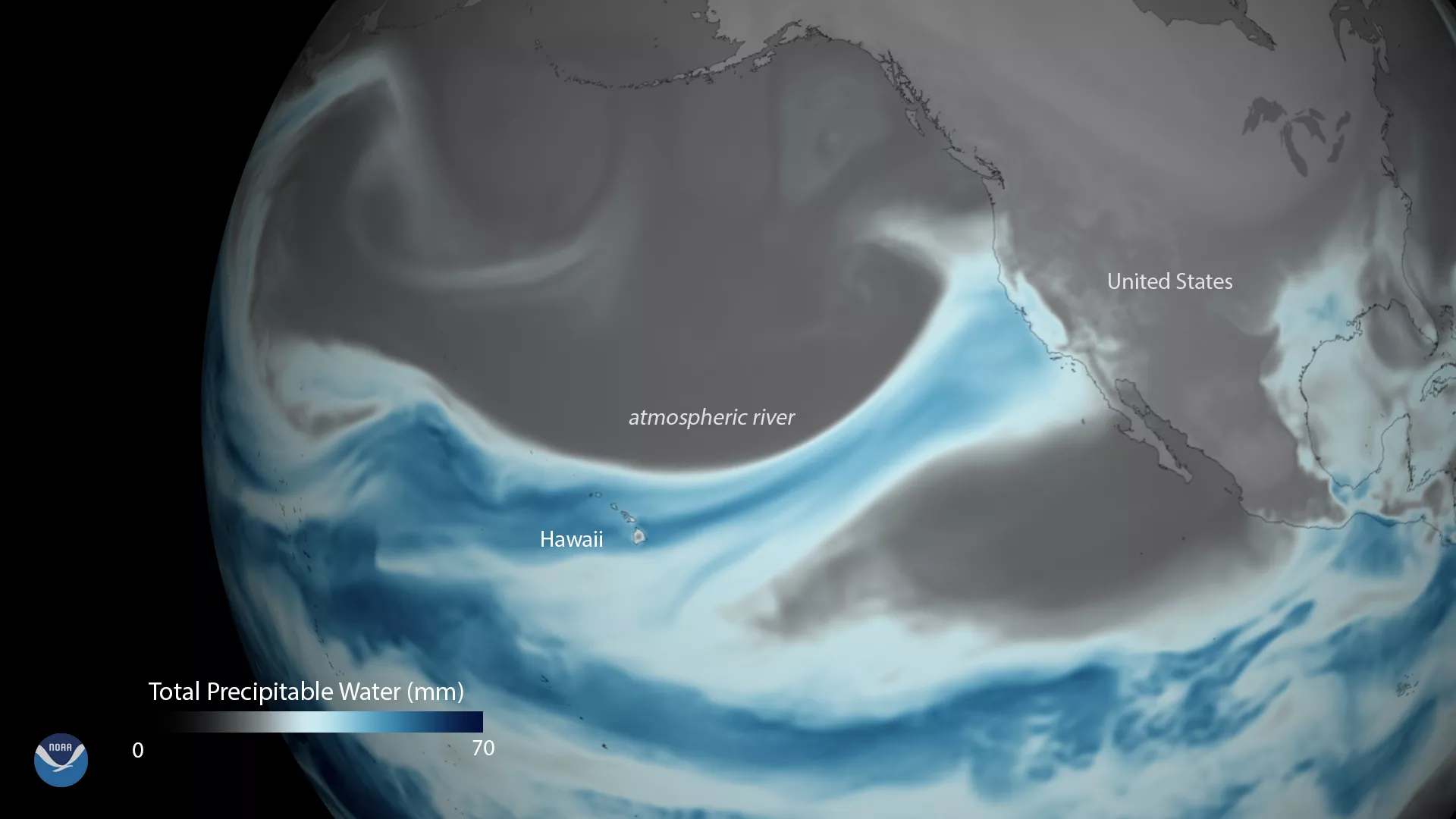
This data visualization shows the deep plume of tropical moisture, stretching from Hawaii to the West Coast of the United States on April 6, 2018, using data from the Global Forecast System model. Satellites can detect this moisture, and the data can then be used to calculate what's known as the "total precipitable water" content of the atmosphere – the amount of water that could theoretically precipitate from clouds under just the right atmospheric conditions.
Atmospheric rivers are relatively long, narrow regions in the atmosphere – about 250 to 375 miles wide – that can carry enormous volumes of water vapor over thousands of miles, from the tropics to the mid-latitudes. While atmospheric rivers can cause serious flooding, they’re also a critical water supply for much of the West Coast of the United States. On average, between 30 and 50 percent of annual precipitation in the west coast states occurs during just a few of these events.
The Global Forecast System (GFS) is used by the National Weather Service to produce forecasts up to 16 days in advance. This weather forecast model is developed by NOAA's National Centers for Environmental Prediction and contains dozens of atmospheric and land-soil variables ranging from temperatures, winds, and precipitation to soil moisture and atmospheric ozone concentration.