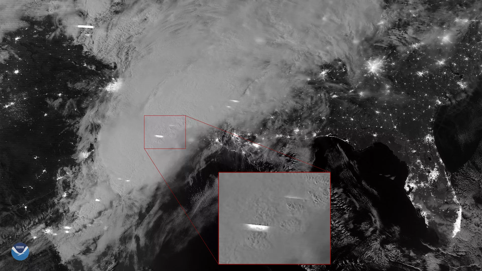
The NOAA-20 polar-orbiting satellite captured this moonlit nighttime imagery of severe thunderstorms moving over the Southern U.S. on March 29, 2018. A slow-moving weather system pulling significant moisture and unstable air from the Gulf of Mexico has caused heavy rain and flash flooding in parts of eastern Texas and the South this week.
This imagery, from NOAA-20's day-night band on the satellite's VIIRS instrument, reveals the extent of the storm system as well as multiple lightning flashes, which appear as horizontal streaks in the clouds. Lightning is distinguishable from the glow of major urban areas due to the sharp edges along each captured flash, as shown in the enlarged portion of the image (red box). As a satellite passes over the storms, its sensor catches only a handful of lines from each lightning flash, due to the sweeping pattern of the sensor and the sustained flickering of lightning strikes within the clouds. Whereas the lightning flashes have a horizontal pattern, the more static glow of city lights allows them to appear true to shape and size in nighttime satellite imagery.
NOAA-20's VIIRS sensor is sensitive enough to detect the nocturnal glow produced by Earth's atmosphere and the light from a single ship in the sea.