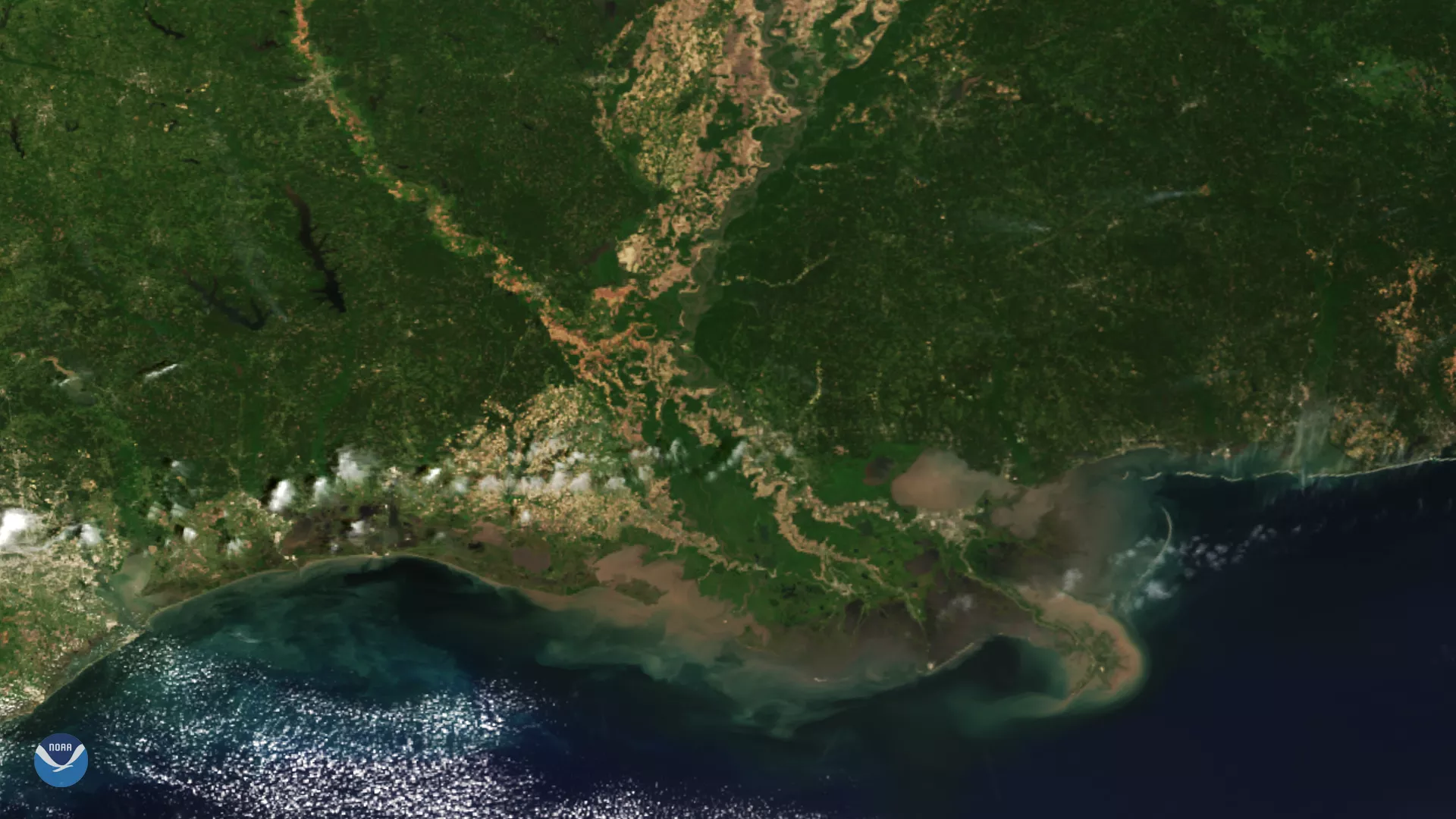
From its vantage point 512 miles up, the NOAA-20 satellite had a clear view of the Mississippi River Delta as it zoomed by on April 16, 2020.
The delta is located where the Mississippi River converges with the Gulf of Mexico in Louisiana. One of the largest areas of coastal wetlands in the United States and the seventh-largest river delta on Earth, this three-million-acre area stretches from Vermilion Bay on the west to the Chandeleur Islands in the east.
In the image above, we can clearly see sediments from the Mississippi and Atchafalaya Rivers draining into the Gulf of Mexico. Further north, you can see the fertile land of the Mississippi Delta, that spans about 7,000 square miles across parts of Mississippi, Arkansas, and Louisiana.
This image was captured by the NOAA-20 satellite's VIIRS instrument , which scans the entire Earth twice per day at a 750-meter resolution. Multiple visible and infrared channels allow it to detect atmospheric aerosols, such as dust, smoke and haze associated with industrial pollution and fires. The polar-orbiting satellite circles the globe 14 times daily and captures a complete daytime view of our planet once every 24 hours.