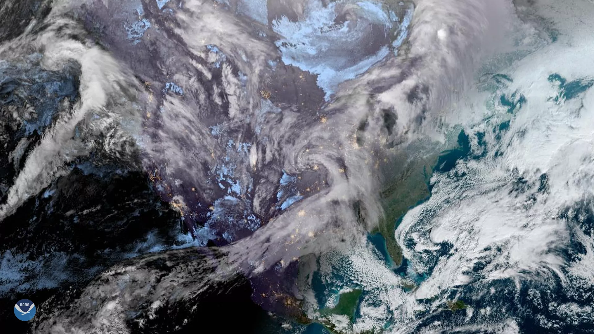
The GOES East satellite captured this Geocolor image of the United States as the sun rose over the East Coast on Jan. 22, 2020. Seen here are two large winter storm systems that are slowly making their way across the country.
The first is currently bringing a mix of snow, ice, and rain to parts of the Plains, Midwest, and the East, which is expected to continue through this coming weekend as moisture from the Gulf of Mexico combines with cold Arctic air. The National Weather Service has posted various winter weather advisories stretching from eastern Nebraska, Kansas, and Oklahoma, up to west-central Wisconsin and down through northwestern Arkansas. Forecasters recommend being wary of sleet and freezing rain in these areas as well, which could be hazardous for travelers.
The cold spell is also reaching as far south as Florida, which saw its coldest temperatures in over nine years. The National Weather Service even issued an unofficial alert about “ falling iguanas ” because as cold blooded animals (meaning their internal body temperature varies with the surrounding environment rather than staying constant), they can become extremely sluggish to conserve energy as temperatures drop. Thus, they tend to fall out of trees and appear dead until their bodies warm up and they start moving again.
The second storm system is impacting the Pacific Northwest, where some winter weather advisories are also in effect, mainly across western Washington state, as a low pressure system heads toward the coast from the Pacific. Portions of Washington as well as Oregon, can expect a mix of snow and rain with heavy winds. The Olympic Mountains, the Cascades, and the Sierra Nevadas may see particularly heavy snowfall through the end of the week.
These cold temperatures may not stay for long, however. Warmer than average temperatures across the country are expected as we head into next week and will likely last through the end of the month.
The GOES East geostationary satellite, also known as GOES-16, keeps watch over most of North America, including the continental United States and Mexico, as well as Central and South America, the Caribbean, and the Atlantic Ocean to the west coast of Africa. The satellite's high-resolution imagery provides optimal viewing of severe weather events, including thunderstorms, tropical storms, and hurricanes.