January 29, 2021
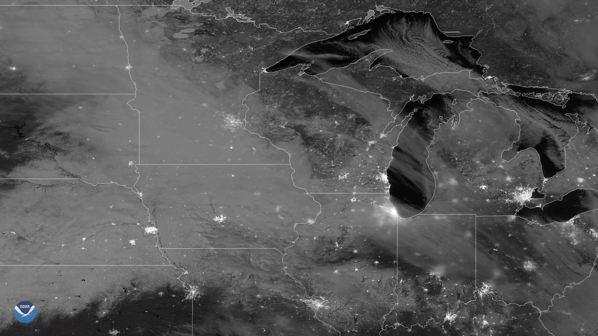
At 2:30 a.m. CT on Jan. 29, 2021, the NOAA-20 satellite took advantage of the full Wolf Moon to view the Midwestern landscape below using the Day-Night Band (DNB) from its Visible Infrared Imaging Radiometer Suite (VIIRS) instrument.
It shows moonlight-enhanced snow on the ground, which is easy to spot across northern Kansas, Nebraska, Iowa, northern Missouri and central Illinois. Over the Great Lakes, high wispy cirrus clouds are also seen reflecting the moonlight back to the satellite’s sensor. Also noticeable in this image are the city lights from around the Midwest and Great Lakes—such as Omaha, Chicago, St, Louis, Milwaukee and Detroit—along with the muted lights of Indianapolis, Cincinnati and Columbus due to the cirrus clouds diffusing their night time glow.
One of 22 bands that range from ultraviolet to mid-infrared, the DNB can capture data that help climate scientists better understand current conditions on Earth, including nighttime phenomena, wildfires, and human-generated light emissions such as city lights.
The polar-orbiting NOAA-20 satellite's VIIRS instrument scans the entire Earth twice per day at a 750-meter resolution. Multiple visible and infrared channels allow it to detect atmospheric aerosols, such as dust, smoke and haze associated with industrial pollution and fires. NOAA-20 circles the globe 14 times daily and captures a complete daytime view of our planet once every 24 hours.