
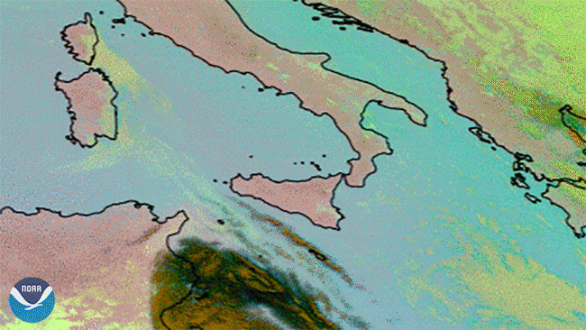
The pastel imagery above is an Ash RGB product captured by Europe’s Meteosat-11 satellite on Feb. 21 and Feb 23, 2021. Based upon infrared channel data, the product is designed to detect ash and sulphur dioxide from volcanic eruptions, which later can be used to warn aviation and other municipal authorities.
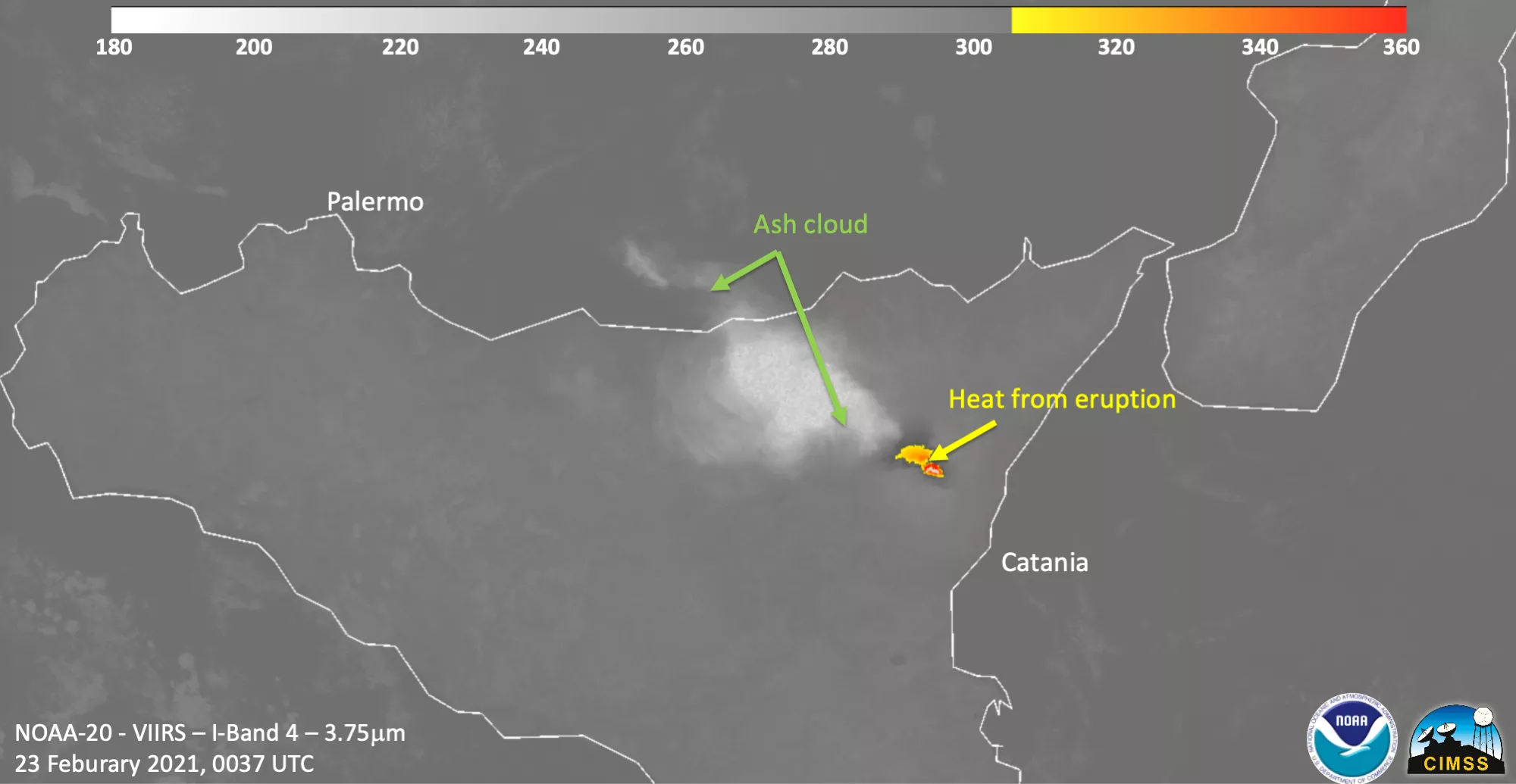
Since Feb. 16, the satelliteâ€â€operated by NOAA’s European partner EUMETSATâ€â€has seen four different " strombolian ", or mild-to-moderate, eruptions from the famous Mt. Etna volcano in the Italian island of Sicily. The volcano, which is well known for its frequent eruptions , spewed out ash and sulfur dioxide into the atmosphere throughout the past week.
According to the Institute of Geophysics and Volcanology (INGV), the entity in charge of observing Mt. Etna’s activity, the sulfur dioxide emissions reached Sardinia, Corsica, and parts of mainland Italy by Tuesday, the same day that eruptive activity on the volcano ended. “It was certainly one of the most spectacular eruptions of recent decades,” Boris Behncke, a volcanologist at the INGV, said. “But this falls within the ordinary activity of this volcano...even if each time everything seems bigger, stronger, more colourful and more threatening.”
Volcanologists like Behncke say that Etna is spewing primitive magma, a deeper magma that comes from the bowels of the mountain and carries a greater charge of gas. Due to this, the volcano is capable of producing strikingly tall lava fountains.
In geostationary orbit at approximately 22,300 miles above the equator, the Meteosat-11 satellite operates over Europe, Africa, and the Atlantic Ocean. Meteosat-11 (launched from the Guiana Space Centre in Kourou in 2015) is positioned at 0 degrees and provides full disc imagery every 15 minutes. Meteosat-11 is one of the four geostationary satellites operated by Europe’s EUMETSAT.