August 05, 2020
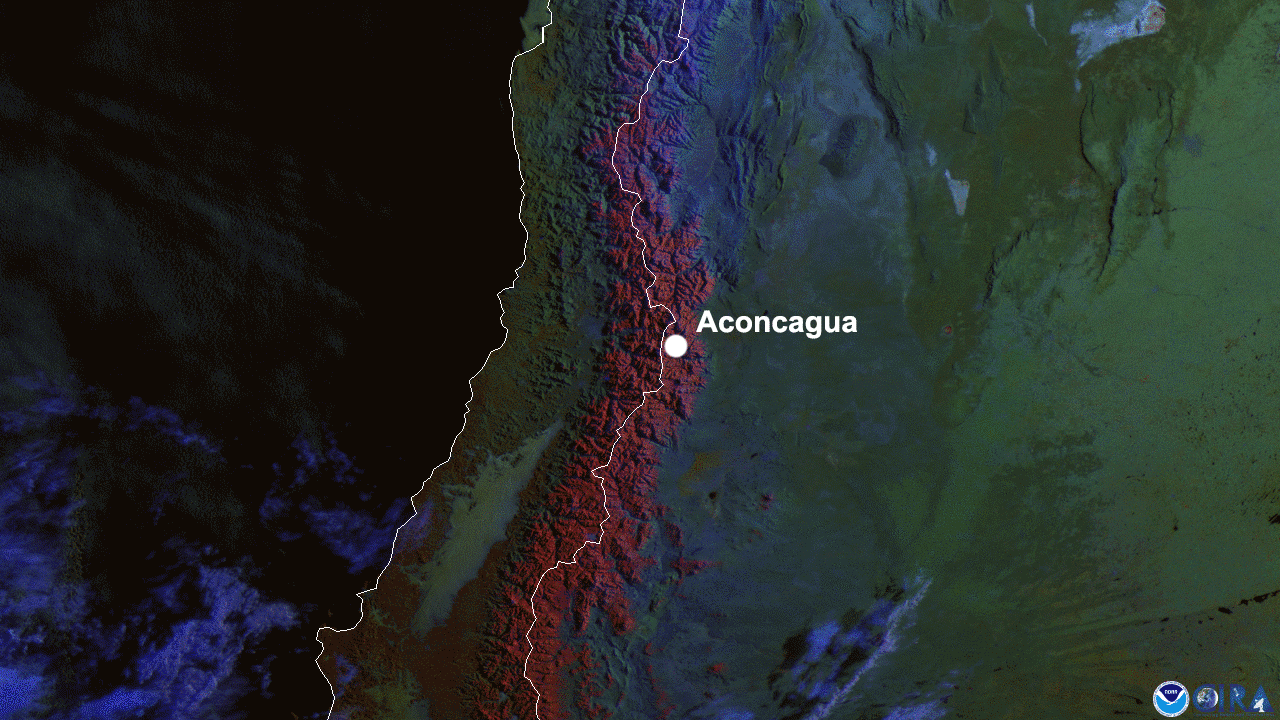
On July 29, 2020, NOAA’s GOES-East satellite viewed the snow-capped Andes mountains along the Chile-Argentina border. The Andes Mountain range is the longest in the world , measuring at 4,500 miles from the tip of Argentina to the top of Venezuela; it’s so long, that the northern and southern ends of it experience winter at different times of the year.
The highest point in the Andes (and the Western Hemisphere) isAconcagua, a mountain that soars over 22,000 ft high in Argentina. Aconcagua is in the wine-producing Mendoza province in Argentina; though the mountain sees unusually harsh, snowy conditions, they wildly differ from more populated areas, such as Buenos Aires.
This shot tapped into a multispectral RGB Day Snow-Fog product, which helps to differentiate between snow, fog, and clouds. The visible band on GOES-East can make it difficult to distinguish white snow from clouds and milky fog. However, with this multispectral product, low clouds and fog show up as a milky gray/blue, land is bright green, and snow appears as a captivating Caravaggio red.
The GOES-East geostationary satellite, also known as GOES-16, keeps watch over most of North America, including the continental United States and Mexico, as well as Central and South America, the Caribbean, and the Atlantic Ocean to the west coast of Africa. The satellite's high-resolution imagery provides optimal viewing of severe weather events, including thunderstorms, tropical storms, and hurricanes.