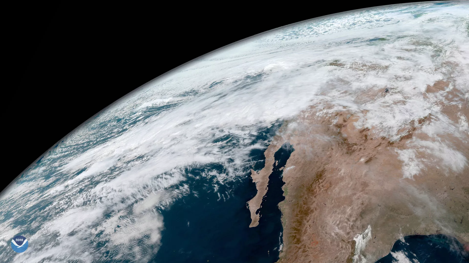
A multi-day heavy precipitation event is underway in California. This image was captured by GOES East March 21, 2018 at 1700 UTC. Widespread amounts of 2 to 4 inches are possible in southern/central California over a 3-day period, with coastal ranges and foothills in Santa Barbara and Ventura Counties potentially seeing 5 to 10 inches. Rainfall rates near 0.75 inches per hour, with amounts of 1.00 inches per hour with embedded thunderstorms, are possible.
The heavy rainfall expected is leading to major concerns for significant flash flooding, including mudslides and debris flow in and around wildfire burn scars, especially the scars from the Thomas, La Tuna, Creek, Detwiler and Railroad Fires.
The Thomas Fire burn scar debris flow event on January 9, 2018 was caused by 3 to 6 inches of rainfall. That burn scar is within an area that could see 5 to 10 inches in this storm.
Very heavy snowfall is also anticipated across the favored ranges of northern California and extend down into the northern and central Sierra Nevada. Parts of the Sierra range could see 2 to 4 feet, with localized amounts up to 5 feet, by late Thursday.
Created by our partners at the Cooperative Institute for Research in the Atmosphere, the GOES East geocolor imagery enhancement displays geostationary satellite data in different ways depending on whether it is day or night. In daytime imagery (shown here), land and shallow-water features appear as they do in true-color imagery, while at night, the window infrared channel 13 and the traditional fog product are used to identify both ice and liquid water clouds, and are made partially transparent against a static city lights background.