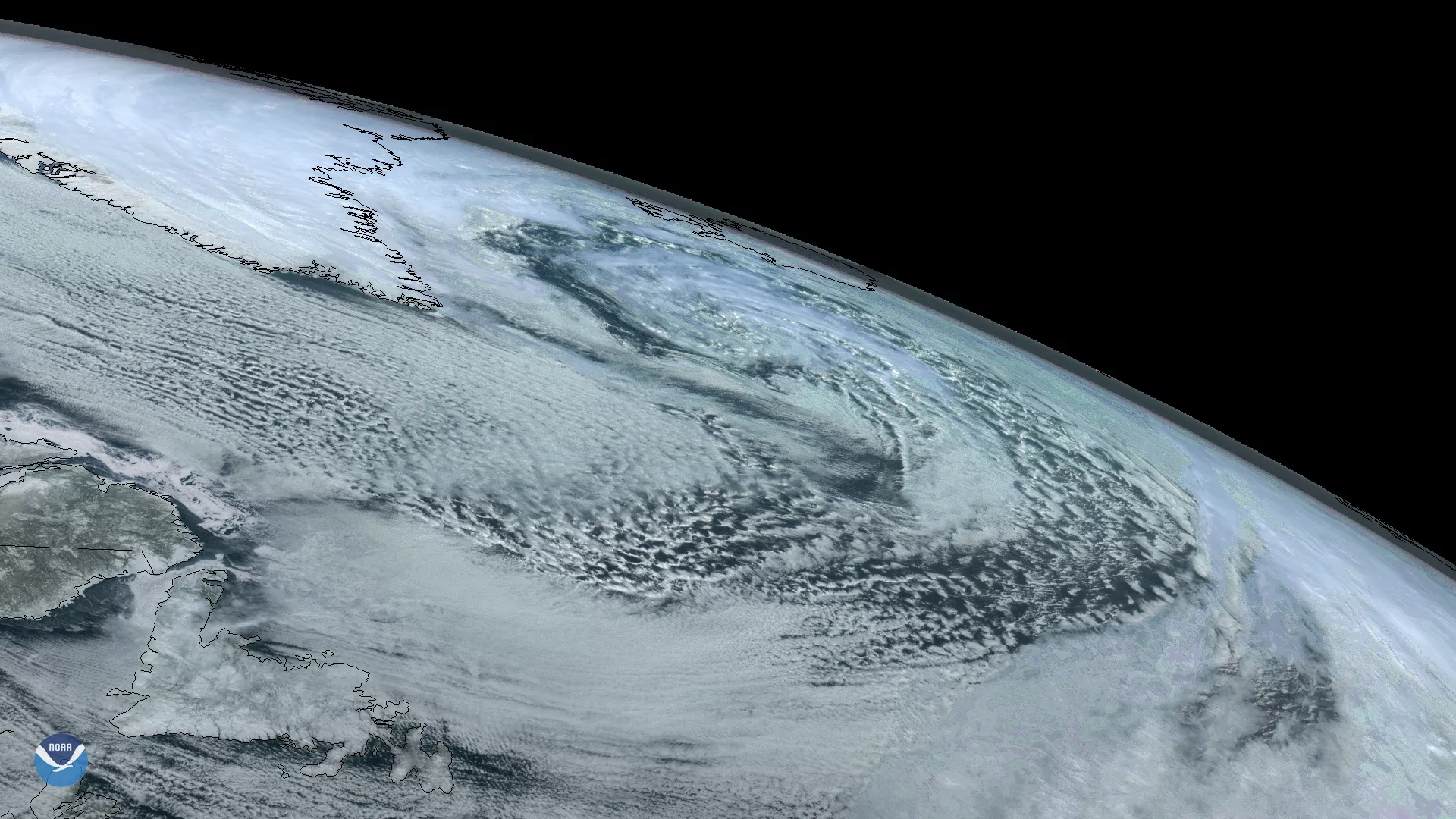
On Sunday, March 22, 2020, the GOES-East satellite captured imagery of a large extratropical mid-latitude cyclone in the North Atlantic between Greenland and Iceland. Toward the evening hours, this cyclone even developed mesovortices within its large core, which are smaller-scale but intense rotational features.
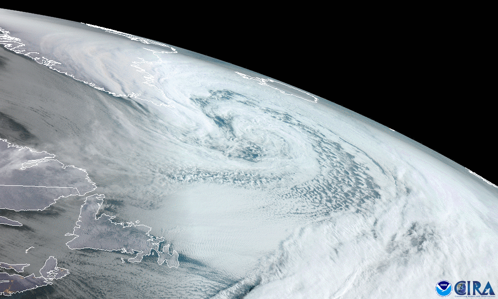
As the cyclone moved across Iceland last night, it brought with it a wintry mix of snow and rain throughout the southern and western regions of the country. Temperatures ranged from 32–43 degrees Fahrenheit and wind speeds reached 29–45 mph in some areas. The Icelandic Met Office issued a Yellow Alert for strong gales and blizzard conditions through Monday for the country’s Northeastern, Eastern, and Central highlands. A combination of strong wind gusts up to 78 mph and blowing snow is causing poor visibility and dangerous traveling conditions.
Today, the system is losing strength as it heads over the Greenland Sea; however, northwestern Europe will still experience high winds and waves as a result. The system’s far-reaching cold front even clipped the East Coast of the United States, and low pressure developing along this front will bring heavy snowfall to parts of the Northeast today and tonight.
The GOES East geostationary satellite, also known as GOES-16, keeps watch over most of North America, including the continental United States and Mexico, as well as Central and South America, the Caribbean, and the Atlantic Ocean to the west coast of Africa. The satellite's high-resolution imagery provides optimal viewing of severe weather events, including thunderstorms, tropical storms, and hurricanes.