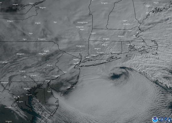
On Dec. 17, 2020, the GOES East satellite zoomed in on a nor’easter that brought the season’s first significant snowfall across parts of the eastern U.S. The term “nor’easter” refers to an extratropical cyclone in the western North Atlantic Ocean where the winds blow from the northeast. These storms can batter the region with high winds, large waves, and heavy snow.
This nor-easter started to develop Wednesday morning, Dec. 16, where snow, ice, and rain stretched from the Southeast up into the Mid-Atlantic. As the winter storm slid up the coast, it brought heavy snow to Pennsylvania and New York state before tracking toward New England. By Thursday morning, shown here in this visible satellite loop, some areas across Pennsylvania and New York state saw 1 to 3 feet of snow. New York City reported 10 inches of snowfall, marking this its biggest snowstorm there since January 2016.
The GOES East geostationary satellite, also known as GOES-16, keeps watch over most of North America, including the continental United States and Mexico, as well as Central and South America, the Caribbean, and the Atlantic Ocean to the west coast of Africa. The satellite's high-resolution imagery provides optimal viewing of severe weather events, including thunderstorms, tropical storms, and hurricanes.