Notice anything interesting about this imagery from GOES-16's Geostationary Lightning Mapper?
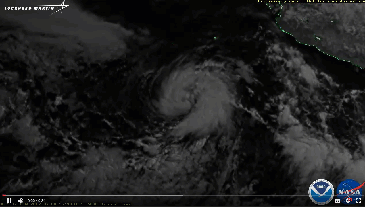
The Geostationary Lightning Mapper aboard GOES-16 captured this imagery of Hurricane Eugene and lightning along (and near) the Mexican mainland over an approximately 48-hour period from July 8 to 10, 2017. Imagery Credit: Lockheed Martin
In addition to showing Hurricane Eugene swirling in the east Pacific Ocean over a more than a 48-hour period beginning July 8, 2017, and ending July 10, it also offers a good demonstration of two interesting lightning facts: Lightning occurs more frequently over land than ocean, and hurricanes generally don't produce much lightning.
Lightning Prefers Land
As demonstrated by the flashes of lightning along the west coast of Mexico in this animation, lightning occurs more frequently over land because the bright sun in the region heats up the land far quicker than the water, so convection -- the vertical transport of heat and moisture in the atmosphere—typically begins there first. The terms "convection" and "thunderstorms" often are used interchangeably, although thunderstorms are only one form of convection. The formation of cumulus clouds over land on a sunny day is another example.
Hurricanes: Where’s the Lightning?
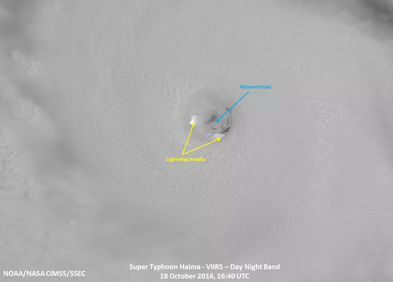
As for the lack of lightning in hurricanes, this happens because these storms don't often have the strong vertical updrafts more typical of continental or land based storms. A hurricane's winds are mostly horizontal, so the vertical churning that leads to lightning doesn't normally happen. This is not to say hurricanes never feature lightning. On the contrary, lightning is sometimes present in the eyewall of a hurricane—the most intense part such storms. In addition, lightning is more likely to occur in a hurricane’s rainbands when a storm moves over land. When lightning is seen in the eyewall, it's an indication of possible changes in storm intensity.
What Is Lightning, and How Does it Originate?
Lightning is a giant spark of electricity in the atmosphere between clouds, the air, or the ground. In the early stages of its development, air acts as an insulator between the positive and negative charges within a cloud and between the cloud and the ground. When these opposite charges build-up enough, the insulating capacity of the air breaks down and there is a rapid discharge of electricity that we know as lightning.
Lightning forms in cumulonimbus clouds—the kind of clouds found in thunderstorms—wherever there is enough upward or vertical motion and moisture to produce a deep and tall cloud with temperatures below freezing. These cold temperature are critical, as ice is required for the development of electricity within the cloud.
About the GOES-16’s Lightning Mapper
The first instrument of its kind in geostationary orbit, GOES-16’s Geostationary Lightning Mapper observes total lightning (both in-cloud and cloud-to-ground) and provides a constant vigil for lightning flashes day and night across the Western Hemisphere. Rapid increases of lightning are a signal that a storm is strengthening and could become more dangerous. The lightning mapper, in concert with other forecaster tools, will help provide more accurate and earlier warnings of developing severe storms and give communities more time to prepare for impending severe weather.
To learn more about GOES-16’s lightning mapper and how it will improve the forecasting of dangerous weather, visit the GOES-R website.
Please note: GOES-16 data are currently experimental and under-going testing and hence should not be used operationally.