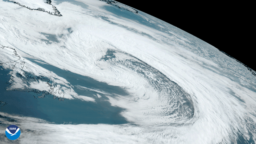
NOAA’s GOES East satellite saw a large and beautiful occluded low pressure system swirl in the East Labrador Sea between the coastlines of Canada and Greenland on May 4, 2021. According to the University Corporation for Atmospheric Research , lows, which are also known as extratropical or mid-latitude cyclones, contain fronts that can move across the surface of the Earth over a period of time; topography can also affect their direction.
The animation above is GeoColor imagery , a composite of several visible bands on GOES East’s Advanced Baseline Imager. It provides as close an approximation to how weather patterns would appear to the naked eye; here, the imagery shows the low’s evolution over a period of 10 hours.
The closest observational point to the low, Mary’s Harbor in Newfoundland, recorded prevalent northerly winds throughout the latter part of the day. In the cyclone’s center, GFS weather models denoted that wind speeds ranged from 35-45 miles per hour. Despite its rather isolated position at sea, the system brought quite a bit of precipitation to the Torngat Mountains in Newfoundland and Labrador.
The GOES East geostationary satellite, also known as GOES-16, keeps watch over most of North America, including the continental United States and Mexico, as well as Central and South America, the Caribbean, and the Atlantic Ocean to the west coast of Africa. The satellite's high-resolution imagery provides optimal viewing of severe weather events, including thunderstorms, tropical storms, and hurricanes.
Imagery courtesy of the Regional and Mesoscale Meteorology Branch at the Cooperative Institute for Research in the Atmosphere.