Eleven days after JPSS-1 launched into Earth orbit, the satellite, now known as NOAA-20, has sent back its first Advanced Technology Microwave Sounder (ATMS) science data as part of a series of instrument startups and checkouts that will take place before the satellite goes into full operational mode. The NOAA-20 satellite carries five instruments that will improve day-to-day weather forecasting while extending the record of many long-term observations of Earth's climate.
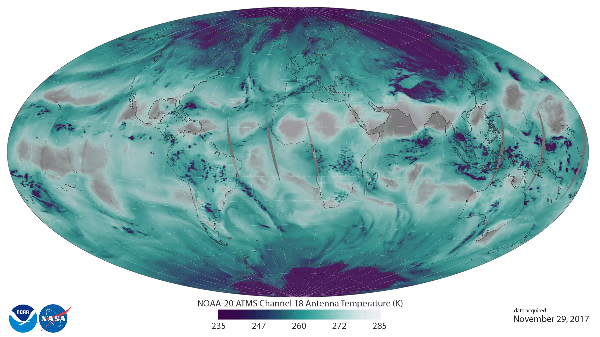
ATMS receives 22 channels of radio waves from 23 to 183 gigahertz. Five water vapor channels, combined with other temperature sounding channels are used to provide the critical global atmospheric temperature and water vapor data needed to provide accurate weather forecasts out to seven days. ATMS also maps global precipitation, snow and ice cover.
This image uses ATMS data to depict the location and abundance of water vapor (as associated with antenna temperatures) in the lower atmosphere, from the surface of the Earth to 5 kilometers altitude. Transparent/grey colors depict areas with less water vapor, while blue-green and purple colors represent abundant water in all phases (vapor, clouds, and precipitation) in low and middle latitudes. In the polar regions, purple depicts surface snow and ice. Water vapor distribution in space and time is a critical measurement for improving global weather forecasts. With detailed vertical information, forecasters can better identify the transport of water vapor associated with jet streams, which can fuel severe weather events.