Forty-eight days after JPSS-1 (NOAA-20) was launched into Earth orbit, it sent back its first Cross-track Infrared Sounder (CrIS) science data. This data is a part of a series of instrument activation and checkout tests that occur before the satellite is declared fully operational. CrIS is one of five key instruments onboard NOAA-20 that will improve day-to-day weather forecasting while extending the record of many long-term observations of Earth's climate.
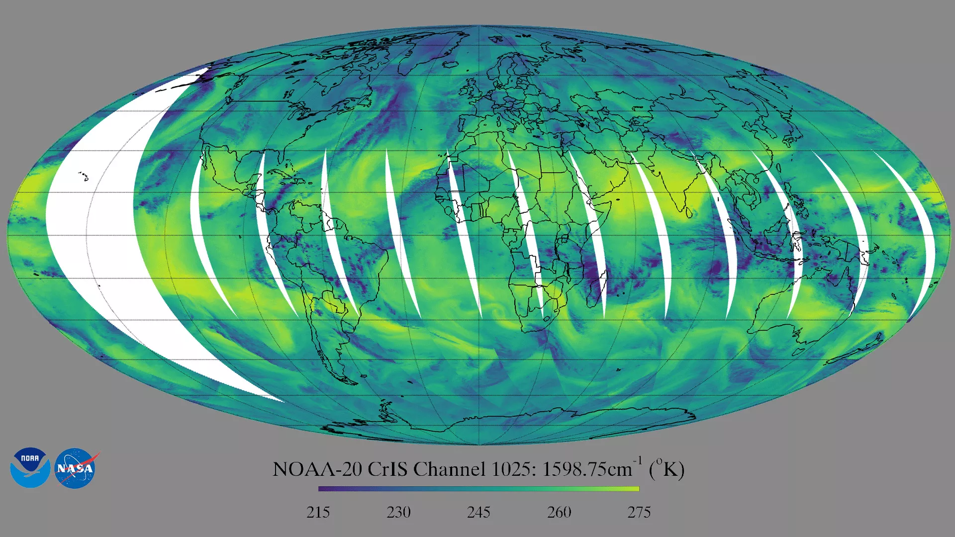
CrIS provides global hyperspectral infrared observations twice daily for profiling atmospheric temperature and water vapor, critically needed information for improving weather forecast accuracy out to seven days. CrIS also supplies information to retrieve greenhouse gases, land surface and cloud properties. CrIS measures infrared spectra in three spectral bands: the long-wave IR (LWIR) band from 650 to 1095 cm-1, mid-wave IR (MWIR) band from 1210 to 1750 cm-1 and short-wave IR (SWIR) band from 2155 to 2550 cm-1.
This image shows the global brightness temperature distribution at day time in one of the CrIS water vapor channels at 1598.75 cm-1. This channel is sensitive to water vapor amounts around 500 hPa, and to mid- to high-level clouds. Dark blue colors in the image represent liquid water and ice clouds. Yellows indicate that the radiation is from the warm Earth’s surface, or a dry layer in the middle troposphere. The image captured the blizzard striking the northeast coast of the United State on January 5, 2018. With the detailed vertical water vapor information provided by CrIS water vapor channels, weather forecasts can be better improved