May 05, 2020

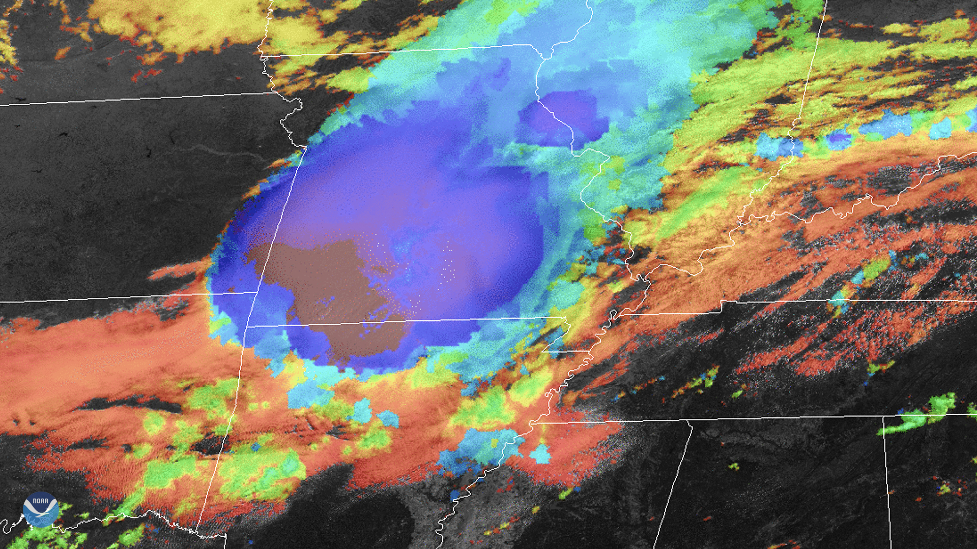
A line of severe thunderstorms, known as aderecho, made an appearance once again this spring—this time, through the lens of GOES-East as it looked over the mid-Mississippi Valley.
Severe thunderstorms with destructive winds and heavy downpours pushed through several states on May 4, 2020. This widespread, long-lived squall line with straight-line winds—or derecho— produced hundreds of reports of large hail and high winds, along with uprooted trees and damaged homes.
Derechos, Spanish for “straight ahead,” are usually quite large, with a damage swath that extends more than 240 miles and spans at least 50 miles in width. Most common during the spring and summer months, derechos can occur in many different types of conditions and locations. They usually are preceded by “ominous-looking "shelf" clouds that form in the zone of rapidly rising air on the leading edge of the storm system's outflow winds,” according to NOAA’s Storm Prediction Center.
The GOES-East geostationary satellite, also known as GOES-16, keeps watch over most of North America, including the continental United States and Mexico, as well as Central and South America, the Caribbean, and the Atlantic Ocean to the west coast of Africa. The satellite’s high-resolution imagery provides optimal viewing of severe weather events, including thunderstorms, tropical storms, and hurricanes.