Every day, NOAA’s network of satellites and Earth-based observation system collect some 20 terabytes of environmental data. This enormous collection of observations allows us to forecast the weather, monitor Earth’s climate and oceans, and map natural hazards – helping save lives, protect our infrastructure and support our economy.
Much of this data is free and open to the public. It’s also widely requested by various user groups in the public and private sector. Every month, NOAA’s National Centers for Environmental Information (NCEI) – which houses NOAA’s environmental data – serves millions of requests for data from its vast archives.
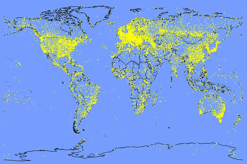
While you could easily spend days, if not weeks, exploring NCEI’s treasure trove of environmental observations , here are five noteworthy databases worth a browse: The Global Historical Climatology Network (GHCN)This massive database contains temperature and precipitation observations from tens of thousands of land-based weather stations around the world – available from the late 1800s to the present. These daily and monthly data allow us to understand long-term climate trends (on local and regional scales) and are used extensively by individuals and organizations (both public and private) in sectors such as agriculture.
The daily climate data in the GHCN come from 180 countries and territories, with the most comprehensive records available in the U.S., Canada and Australia. Integrated Surface Database (ISD). This global database merges NOAA and U.S. Air Force hourly weather station data from more than 35,000 stations in the U.S. and around the world. Records extend as far back as 1901 and cover all seven continents. Observations such as temperature, precipitation, cloud cover, wind speed, snow depth, and solar radiation are available from more than 14,000 active stations updating daily.
The ISD is used extensively by the utility sector for understanding electricity generation and distribution needs.World Ocean Database (WOD)Did you know NOAA has ocean records dating back to the sailing days of Captain Cook? The World Ocean Database contains more than 20,000 datasets measuring sea surface temperature, salinity, nutrients, pH levels, oxygen concentrations, and more. These datasets consist of millions of uniformly formatted records called “profiles,” which are continually updated by about 90 countries around the world. It is the largest publicly available in situ ocean profile database in the world.
The World Ocean Database is widely used by the global oceanography community.
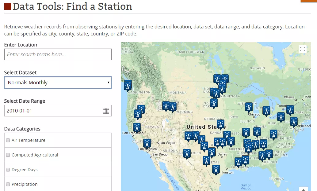
U.S. Climate Normals Climate normals are long-term averages of historical climate data, such as temperature and precipitation, based on a 30-year reference period (currently 1981-2010). Knowing these averages gives insight into how much warmer or cooler, wetter or drier the weather has been lately. This database lets you search more than 9,800 stations across the U.S. to learn about the long-term average climate at any one location, and includes a series of interactive maps.
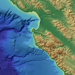
Bathymetry Data If you’ve ever heard that we know more about the surface of the moon than the ocean floor, it’s true: To date, we’ve mapped less than 20 percent of Earth’s oceans, and even close to our shores, only 50 percent of the world’s coastal waters have ever been surveyed.
NOAA provides a database of digital elevation models (DEMs), which use ocean depth and coastal land elevation data to help us visualize Earth’s land surface and the sea floor in coastal regions. The maps are used to model the impact of coastal flooding from tsunamis, storm surges, and sea level rise, and also help us manage coastal habitats and ecosystems.
These models were developed using data from NOAA other federal agencies (including the U.S. Geological Survey and NASA), and all datasets are free and open to the public.
Looking for more data? Find data from NOAA satellites and more.