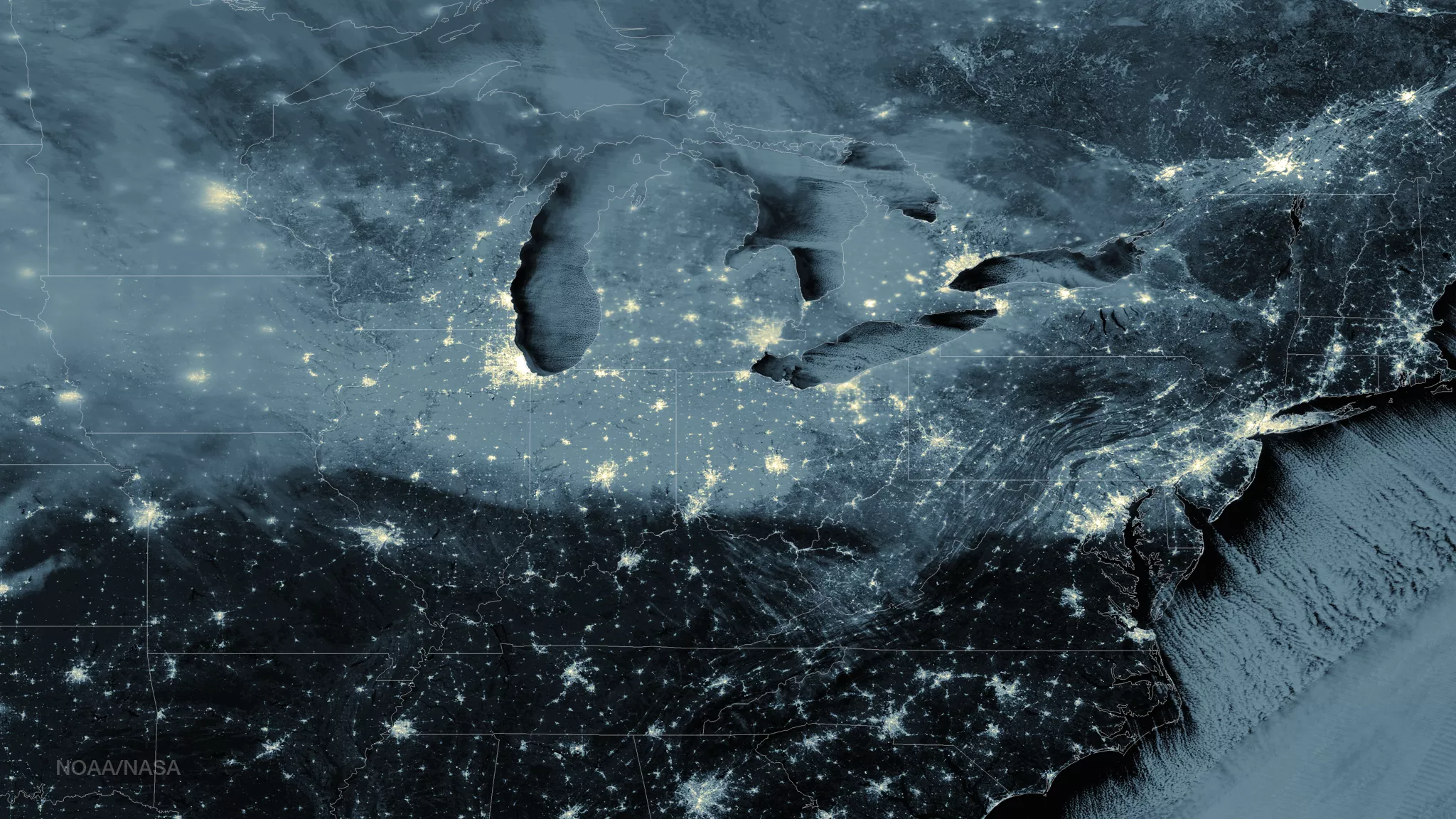
This image from the Suomi NPP satellite's Day/Night Band shows the eastern part of the U.S. clearly for the most part, highlighting the snow on the ground from the latest storms. Cold air moving over the Great Lakes and upper-level energy will aid in producing lake effect snow downwind from the Great Lakes on Thursday morning while a developing clipper system will move eastward from the Northern Plains to the Great Lakes by early Friday morning and then northeastward to Eastern Canada by Friday evening. The associated cold front will move eastward and off the East Coast by Friday afternoon. The system will produce light snow over parts of the Upper Mississippi Valley on Thursday morning and lake enhanced snow over the Great Lakes Thursday afternoon through Friday morning. Snow will be heavy downwind from the Great Lakes Friday morning into Friday evening. This image was taken around 0745Z on January 8, 2015