March 10, 2020
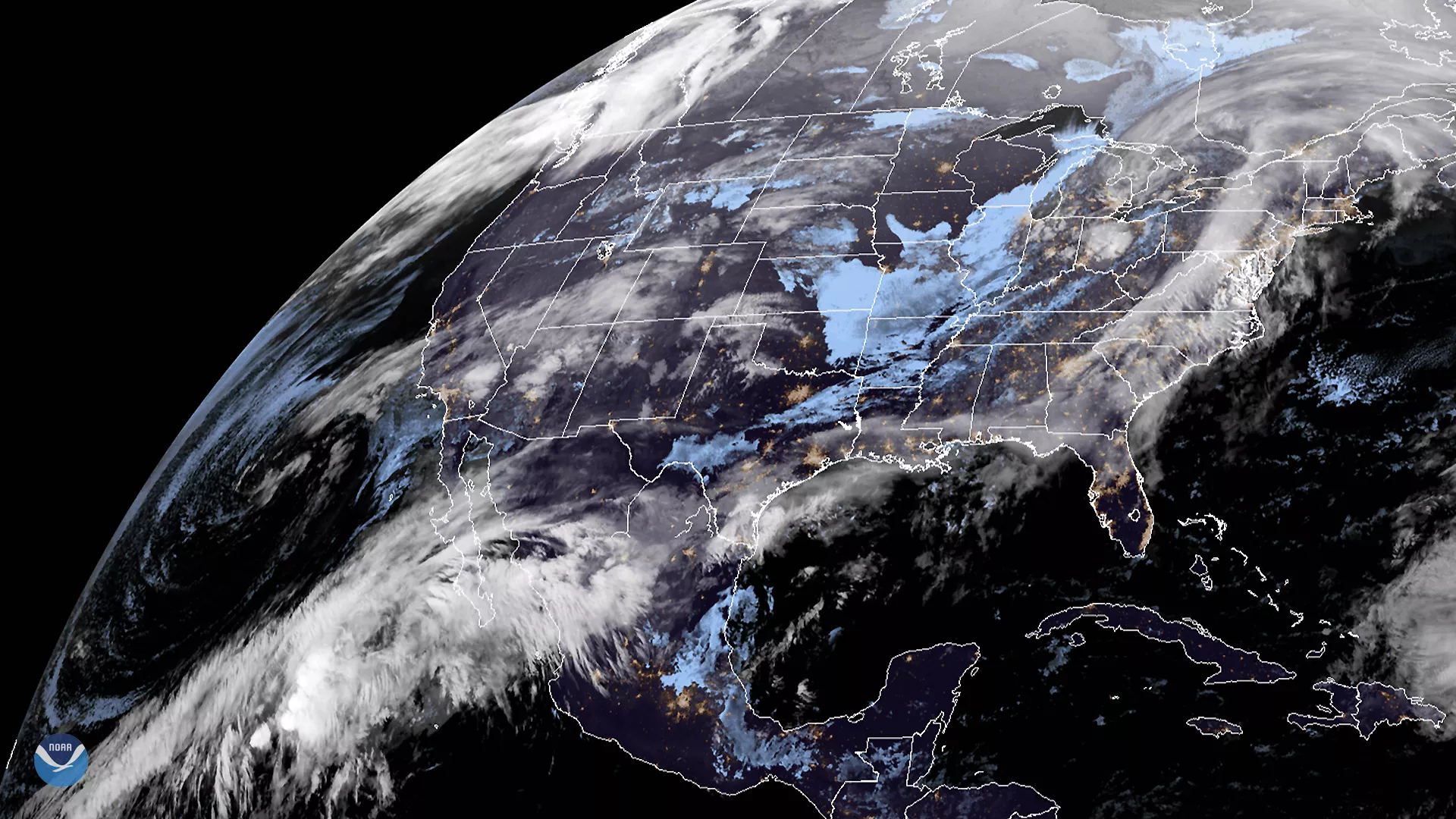
On March 10, 2020, the GOES-East satellite viewed an atmospheric river (or AR) flowing up from the South Pacific, across the Gulf of Mexico and into the U.S. As a result, much of the eastern and southeastern United States will see chances for precipitation , through Wednesday morning.
While ARs usually bring heavy rain to the West Coast of the U.S., this particular AR is setting up farther south over the Baja California Peninsula of Mexico. A cold front pushing southeastward from the Great Lakes is helping to funnel the AR moisture north and eastward. As a result, the weather around the lower Mississippi River Valley will be affected, compounding the recent wet winter and flooding concerns , as well as reinforcing the warmer-than-average temperatures in the region. According to the previously cited Feb. 2020 temperature departures, temperatures in the Southeast have deviated from the 1981–2010 historic normal by as much as 21 degrees Fahrenheit.
The GOES-East geostationary satellite, also known as GOES-16, keeps watch over most of North America, including the continental United States and Mexico, as well as Central and South America, the Caribbean, and the Atlantic Ocean to the west coast of Africa. The satellite's high-resolution imagery provides optimal viewing of severe weather events, including thunderstorms, tropical storms, and hurricanes.