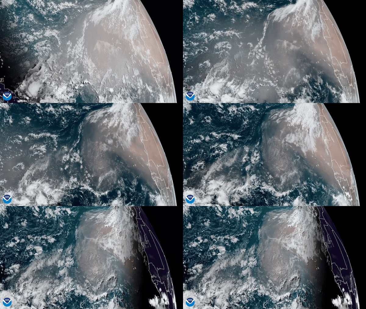
On June 16, 2020, the GOES-East satellite captured this GeoColor imagery of an expansive plume of dust from the Sahara Desert traveling westward across the Atlantic Ocean. The dust is expected to reach the Caribbean later this week, and may even make it to parts of the United States next week.
According to NOAA’s Hurricane Research Division, every three to five days from late spring through early fall, a mass of dusty air known as the Saharan Air Layer (SAL) forms over the Sahara Desert and moves westward across the tropical North Atlantic. The SAL, which extends about 5,000 to 20,000 feet into the atmosphere, can be transported several thousand miles, reaching as far as the Caribbean, Florida, and the U.S. Gulf Coast when winds are particularly strong. Some of this dust also blows farther south into the Amazon River Basin in South America, where the minerals in the dust replenish nutrients in rainforest soils, which are continually depleted by drenching, tropical rains.
The dry, dusty air associated with the SAL has been known to cause hazy skies over the areas where it blows, as well as toxic algal blooms, according to NASA. It also can help suppress hurricane and tropical storm development in the Atlantic Basin due to its dense, dry air and increased wind shear.

The GOES-East geostationary satellite, also known as GOES-16, keeps watch over most of North America, including the continental United States and Mexico, as well as Central and South America, the Caribbean, and the Atlantic Ocean to the west coast of Africa. The satellite's high-resolution imagery provides optimal viewing of severe weather events, including thunderstorms, tropical storms, and hurricanes.